Singapore to Lakehurst is 9,576 miles (15,410 km), a flight of about 19 hours.
The right side wins overall due to the spectacular departure views over the Strait of Singapore and Indonesian archipelago. The flight tracks northeast over the South China Sea, southern China, across Central Asia, Russia, and the North Atlantic — the right side also captures more of the South China Sea coastline early in the flight before the route settles into the high-latitude polar track where both sides see similar Arctic and Canadian terrain.
Flight Path
South China Sea and Vietnamese coastline in the first few hours, southern China and eastern China plains, then across Mongolia and Siberia's vast taiga and river systems including the Ob and Yenisei rivers, the Ural Mountains as a low ridge, then across Scandinavia or the Arctic Ocean depending on exact routing, Greenland's ice sheet, Labrador and the Canadian Maritime provinces, and finally the US Northeast coastline approaching New Jersey
Great circle distance and headings ›


.jpeg?width=600)
.jpg?width=600)
Phase by phase
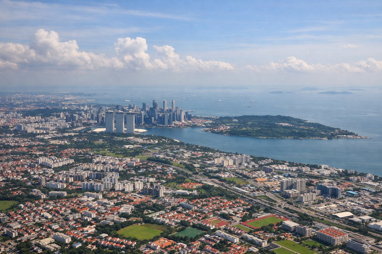
Takeoff from SIN
RIGHTChangi typically departs on runway 02C/02L heading north, so the right (east) side gives you views over the Strait of Singapore and the southern islands. You'll see the dense shipping lanes and the Indonesian Riau Islands archipelago stretching south.
Landing at NEL
LEFTLakehurst NAS/NEL sits in the New Jersey Pine Barrens, and approaches typically come in from the south or east. The left (south/east) side gives views over the Jersey Shore barrier islands, Barnegat Bay, and the distinctive Pine Barrens landscape before touchdown.
Landmarks on this routeAll landmarks →
Will your flight be in sunlight?
Pick a date and time in the Sun Map to watch the sun move across your whole flight.
About This Route
Which side of the plane should I sit on flying from Singapore Changi (SIN) to Lakehurst Naes (NEL)?
Sit on the Right side of the plane for the best views on flights from Singapore to Lakehurst. The right side wins overall due to the spectacular departure views over the Strait of Singapore and Indonesian archipelago. The flight tracks northeast over the South China Sea, southern China, across Central Asia, Russia, and the North Atlantic — the right side also captures more of the South China Sea coastline early in the flight before the route settles into the high-latitude polar track where both sides see similar Arctic and Canadian terrain.
What can I see during takeoff from Singapore Changi in Singapore?
During takeoff from Singapore Changi (SIN), sit on the Right side for the best views. Changi typically departs on runway 02C/02L heading north, so the right (east) side gives you views over the Strait of Singapore and the southern islands. You'll see the dense shipping lanes and the Indonesian Riau Islands archipelago stretching south. Notable sights include: Strait of Singapore shipping lanes, Batam Island (Indonesia), Bintan Island, Singapore's eastern coastline and Changi Beach.
What can I see when landing at Lakehurst Naes in Lakehurst?
When landing at Lakehurst Naes (NEL), sit on the Left side for the best views. Lakehurst NAS/NEL sits in the New Jersey Pine Barrens, and approaches typically come in from the south or east. The left (south/east) side gives views over the Jersey Shore barrier islands, Barnegat Bay, and the distinctive Pine Barrens landscape before touchdown. Notable sights include: Barnegat Bay, Island Beach State Park barrier strip, Toms River estuary, New Jersey Pine Barrens forest.
How long is the flight from Singapore to Lakehurst?
The flight from Singapore Changi (SIN) to Lakehurst Naes (NEL) takes about 19 hours. The shortest flight path between them is 9,576 miles (15,410 km); winds and air traffic control usually add a few percent.
What does the Singapore to Lakehurst flight path pass over?
South China Sea and Vietnamese coastline in the first few hours, southern China and eastern China plains, then across Mongolia and Siberia's vast taiga and river systems including the Ob and Yenisei rivers, the Ural Mountains as a low ridge, then across Scandinavia or the Arctic Ocean depending on exact routing, Greenland's ice sheet, Labrador and the Canadian Maritime provinces, and finally the US Northeast coastline approaching New Jersey