Singapore to Palmdale is 8,752 miles (14,085 km), a flight of about 16 hours 30 minutes.
Right side captures the most dramatic geography: Singapore's urban and maritime features during departure, then the Pacific crossing offers occasional island views, and finally the Sierra Nevada and San Gabriel Mountains during descent into California.
Flight Path
Pacific Ocean crossing with potential views of Hawaii (Big Island, Maui, or Oahu depending on routing), the California coast near Los Angeles basin on approach, and the transition from ocean to desert terrain in Southern California
Great circle distance and headings ›
.jpg?width=600)
Phase by phase
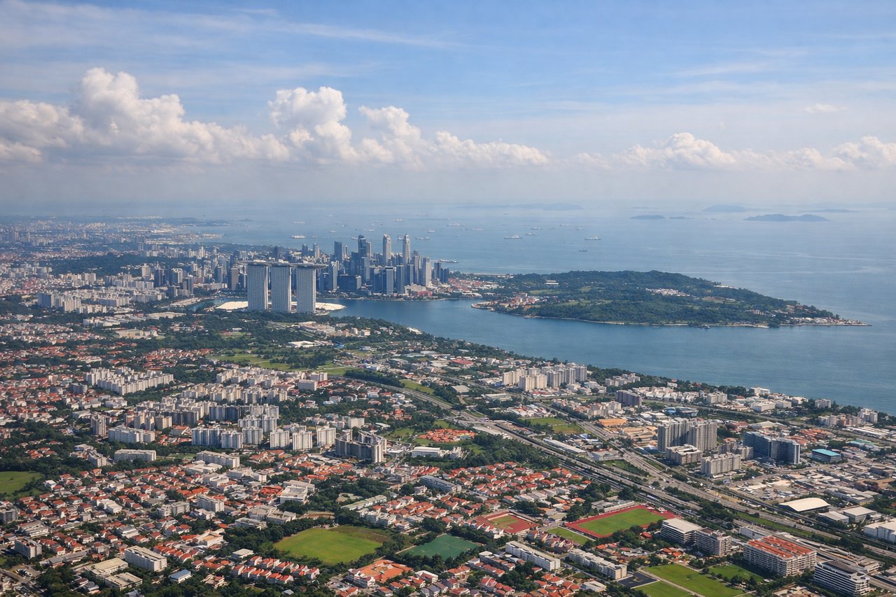
Takeoff from SIN
RIGHTRight side offers views of Singapore's urban sprawl, the Strait of Malacca, and the Malaysian peninsula as the aircraft climbs northwestward. Left side faces the South China Sea with minimal distinguishing features during initial climb.
Landing at PMD
LEFTLeft side provides views of the Sierra Nevada mountains, the Mojave Desert floor, and the San Gabriel Mountains as the aircraft descends into the Palmdale region. Right side faces inland desert with fewer visual landmarks during approach.
Landmarks on this routeAll landmarks →
Will your flight be in sunlight?
Pick a date and time in the Sun Map to watch the sun move across your whole flight.
About This Route
Which side of the plane should I sit on flying from Singapore Changi (SIN) to Palmdale Prod Flt Test Instl Af Plt 42 (PMD)?
Sit on the Right side of the plane for the best views on flights from Singapore to Palmdale. Right side captures the most dramatic geography: Singapore's urban and maritime features during departure, then the Pacific crossing offers occasional island views, and finally the Sierra Nevada and San Gabriel Mountains during descent into California.
What can I see during takeoff from Singapore Changi in Singapore?
During takeoff from Singapore Changi (SIN), sit on the Right side for the best views. Right side offers views of Singapore's urban sprawl, the Strait of Malacca, and the Malaysian peninsula as the aircraft climbs northwestward. Left side faces the South China Sea with minimal distinguishing features during initial climb. Notable sights include: Singapore city center and harbor, Strait of Malacca, Johor Bahru (Malaysia) across the causeway, Malaysian peninsula coastline.
What can I see when landing at Palmdale Prod Flt Test Instl Af Plt 42 in Palmdale?
When landing at Palmdale Prod Flt Test Instl Af Plt 42 (PMD), sit on the Left side for the best views. Left side provides views of the Sierra Nevada mountains, the Mojave Desert floor, and the San Gabriel Mountains as the aircraft descends into the Palmdale region. Right side faces inland desert with fewer visual landmarks during approach. Notable sights include: Sierra Nevada range (distant), San Gabriel Mountains, Mojave Desert floor, Antelope Valley.
How long is the flight from Singapore to Palmdale?
The flight from Singapore Changi (SIN) to Palmdale Prod Flt Test Instl Af Plt 42 (PMD) takes about 16 hours 30 minutes. The shortest flight path between them is 8,752 miles (14,085 km); winds and air traffic control usually add a few percent.
What does the Singapore to Palmdale flight path pass over?
Pacific Ocean crossing with potential views of Hawaii (Big Island, Maui, or Oahu depending on routing), the California coast near Los Angeles basin on approach, and the transition from ocean to desert terrain in Southern California