Right side dominates both departure and arrival with superior views: Singapore's maritime geography on takeoff and the Parnaíba River delta on landing. Left side offers only open ocean for most of the flight.
Flown SIN to THE? Did we get it right?
Flight Path
Singapore to Teresina is 10,134 miles (16,309 km), a flight of about 16 hours 45 minutes.
Indian Ocean crossing with no visible landmarks for approximately 8 hours; the flight passes south of India (not visible at cruise altitude), over the Arabian Sea, then across the African continent (Mozambique Channel, East African coast, and interior plateau regions remain below typical cruise altitude visibility); final approach crosses the Atlantic toward Brazil's northeastern coast and the Parnaíba River system.
Great circle distance and headings ›


Phase by phase
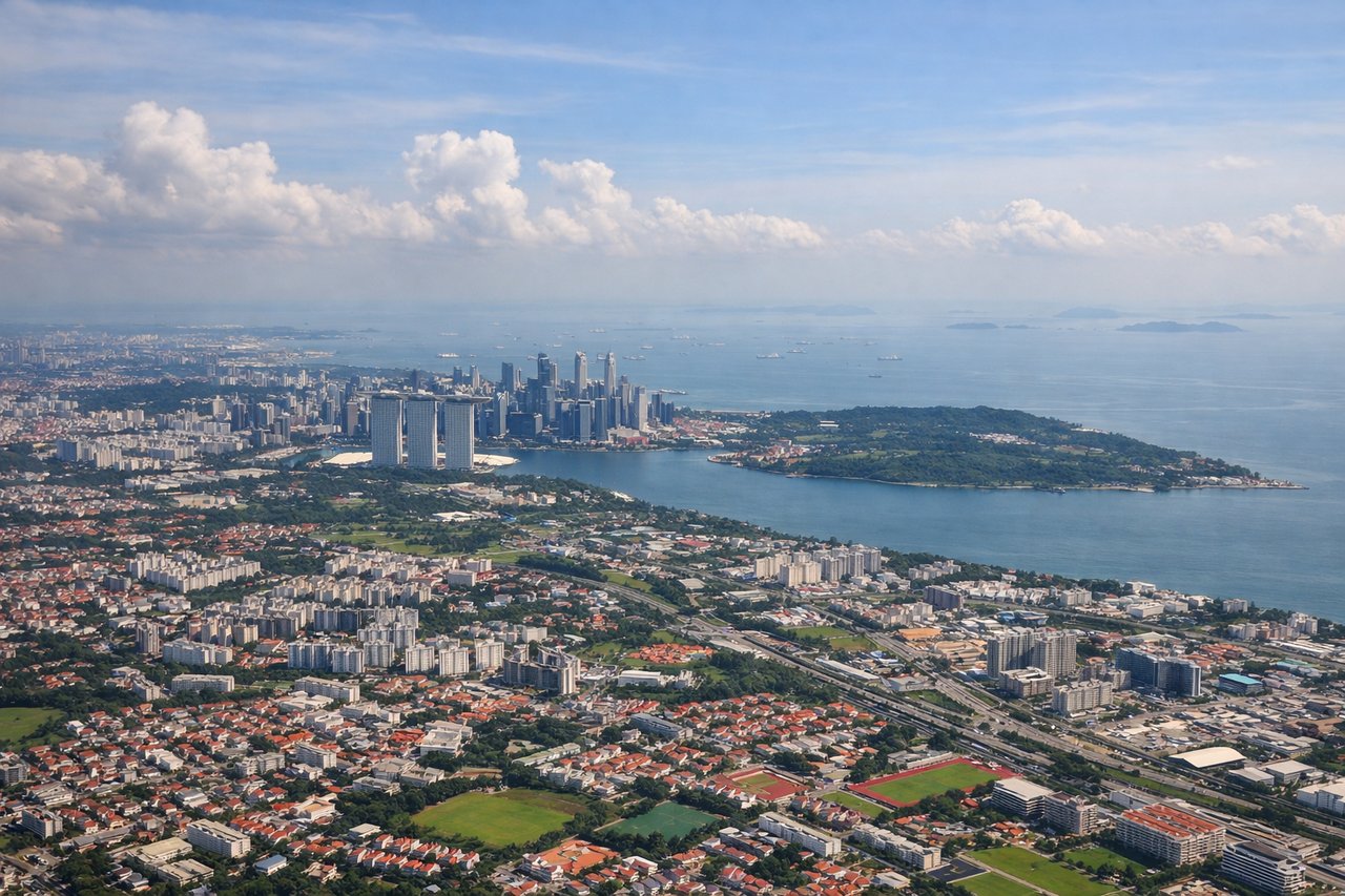
Takeoff from SIN
RIGHTRight side seats offer views of Singapore Strait and the Malaysian Peninsula as the aircraft climbs out westward. You'll see the busy shipping lanes and coastal geography that define Singapore's maritime setting.
Landing at THE
RIGHTRight side provides views of the Parnaíba River delta and the approach to Teresina from the east. The river's distinctive braided channels and wetlands are striking features during descent into THE.
Will your flight be in sunlight?
Pick a date and time in the Sun Map to watch the sun move across your whole flight.
About This Route
Which side of the plane should I sit on flying from Singapore Changi (SIN) to Senador Petronio Portella (THE)?
Sit on the Right side of the plane for the best views on flights from Singapore to Teresina. Right side dominates both departure and arrival with superior views: Singapore's maritime geography on takeoff and the Parnaíba River delta on landing. Left side offers only open ocean for most of the flight.
What can I see during takeoff from Singapore Changi in Singapore?
During takeoff from Singapore Changi (SIN), sit on the Right side for the best views. Right side seats offer views of Singapore Strait and the Malaysian Peninsula as the aircraft climbs out westward. You'll see the busy shipping lanes and coastal geography that define Singapore's maritime setting. Notable sights include: Singapore Strait, Johor Strait, Malaysian Peninsula coastline, Batam Island (Indonesia).
What can I see when landing at Senador Petronio Portella in Teresina?
When landing at Senador Petronio Portella (THE), sit on the Right side for the best views. Right side provides views of the Parnaíba River delta and the approach to Teresina from the east. The river's distinctive braided channels and wetlands are striking features during descent into THE. Notable sights include: Parnaíba River delta, Parnaíba River main channel, Atlantic coastal plains, Teresina city grid.
How long is the flight from Singapore to Teresina?
The flight from Singapore Changi (SIN) to Senador Petronio Portella (THE) takes about 16 hours 45 minutes. The shortest flight path between them is 10,134 miles (16,309 km); winds and air traffic control usually add a few percent.
What does the Singapore to Teresina flight path pass over?
Indian Ocean crossing with no visible landmarks for approximately 8 hours; the flight passes south of India (not visible at cruise altitude), over the Arabian Sea, then across the African continent (Mozambique Channel, East African coast, and interior plateau regions remain below typical cruise altitude visibility); final approach crosses the Atlantic toward Brazil's northeastern coast and the Parnaíba River system.