Right side scores higher (3.5 vs 2.5) due to superior scenic variety across the full flight: Singapore's harbor and strait during departure, followed by extended views of Southeast Asian coastlines and the Malay Peninsula during cruise, and culminating in the Khangai Mountains and Ulaanbaatar valley during approach. Left side offers only flat Malaysian peninsula and open steppe with minimal landmark density.
Flown SIN to UBN? Did we get it right?
Flight Path
Singapore to Ulaanbaatar is 3,203 miles (5,155 km), a flight of about 5 hours 50 minutes.
Malay Peninsula (Kuala Lumpur region visible from cruise altitude), Strait of Malacca, Thai-Myanmar border mountains, Shan Plateau, northern Thailand highlands, Laos-Thailand border along Mekong River, Chinese Yunnan Province mountains, Tibetan Plateau edge, Inner Mongolia steppe transition zone
Great circle distance and headings ›Phase by phase
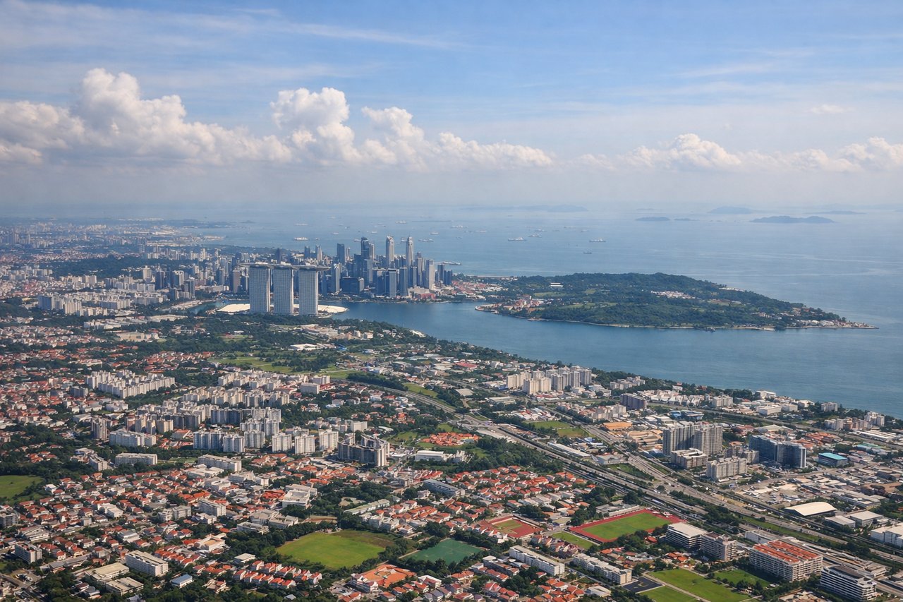
Takeoff from SIN
RIGHTRight side captures Singapore's harbor, Changi Airport's coastal setting, and the Strait of Malacca during initial climb. Left side faces inland toward Johor Bahru and flat Malaysian peninsula with minimal visual interest during departure.
Landing at UBN
RIGHTRight side offers superior approach scenery: the Khangai Mountains become visible during descent into Ulaanbaatar, providing dramatic terrain contrast. The city itself sits in a valley surrounded by rolling steppe and distant peaks. Left side faces open steppe with minimal landmarks until final approach.
Will your flight be in sunlight?
Pick a date and time in the Sun Map to watch the sun move across your whole flight.
About This Route
Which side of the plane should I sit on flying from Singapore Changi (SIN) to Ulaanbaatar Chinggis Khaan International Airport (UBN)?
Sit on the Right side of the plane for the best views on flights from Singapore to Ulaanbaatar. Right side scores higher (3.5 vs 2.5) due to superior scenic variety across the full flight: Singapore's harbor and strait during departure, followed by extended views of Southeast Asian coastlines and the Malay Peninsula during cruise, and culminating in the Khangai Mountains and Ulaanbaatar valley during approach. Left side offers only flat Malaysian peninsula and open steppe with minimal landmark density.
What can I see during takeoff from Singapore Changi in Singapore?
During takeoff from Singapore Changi (SIN), sit on the Right side for the best views. Right side captures Singapore's harbor, Changi Airport's coastal setting, and the Strait of Malacca during initial climb. Left side faces inland toward Johor Bahru and flat Malaysian peninsula with minimal visual interest during departure. Notable sights include: Singapore Strait with container ships, Changi Airport's reclaimed land and terminal complex, Sentosa Island and southern Singapore islands, Johor Bahru cityscape across the strait.
What can I see when landing at Ulaanbaatar Chinggis Khaan International Airport in Ulaanbaatar?
When landing at Ulaanbaatar Chinggis Khaan International Airport (UBN), sit on the Right side for the best views. Right side offers superior approach scenery: the Khangai Mountains become visible during descent into Ulaanbaatar, providing dramatic terrain contrast. The city itself sits in a valley surrounded by rolling steppe and distant peaks. Left side faces open steppe with minimal landmarks until final approach. Notable sights include: Khangai Mountains (southern approach), Tuul River valley, Ulaanbaatar city sprawl in the basin, surrounding Mongolian steppe and rolling hills.
How long is the flight from Singapore to Ulaanbaatar?
The flight from Singapore Changi (SIN) to Ulaanbaatar Chinggis Khaan International Airport (UBN) takes about 5 hours 50 minutes. The shortest flight path between them is 3,203 miles (5,155 km); winds and air traffic control usually add a few percent.
What does the Singapore to Ulaanbaatar flight path pass over?
Malay Peninsula (Kuala Lumpur region visible from cruise altitude), Strait of Malacca, Thai-Myanmar border mountains, Shan Plateau, northern Thailand highlands, Laos-Thailand border along Mekong River, Chinese Yunnan Province mountains, Tibetan Plateau edge, Inner Mongolia steppe transition zone