San Jose to Las Vegas is 386 miles (620 km), a flight of about 1 hour 25 minutes.
The right side tracks the Sierra Nevada crest near Mount Whitney, passes just north of Death Valley's dramatic basin, and ends with a Strip-side view on final approach into Las Vegas — a much more varied and dramatic sequence than the flatter Central Valley and Great Basin scenery visible from the left.
Flight Path
Sierra Nevada high country near Mount Whitney and the Owens Valley, followed by the Basin and Range desert terrain of eastern California and Nevada, with Death Valley National Park visible just south of the flight path.
Great circle distance and headings ›


Phase by phase
Takeoff from SJC
RIGHTDeparting SJC on runway 30, the aircraft climbs over the South Bay and banks right toward Nevada, giving right-side passengers a good look at the Diablo Range and Mount Hamilton's Lick Observatory before the terrain flattens into the Central Valley. Left-side views are mostly the flat Santa Clara Valley floor and distant Santa Cruz Mountains.
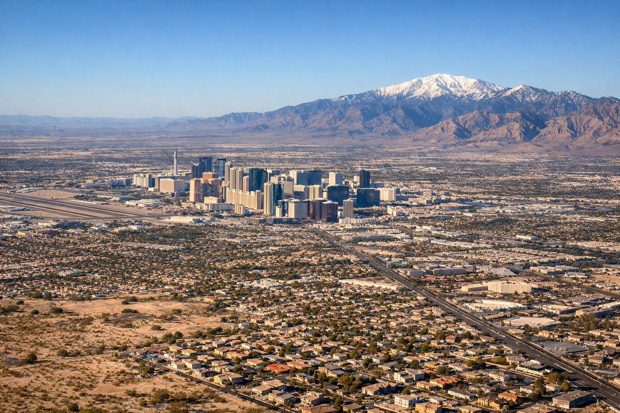
Landing at LAS
RIGHTOn the common westbound approach to runway 26, the flight path passes south of the Strip before turning onto final, putting the Las Vegas Strip's casino towers on the right side of the cabin as the aircraft descends. The Spring Mountains also loom on the right horizon during the turn, while the left side mostly shows suburban Las Vegas and Lake Mead's distant basin.
Landmarks on this routeAll landmarks →
Will your flight be in sunlight?
Pick a date and time in the Sun Map to watch the sun move across your whole flight.
About This Route
Which side of the plane should I sit on flying from Norman Y Mineta San Jose International (SJC) to Mc Carran International (LAS)?
Sit on the Right side of the plane for the best views on flights from San Jose to Las Vegas. The right side tracks the Sierra Nevada crest near Mount Whitney, passes just north of Death Valley's dramatic basin, and ends with a Strip-side view on final approach into Las Vegas — a much more varied and dramatic sequence than the flatter Central Valley and Great Basin scenery visible from the left.
What can I see during takeoff from Norman Y Mineta San Jose International in San Jose?
During takeoff from Norman Y Mineta San Jose International (SJC), sit on the Right side for the best views. Departing SJC on runway 30, the aircraft climbs over the South Bay and banks right toward Nevada, giving right-side passengers a good look at the Diablo Range and Mount Hamilton's Lick Observatory before the terrain flattens into the Central Valley. Left-side views are mostly the flat Santa Clara Valley floor and distant Santa Cruz Mountains. Notable sights include: Diablo Range, Mount Hamilton and Lick Observatory, San Jose urban grid, Central Valley haze on the horizon.
What can I see when landing at Mc Carran International in Las Vegas?
When landing at Mc Carran International (LAS), sit on the Right side for the best views. On the common westbound approach to runway 26, the flight path passes south of the Strip before turning onto final, putting the Las Vegas Strip's casino towers on the right side of the cabin as the aircraft descends. The Spring Mountains also loom on the right horizon during the turn, while the left side mostly shows suburban Las Vegas and Lake Mead's distant basin. Notable sights include: Las Vegas Strip skyline, Spring Mountains, Red Rock Canyon escarpment, McCarran runway threshold.
How long is the flight from San Jose to Las Vegas?
The flight from Norman Y Mineta San Jose International (SJC) to Mc Carran International (LAS) takes about 1 hour 25 minutes. The shortest flight path between them is 386 miles (620 km); winds and air traffic control usually add a few percent.
What does the San Jose to Las Vegas flight path pass over?
Sierra Nevada high country near Mount Whitney and the Owens Valley, followed by the Basin and Range desert terrain of eastern California and Nevada, with Death Valley National Park visible just south of the flight path.