San Jose Del Cabo to San Francisco is 1,250 miles (2,011 km), a flight of about 2 hours 55 minutes.
Left side wins both ends of the flight. During the cruise over the Pacific and Baja coastline, the left side also tracks closer to the Mexican coast and offers occasional glimpses of the Baja Peninsula's western shore and the Channel Islands off Southern California. The right side is mostly open Pacific for the majority of the flight.
Flight Path
The flight tracks northwest over the Pacific, roughly paralleling the Baja California Peninsula. Over Southern California, the Channel Islands (Santa Catalina, San Clemente, Santa Cruz) are visible to the left on clear days. The flight then crosses the California coast somewhere near Point Conception or Monterey Bay before descending toward the Bay Area. The Santa Lucia Range and Big Sur coastline may be visible on the left during descent.
Great circle distance and headings ›.jpg?width=600)

Phase by phase
Takeoff from SJD
LEFTSJD's primary departure runway 16/34 means northbound departures head roughly north, putting the Sea of Cortez and the Baja Peninsula's eastern coastline on the left (west) side. You get a clear view of the dramatic tip of Baja California and the Pacific coast as the aircraft banks northwest.
Landing at SFO
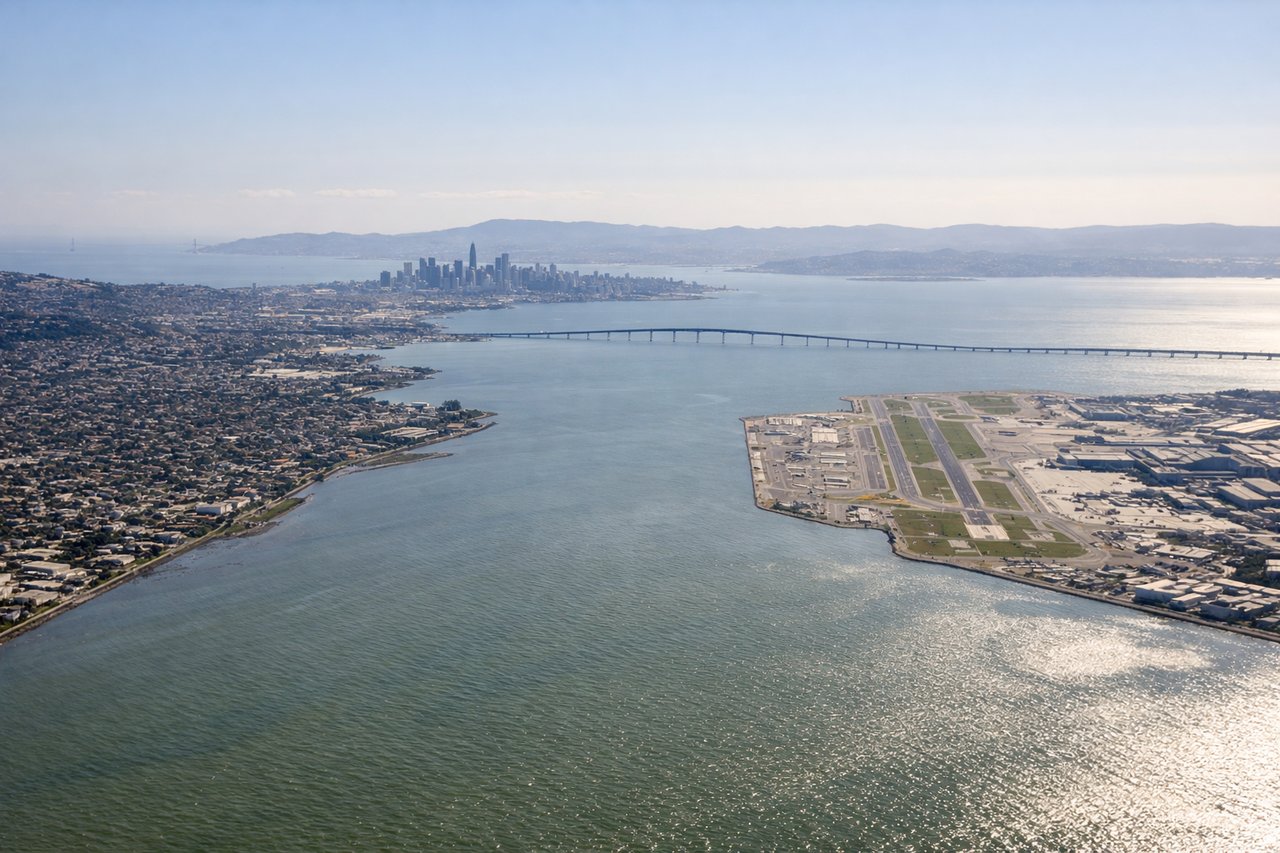
LEFTSFO's dominant arrival configuration uses runways 28L/28R, meaning aircraft approach from the east over the Bay Area. A left window seat gives you the San Francisco Bay, the city skyline, the Bay Bridge, and Alcatraz as you descend over the water on final approach.
Landmarks on this routeAll landmarks →
Will your flight be in sunlight?
Pick a date and time in the Sun Map to watch the sun move across your whole flight.
About This Route
Which side of the plane should I sit on flying from Los Cabos International (SJD) to San Francisco International (SFO)?
Sit on the Left side of the plane for the best views on flights from San Jose Del Cabo to San Francisco. Left side wins both ends of the flight. During the cruise over the Pacific and Baja coastline, the left side also tracks closer to the Mexican coast and offers occasional glimpses of the Baja Peninsula's western shore and the Channel Islands off Southern California. The right side is mostly open Pacific for the majority of the flight.
What can I see during takeoff from Los Cabos International in San Jose Del Cabo?
During takeoff from Los Cabos International (SJD), sit on the Left side for the best views. SJD's primary departure runway 16/34 means northbound departures head roughly north, putting the Sea of Cortez and the Baja Peninsula's eastern coastline on the left (west) side. You get a clear view of the dramatic tip of Baja California and the Pacific coast as the aircraft banks northwest. Notable sights include: Cabo San Lucas bay and Land's End rock arch (briefly), the narrow Baja Peninsula spine, Sea of Cortez eastern shoreline, Pacific Ocean coastline to the west.
What can I see when landing at San Francisco International in San Francisco?
When landing at San Francisco International (SFO), sit on the Left side for the best views. SFO's dominant arrival configuration uses runways 28L/28R, meaning aircraft approach from the east over the Bay Area. A left window seat gives you the San Francisco Bay, the city skyline, the Bay Bridge, and Alcatraz as you descend over the water on final approach. Notable sights include: San Francisco Bay, San Francisco city skyline and downtown, Bay Bridge, Alcatraz Island.
How long is the flight from San Jose Del Cabo to San Francisco?
The flight from Los Cabos International (SJD) to San Francisco International (SFO) takes about 2 hours 55 minutes. The shortest flight path between them is 1,250 miles (2,011 km); winds and air traffic control usually add a few percent.
What does the San Jose Del Cabo to San Francisco flight path pass over?
The flight tracks northwest over the Pacific, roughly paralleling the Baja California Peninsula. Over Southern California, the Channel Islands (Santa Catalina, San Clemente, Santa Cruz) are visible to the left on clear days. The flight then crosses the California coast somewhere near Point Conception or Monterey Bay before descending toward the Bay Area. The Santa Lucia Range and Big Sur coastline may be visible on the left during descent.