Left side wins both ends of the flight. At takeoff you get the Wasatch Front and Great Salt Lake; at landing you get the Boston skyline and harbor. Over the Rockies and Midwest the left side also tends to face slightly south, keeping the sun out of your eyes on this eastbound route.
Flown SLC to BOS? Did we get it right?
Flight Path
Salt Lake City to Boston is 2,100 miles (3,380 km), a flight of about 4 hours 30 minutes.
After the Rockies, the flight crosses the high plains of Wyoming and Nebraska, then the Missouri and Mississippi Rivers (visible as broad brown ribbons), the flat agricultural checkerboard of Iowa and Illinois, the Great Lakes region near Lake Erie's southern shore, then the Appalachian ridges of Pennsylvania and New York before descending over New England.
Great circle distance and headings ›


Phase by phase
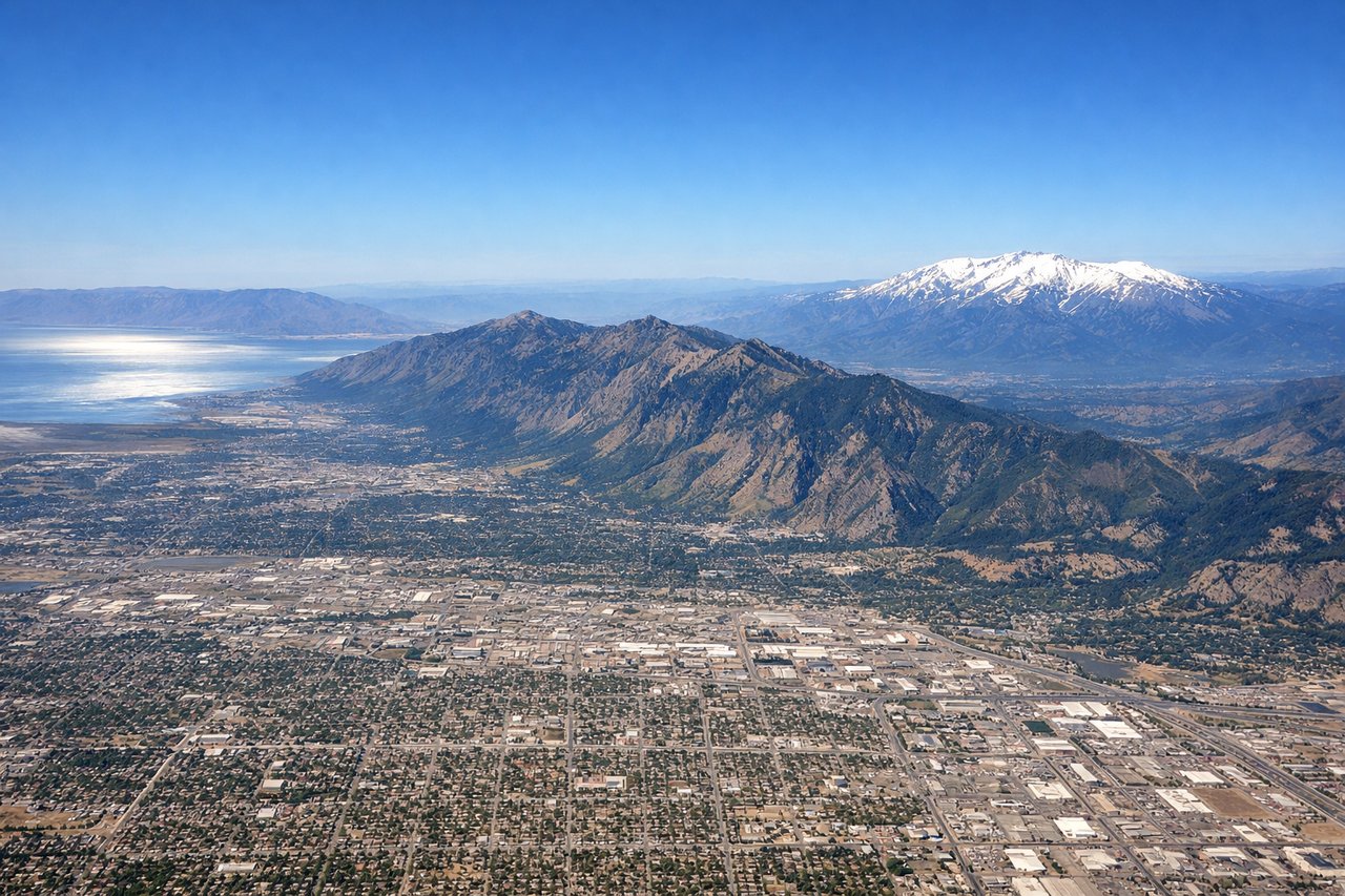
Takeoff from SLC
LEFTSLC's primary departure runway 34L sends aircraft northward before turning east. The left side captures the full panorama of the Wasatch Front — the dramatic east-facing escarpment rising directly above the city — while the right side looks west toward the flat salt flats. As the aircraft banks right heading east, the left side briefly sweeps across the Great Salt Lake's southern arm.
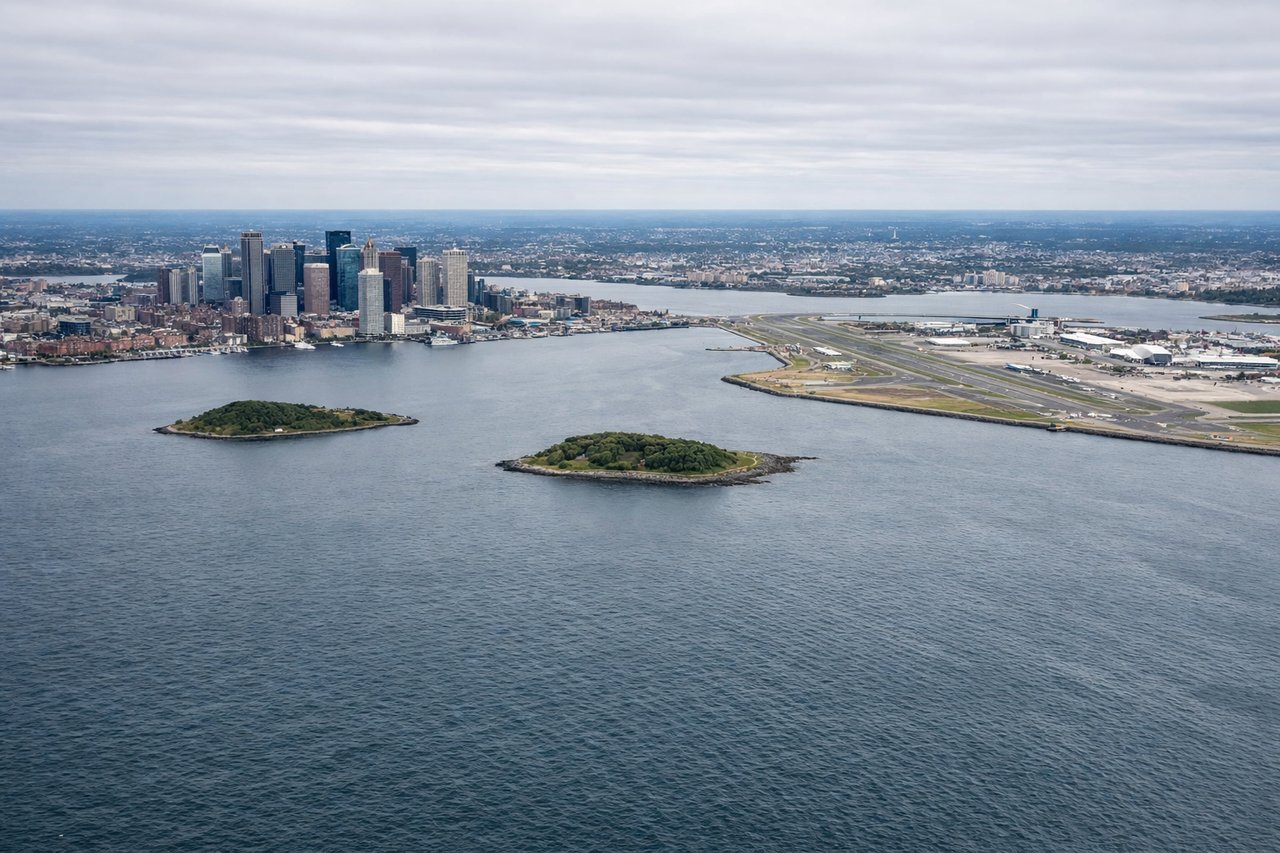
Landing at BOS
LEFTLogan Airport's primary westward approach on runway 33L/22L brings aircraft in over Boston Harbor from the east or southeast. The left side faces south toward downtown Boston, giving a clear view of the city skyline, the Charles River, and the harbor islands. The right side looks north toward Chelsea and Revere Beach with less visual interest.
Will your flight be in sunlight?
Pick a date and time in the Sun Map to watch the sun move across your whole flight.
About This Route
Which side of the plane should I sit on flying from Salt Lake City International (SLC) to General Edward Lawrence Logan International (BOS)?
Sit on the Left side of the plane for the best views on flights from Salt Lake City to Boston. Left side wins both ends of the flight. At takeoff you get the Wasatch Front and Great Salt Lake; at landing you get the Boston skyline and harbor. Over the Rockies and Midwest the left side also tends to face slightly south, keeping the sun out of your eyes on this eastbound route.
What can I see during takeoff from Salt Lake City International in Salt Lake City?
During takeoff from Salt Lake City International (SLC), sit on the Left side for the best views. SLC's primary departure runway 34L sends aircraft northward before turning east. The left side captures the full panorama of the Wasatch Front — the dramatic east-facing escarpment rising directly above the city — while the right side looks west toward the flat salt flats. As the aircraft banks right heading east, the left side briefly sweeps across the Great Salt Lake's southern arm. Notable sights include: Wasatch Front escarpment (Lone Peak, Mount Timpanogos), Great Salt Lake southern arm, Salt Lake Valley urban grid, Oquirrh Mountains to the southwest.
What can I see when landing at General Edward Lawrence Logan International in Boston?
When landing at General Edward Lawrence Logan International (BOS), sit on the Left side for the best views. Logan Airport's primary westward approach on runway 33L/22L brings aircraft in over Boston Harbor from the east or southeast. The left side faces south toward downtown Boston, giving a clear view of the city skyline, the Charles River, and the harbor islands. The right side looks north toward Chelsea and Revere Beach with less visual interest. Notable sights include: Downtown Boston skyline (Prudential Tower, Hancock Tower), Boston Harbor and harbor islands, Charles River and Cambridge, Logan Airport peninsula.
How long is the flight from Salt Lake City to Boston?
The flight from Salt Lake City International (SLC) to General Edward Lawrence Logan International (BOS) takes about 4 hours 30 minutes. The shortest flight path between them is 2,100 miles (3,380 km); winds and air traffic control usually add a few percent.
What does the Salt Lake City to Boston flight path pass over?
After the Rockies, the flight crosses the high plains of Wyoming and Nebraska, then the Missouri and Mississippi Rivers (visible as broad brown ribbons), the flat agricultural checkerboard of Iowa and Illinois, the Great Lakes region near Lake Erie's southern shore, then the Appalachian ridges of Pennsylvania and New York before descending over New England.