While takeoff offers excellent Wasatch Range views on the right, the landing approach provides more sustained and dramatic scenery. The San Gabriel Mountains and the visual transition into the LA basin from the left side during descent is more compelling than the brief takeoff window. Left seats capture both the mountain drama and the urban context of arrival.
Flown SLC to BUR? Did we get it right?
Flight Path
Salt Lake City to Burbank is 573 miles (923 km), a flight of about 2 hours 15 minutes.
The flight path crosses the Mojave Desert at cruise altitude (around 35,000 ft). Notable features include the Sevier Plateau and High Plateaus of Utah (visible during climb to cruise), the transition into the Mojave Desert with sparse vegetation and distinctive dry lake beds (Soda Lake, Bicycle Lake visible from altitude), and the San Bernardino Mountains appearing on the horizon as you begin descent into Southern California. The Colorado River drainage system is visible as a faint linear feature in the desert. At cruise, the curvature of the terrain and the vast emptiness of the Mojave dominate the view—few landmarks are distinctly visible at 35,000 feet, but the general topography shows the transition from the Great Basin to the Mojave Desert.
Great circle distance and headings ›


Phase by phase
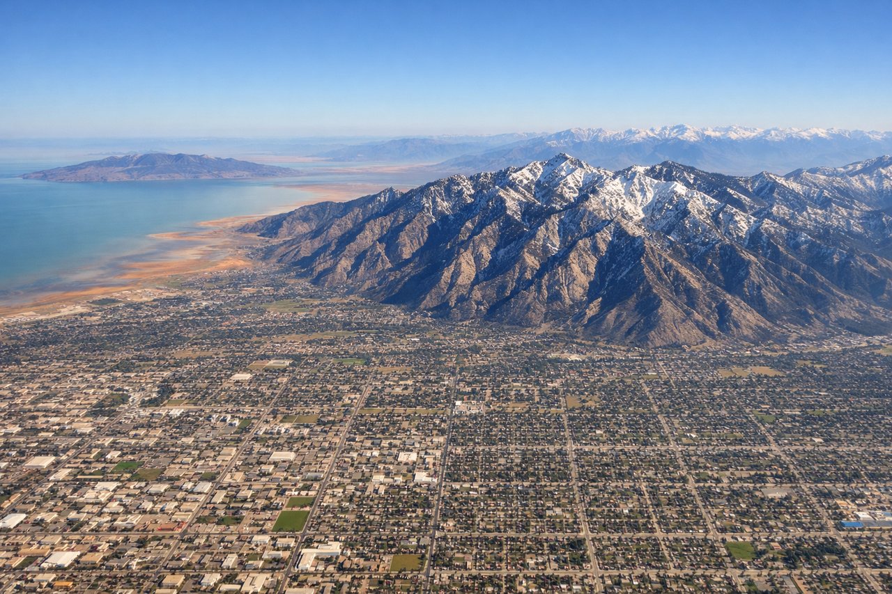
Takeoff from SLC
RIGHTSLC typically departs westbound (Runway 16L/R). Right-side seats face south toward the Wasatch Range's most dramatic peaks and the Salt Lake Valley floor. You'll see the urban grid of Salt Lake City and the lake itself receding beneath the wing.
Landing at BUR
LEFTBUR uses Runway 15 for most arrivals (southbound approach). Left-side seats face east toward the San Gabriel Mountains and the sprawling Los Angeles basin. You'll see the transition from desert to urban development and get clear views of the mountain backdrop that defines the LA metro area.
Will your flight be in sunlight?
Pick a date and time in the Sun Map to watch the sun move across your whole flight.
About This Route
Which side of the plane should I sit on flying from Salt Lake City International (SLC) to Burbank Glendale Pasadena (BUR)?
Sit on the Left side of the plane for the best views on flights from Salt Lake City to Burbank. While takeoff offers excellent Wasatch Range views on the right, the landing approach provides more sustained and dramatic scenery. The San Gabriel Mountains and the visual transition into the LA basin from the left side during descent is more compelling than the brief takeoff window. Left seats capture both the mountain drama and the urban context of arrival.
What can I see during takeoff from Salt Lake City International in Salt Lake City?
During takeoff from Salt Lake City International (SLC), sit on the Right side for the best views. SLC typically departs westbound (Runway 16L/R). Right-side seats face south toward the Wasatch Range's most dramatic peaks and the Salt Lake Valley floor. You'll see the urban grid of Salt Lake City and the lake itself receding beneath the wing. Notable sights include: Wasatch Range (Lone Peak, Mount Olympus), Great Salt Lake (northern arm), Salt Lake City downtown grid, Oquirrh Mountains to the west.
What can I see when landing at Burbank Glendale Pasadena in Burbank?
When landing at Burbank Glendale Pasadena (BUR), sit on the Left side for the best views. BUR uses Runway 15 for most arrivals (southbound approach). Left-side seats face east toward the San Gabriel Mountains and the sprawling Los Angeles basin. You'll see the transition from desert to urban development and get clear views of the mountain backdrop that defines the LA metro area. Notable sights include: San Gabriel Mountains (Mount Baldy, San Gabriel Peak), Los Angeles basin urban sprawl, Verdugo Mountains, Hollywood Hills.
How long is the flight from Salt Lake City to Burbank?
The flight from Salt Lake City International (SLC) to Burbank Glendale Pasadena (BUR) takes about 2 hours 15 minutes. The shortest flight path between them is 573 miles (923 km); winds and air traffic control usually add a few percent.
What does the Salt Lake City to Burbank flight path pass over?
The flight path crosses the Mojave Desert at cruise altitude (around 35,000 ft). Notable features include the Sevier Plateau and High Plateaus of Utah (visible during climb to cruise), the transition into the Mojave Desert with sparse vegetation and distinctive dry lake beds (Soda Lake, Bicycle Lake visible from altitude), and the San Bernardino Mountains appearing on the horizon as you begin descent into Southern California. The Colorado River drainage system is visible as a faint linear feature in the desert. At cruise, the curvature of the terrain and the vast emptiness of the Mojave dominate the view—few landmarks are distinctly visible at 35,000 feet, but the general topography shows the transition from the Great Basin to the Mojave Desert.