The right side delivers a stronger scenic arc: dramatic Wasatch peaks at departure, forested Idaho panhandle terrain during cruise, and Selkirk foothills on the arrival turn into Spokane, compared to the flatter valley and farmland views dominating the left side.
Flown SLC to GEG? Did we get it right?
Flight Path
Salt Lake City to Spokane is 546 miles (879 km), a flight of about 1 hour 25 minutes.
Snake River Plain of southern Idaho, distant Sawtooth and Bitterroot foothills to the east, transitioning into the rolling Palouse hills of eastern Washington near Spokane
Great circle distance and headings ›Phase by phase
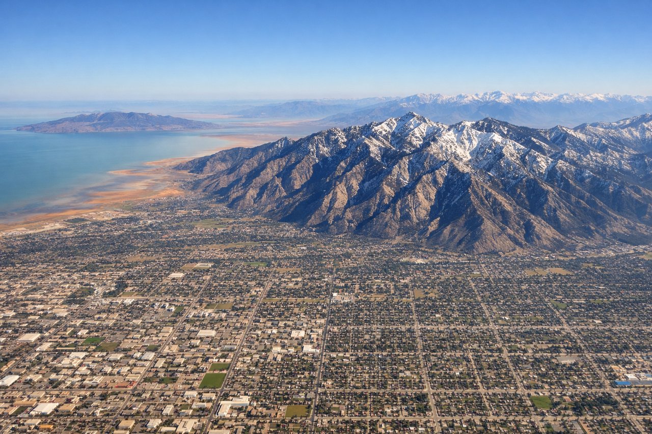
Takeoff from SLC
RIGHTClimbing out of SLC on a north-northwest heading, the right side puts passengers face-to-face with the steep, snow-streaked Wasatch Front rising directly east of the valley. The left side shows the flatter Great Salt Lake basin, which is scenic but less dramatic than the mountain wall.
Landing at GEG
RIGHTOn the turn into Spokane's Runway 21, the aircraft banks over the forested Selkirk foothills and rolling Palouse country to the northeast before lining up for landing, giving the right side a richer mix of pine ridges and river valleys. The left side mostly shows open farmland during the same turn.
Will your flight be in sunlight?
Pick a date and time in the Sun Map to watch the sun move across your whole flight.
About This Route
Which side of the plane should I sit on flying from Salt Lake City International (SLC) to Spokane International (GEG)?
Sit on the Right side of the plane for the best views on flights from Salt Lake City to Spokane. The right side delivers a stronger scenic arc: dramatic Wasatch peaks at departure, forested Idaho panhandle terrain during cruise, and Selkirk foothills on the arrival turn into Spokane, compared to the flatter valley and farmland views dominating the left side.
What can I see during takeoff from Salt Lake City International in Salt Lake City?
During takeoff from Salt Lake City International (SLC), sit on the Right side for the best views. Climbing out of SLC on a north-northwest heading, the right side puts passengers face-to-face with the steep, snow-streaked Wasatch Front rising directly east of the valley. The left side shows the flatter Great Salt Lake basin, which is scenic but less dramatic than the mountain wall. Notable sights include: Wasatch Range, Mount Olympus, Salt Lake Valley floor, distant Great Salt Lake to the northwest.
What can I see when landing at Spokane International in Spokane?
When landing at Spokane International (GEG), sit on the Right side for the best views. On the turn into Spokane's Runway 21, the aircraft banks over the forested Selkirk foothills and rolling Palouse country to the northeast before lining up for landing, giving the right side a richer mix of pine ridges and river valleys. The left side mostly shows open farmland during the same turn. Notable sights include: Selkirk Mountain foothills, Spokane River valley, Palouse wheat hills, forested ridgelines north of Spokane.
How long is the flight from Salt Lake City to Spokane?
The flight from Salt Lake City International (SLC) to Spokane International (GEG) takes about 1 hour 25 minutes. The shortest flight path between them is 546 miles (879 km); winds and air traffic control usually add a few percent.
What does the Salt Lake City to Spokane flight path pass over?
Snake River Plain of southern Idaho, distant Sawtooth and Bitterroot foothills to the east, transitioning into the rolling Palouse hills of eastern Washington near Spokane