The Mount Fuji view on arrival on the right side is one of the most iconic and reliable aerial landmarks in the world, and Tokyo Bay on approach is visually compelling. The left side at takeoff offers excellent Wasatch and Great Salt Lake views but the right side delivers more consistently across the full flight experience.
Flight Path
The great circle route arcs northward over southern Idaho and Montana, crosses into Canada over British Columbia and the Canadian Rockies, then tracks across the Gulf of Alaska and the Aleutian Island chain. The flight passes south of the Aleutians over the North Pacific, crossing the International Date Line roughly midway. The Kamchatka Peninsula and Kuril Islands appear on the descent toward Japan before landfall over Hokkaido or northeastern Honshu.
Great circle distance and headings ›


Phase by phase
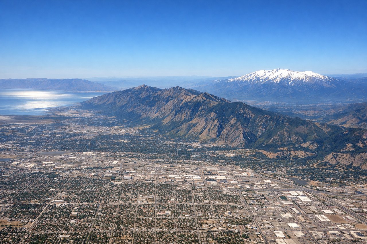
Takeoff from SLC
LEFTSLC typically departs westbound on runway 34L/34R or eastbound on 17s. For westbound departures heading toward the Pacific, a left turn northward puts the Wasatch Range directly on the left side. You get a clear view of the Wasatch Front peaks including Mount Olympus and Twin Peaks rising above the Salt Lake Valley, plus the Great Salt Lake spreading out to the northwest.
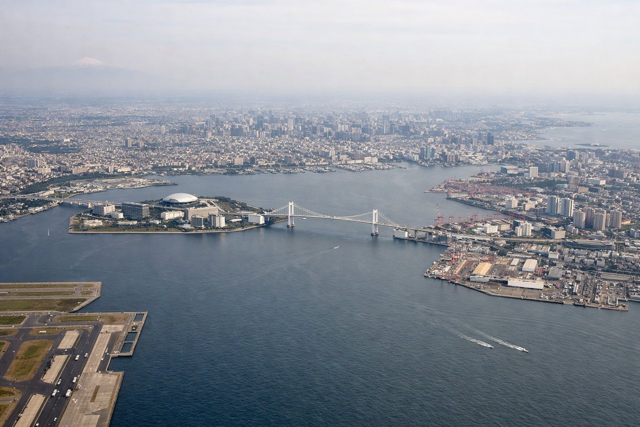
Landing at HND
RIGHTHND approaches from the north or east over Tokyo Bay on runway 34L/34R or from the south. Arriving from the northeast on a typical transpacific routing, the right side gives you Tokyo Bay, the dense urban fabric of central Tokyo, and on clear days Mount Fuji sitting prominently to the southwest as a lone volcanic cone above the Kanto Plain.
Landmarks on this routeAll landmarks →
Will your flight be in sunlight?
See exactly which side of the plane gets sun and shade at your departure time.
About This Route
Which side of the plane should I sit on flying from Salt Lake City International (SLC) to Tokyo International (HND)?
Sit on the Right side of the plane for the best views on flights from Salt Lake City to Tokyo. The Mount Fuji view on arrival on the right side is one of the most iconic and reliable aerial landmarks in the world, and Tokyo Bay on approach is visually compelling. The left side at takeoff offers excellent Wasatch and Great Salt Lake views but the right side delivers more consistently across the full flight experience.
What can I see during takeoff from Salt Lake City International in Salt Lake City?
During takeoff from Salt Lake City International (SLC), sit on the Left side for the best views. SLC typically departs westbound on runway 34L/34R or eastbound on 17s. For westbound departures heading toward the Pacific, a left turn northward puts the Wasatch Range directly on the left side. You get a clear view of the Wasatch Front peaks including Mount Olympus and Twin Peaks rising above the Salt Lake Valley, plus the Great Salt Lake spreading out to the northwest. Notable sights include: Wasatch Range (Mount Olympus, Twin Peaks), Great Salt Lake, Salt Lake Valley urban grid, Oquirrh Mountains to the southwest.
What can I see when landing at Tokyo International in Tokyo?
When landing at Tokyo International (HND), sit on the Right side for the best views. HND approaches from the north or east over Tokyo Bay on runway 34L/34R or from the south. Arriving from the northeast on a typical transpacific routing, the right side gives you Tokyo Bay, the dense urban fabric of central Tokyo, and on clear days Mount Fuji sitting prominently to the southwest as a lone volcanic cone above the Kanto Plain. Notable sights include: Mount Fuji (southwest horizon), Tokyo Bay, central Tokyo urban density, Yokohama waterfront.
How long is the flight from Salt Lake City to Tokyo?
The flight from Salt Lake City International (SLC) to Tokyo International (HND) takes Approximately 11 to 12 hours.
What does the Salt Lake City to Tokyo flight path pass over?
The great circle route arcs northward over southern Idaho and Montana, crosses into Canada over British Columbia and the Canadian Rockies, then tracks across the Gulf of Alaska and the Aleutian Island chain. The flight passes south of the Aleutians over the North Pacific, crossing the International Date Line roughly midway. The Kamchatka Peninsula and Kuril Islands appear on the descent toward Japan before landfall over Hokkaido or northeastern Honshu.