Left side wins at both ends of the flight. During the cruise over Colorado and the Rockies, the left side also gives better angles on the Colorado Rockies as the route tracks northeast, making it the clear choice for the full journey.
Flown SLC to IAD? Did we get it right?
Flight Path
Salt Lake City to Washington is 1,823 miles (2,935 km), a flight of about 3 hours 40 minutes.
The route crosses the Wasatch Plateau and Book Cliffs of eastern Utah, then the Colorado Rockies including the Sawatch and Front Range, the high plains of eastern Colorado and Kansas, the Missouri River valley, and the Appalachian ridges of western Maryland and Virginia before descending into the DC area.
Great circle distance and headings ›


Phase by phase
Takeoff from SLC
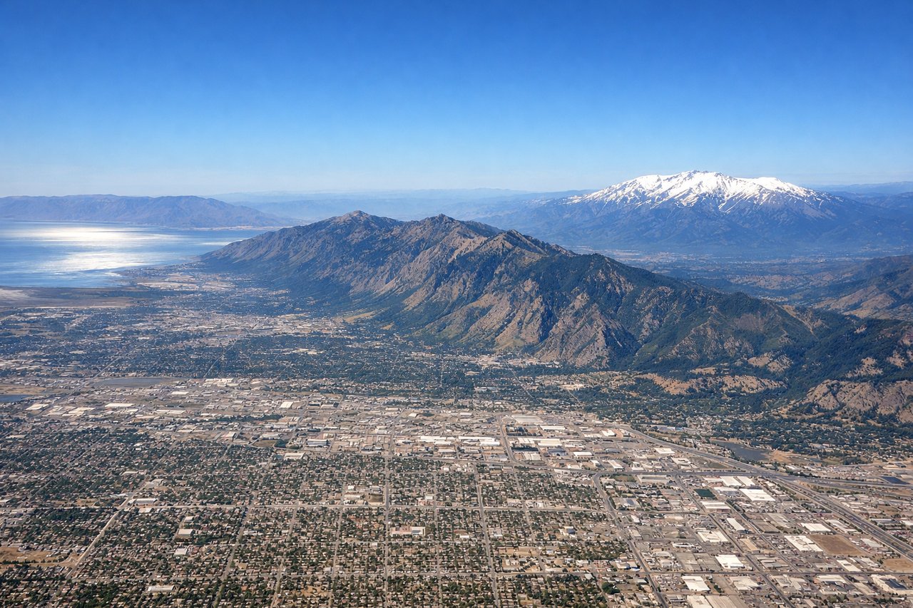
LEFTSLC's primary departure runway 34L sends aircraft northward before turning east, putting the Wasatch Range directly on the left side. You get a close-up view of the central Wasatch peaks including Mount Olympus and Twin Peaks rising above the Salt Lake Valley, plus a clear look back at the Great Salt Lake to the northwest.
Landing at IAD
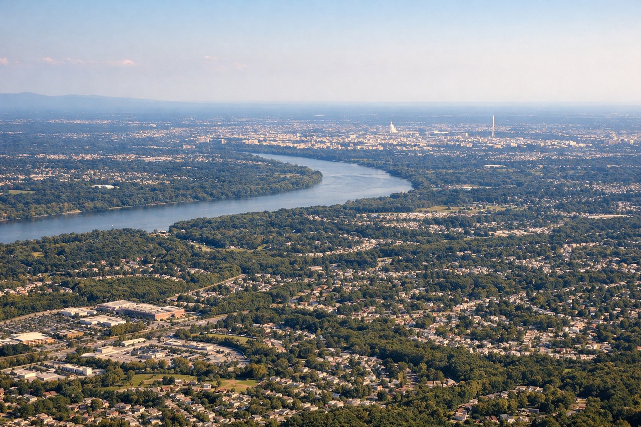
LEFTDulles typically uses runways 01L/R for northbound arrivals or 19L/R for southbound, but the most common approach from the west is runway 01R, bringing aircraft in from the south-southwest. A left window seat gives you the best view of the DC skyline, the Potomac River, and the monuments as you descend over Northern Virginia.
Will your flight be in sunlight?
Pick a date and time in the Sun Map to watch the sun move across your whole flight.
About This Route
Which side of the plane should I sit on flying from Salt Lake City International (SLC) to Washington Dulles International (IAD)?
Sit on the Left side of the plane for the best views on flights from Salt Lake City to Washington. Left side wins at both ends of the flight. During the cruise over Colorado and the Rockies, the left side also gives better angles on the Colorado Rockies as the route tracks northeast, making it the clear choice for the full journey.
What can I see during takeoff from Salt Lake City International in Salt Lake City?
During takeoff from Salt Lake City International (SLC), sit on the Left side for the best views. SLC's primary departure runway 34L sends aircraft northward before turning east, putting the Wasatch Range directly on the left side. You get a close-up view of the central Wasatch peaks including Mount Olympus and Twin Peaks rising above the Salt Lake Valley, plus a clear look back at the Great Salt Lake to the northwest. Notable sights include: Wasatch Range (Mount Olympus, Twin Peaks), Great Salt Lake, Salt Lake Valley urban grid, Oquirrh Mountains across the valley.
What can I see when landing at Washington Dulles International in Washington?
When landing at Washington Dulles International (IAD), sit on the Left side for the best views. Dulles typically uses runways 01L/R for northbound arrivals or 19L/R for southbound, but the most common approach from the west is runway 01R, bringing aircraft in from the south-southwest. A left window seat gives you the best view of the DC skyline, the Potomac River, and the monuments as you descend over Northern Virginia. Notable sights include: Potomac River, Washington Monument and Capitol dome (distant), Tysons Corner urban cluster, Blue Ridge Mountains on the western horizon.
How long is the flight from Salt Lake City to Washington?
The flight from Salt Lake City International (SLC) to Washington Dulles International (IAD) takes about 3 hours 40 minutes. The shortest flight path between them is 1,823 miles (2,935 km); winds and air traffic control usually add a few percent.
What does the Salt Lake City to Washington flight path pass over?
The route crosses the Wasatch Plateau and Book Cliffs of eastern Utah, then the Colorado Rockies including the Sawatch and Front Range, the high plains of eastern Colorado and Kansas, the Missouri River valley, and the Appalachian ridges of western Maryland and Virginia before descending into the DC area.