The left side wins on both ends of the flight: dramatic close-up Wasatch Range scenery at takeoff and a sweeping Pacific coastline with Catalina Island and Long Beach Harbor on arrival, while the right side offers only distant desert basins and hazy inland cityscape.
Flight Path
The route crosses the basin-and-range desert terrain of central Nevada, with long parallel mountain ridges separated by flat valley floors, before descending over the Mojave Desert and the San Bernardino/San Gabriel Mountains into the Los Angeles basin.
Great circle distance and headings ›

.jpg?width=600)
Phase by phase
Takeoff from SLC
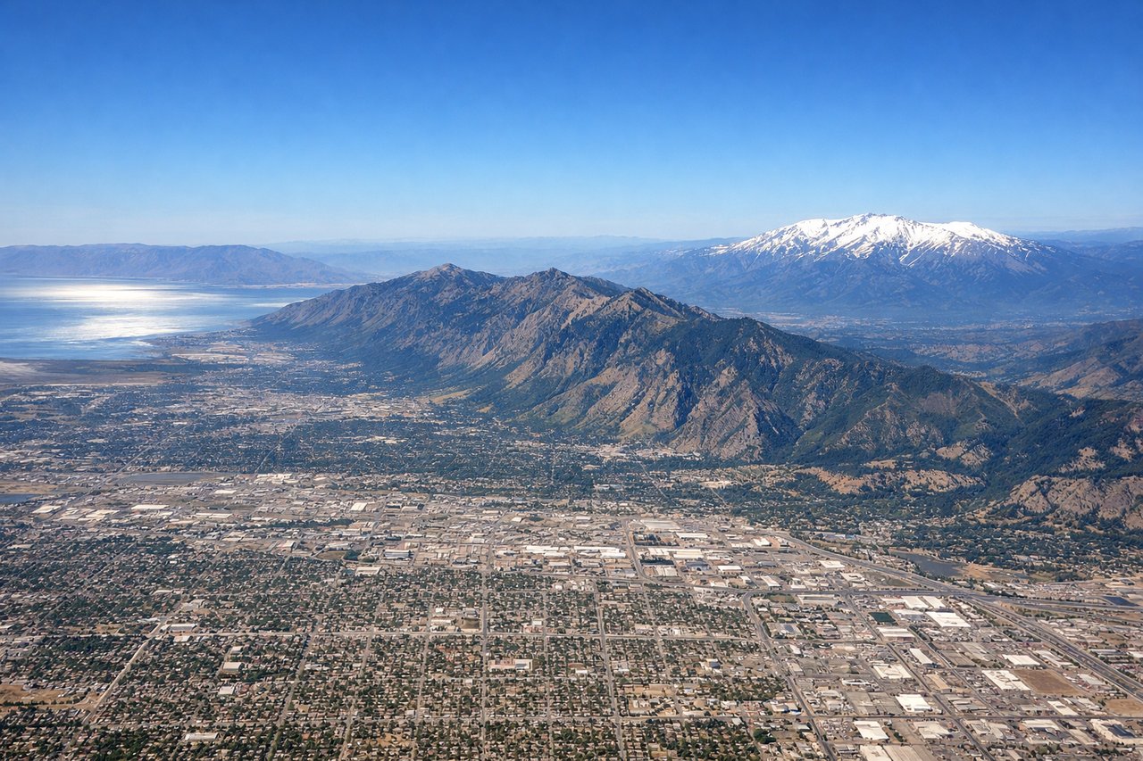
LEFTDeparting SLC on the south-facing runway, the Wasatch Range rises dramatically just east of the airport, giving left-side passengers close, steep mountain walls right after liftoff. The right side only offers the flat, hazy expanse of the Great Salt Lake basin, which is scenic but far less dramatic.
Landing at LGB
LEFTOn the approach into LGB from the southeast, the final turn onto runway 30 puts the ocean, harbor, and Catalina Island on the left side of the aircraft. This coastal panorama is far more scenic than the inland view of the Los Angeles basin's urban sprawl and haze on the right.
Landmarks on this routeAll landmarks →
Will your flight be in sunlight?
See exactly which side of the plane gets sun and shade at your departure time.
About This Route
Which side of the plane should I sit on flying from Salt Lake City International (SLC) to Long Beach (LGB)?
Sit on the Left side of the plane for the best views on flights from Salt Lake City to Long Beach. The left side wins on both ends of the flight: dramatic close-up Wasatch Range scenery at takeoff and a sweeping Pacific coastline with Catalina Island and Long Beach Harbor on arrival, while the right side offers only distant desert basins and hazy inland cityscape.
What can I see during takeoff from Salt Lake City International in Salt Lake City?
During takeoff from Salt Lake City International (SLC), sit on the Left side for the best views. Departing SLC on the south-facing runway, the Wasatch Range rises dramatically just east of the airport, giving left-side passengers close, steep mountain walls right after liftoff. The right side only offers the flat, hazy expanse of the Great Salt Lake basin, which is scenic but far less dramatic. Notable sights include: Wasatch Range peaks (Mount Olympus, Lone Peak), Salt Lake Valley foothills, Great Salt Lake in the distant right background.
What can I see when landing at Long Beach in Long Beach?
When landing at Long Beach (LGB), sit on the Left side for the best views. On the approach into LGB from the southeast, the final turn onto runway 30 puts the ocean, harbor, and Catalina Island on the left side of the aircraft. This coastal panorama is far more scenic than the inland view of the Los Angeles basin's urban sprawl and haze on the right. Notable sights include: Long Beach Harbor and container port, Queen Mary ship, Palos Verdes Peninsula, Catalina Island on the horizon.
How long is the flight from Salt Lake City to Long Beach?
The flight from Salt Lake City International (SLC) to Long Beach (LGB) takes 2h 00m.
What does the Salt Lake City to Long Beach flight path pass over?
The route crosses the basin-and-range desert terrain of central Nevada, with long parallel mountain ridges separated by flat valley floors, before descending over the Mojave Desert and the San Bernardino/San Gabriel Mountains into the Los Angeles basin.