The right side wins primarily on the strength of the Wasatch Range views during departure from SLC, which stand out sharply against the otherwise flat, plains-dominated route across Wyoming, Nebraska, and Kansas. The left side lacks comparable terrain drama at either end of the flight.
Flown SLC to MCI? Did we get it right?
Flight Path
Salt Lake City to Kansas City is 918 miles (1,477 km), a flight of about 2 hours 15 minutes.
High plains of Wyoming and Nebraska, gently rolling terrain with occasional river valleys (Platte River), transitioning into flat Kansas farmland — largely featureless from cruise altitude
Great circle distance and headings ›

Phase by phase
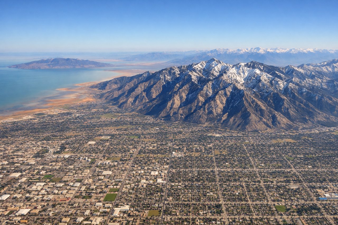
Takeoff from SLC
RIGHTDeparting SLC with a turn toward the east, the right side gets a strong view of the Wasatch Range rising sharply along the Salt Lake Valley's eastern edge, with the urbanized valley floor below. The left side mostly shows the flat, pale expanse of the Great Salt Lake basin and desert, which is interesting briefly but fades fast.
Landing at MCI
RIGHTOn approach into MCI, southerly wind patterns typically bring aircraft in from the north, and the right side offers glimpses of the Missouri River valley and the patchwork of farmland transitioning into the Kansas City metro edge. The left side stays over featureless agricultural plains with no distinguishing terrain.
Will your flight be in sunlight?
Pick a date and time in the Sun Map to watch the sun move across your whole flight.
About This Route
Which side of the plane should I sit on flying from Salt Lake City International (SLC) to Kansas City International (MCI)?
Sit on the Right side of the plane for the best views on flights from Salt Lake City to Kansas City. The right side wins primarily on the strength of the Wasatch Range views during departure from SLC, which stand out sharply against the otherwise flat, plains-dominated route across Wyoming, Nebraska, and Kansas. The left side lacks comparable terrain drama at either end of the flight.
What can I see during takeoff from Salt Lake City International in Salt Lake City?
During takeoff from Salt Lake City International (SLC), sit on the Right side for the best views. Departing SLC with a turn toward the east, the right side gets a strong view of the Wasatch Range rising sharply along the Salt Lake Valley's eastern edge, with the urbanized valley floor below. The left side mostly shows the flat, pale expanse of the Great Salt Lake basin and desert, which is interesting briefly but fades fast. Notable sights include: Wasatch Range, Salt Lake Valley urban grid, Great Salt Lake (distant, left).
What can I see when landing at Kansas City International in Kansas City?
When landing at Kansas City International (MCI), sit on the Right side for the best views. On approach into MCI, southerly wind patterns typically bring aircraft in from the north, and the right side offers glimpses of the Missouri River valley and the patchwork of farmland transitioning into the Kansas City metro edge. The left side stays over featureless agricultural plains with no distinguishing terrain. Notable sights include: Missouri River bends, Kansas City metro edge, checkerboard farmland.
How long is the flight from Salt Lake City to Kansas City?
The flight from Salt Lake City International (SLC) to Kansas City International (MCI) takes about 2 hours 15 minutes. The shortest flight path between them is 918 miles (1,477 km); winds and air traffic control usually add a few percent.
What does the Salt Lake City to Kansas City flight path pass over?
High plains of Wyoming and Nebraska, gently rolling terrain with occasional river valleys (Platte River), transitioning into flat Kansas farmland — largely featureless from cruise altitude