While left seats dominate the departure, right seats capture the more dramatic and sustained views during the lengthy descent into New Orleans, including Lake Pontchartrain and the Mississippi River's iconic meanders—the signature geographic features of this route's destination.
Flown SLC to MSY? Did we get it right?
Flight Path
Salt Lake City to New Orleans is 1,427 miles (2,296 km), a flight of about 4 hours 15 minutes.
The flight path crosses the Colorado Plateau (visible as high desert terrain with subtle canyon systems), then transitions over the Texas Panhandle and Oklahoma (flat agricultural plains), before descending into the Mississippi River valley. The transition from high desert to Gulf Coast lowlands is gradual but marked by decreasing elevation and increasing vegetation density. No major mountain ranges are crossed after leaving Utah, making the descent into Louisiana's flat deltaic landscape the most visually distinctive portion of the route.
Great circle distance and headings ›


Phase by phase
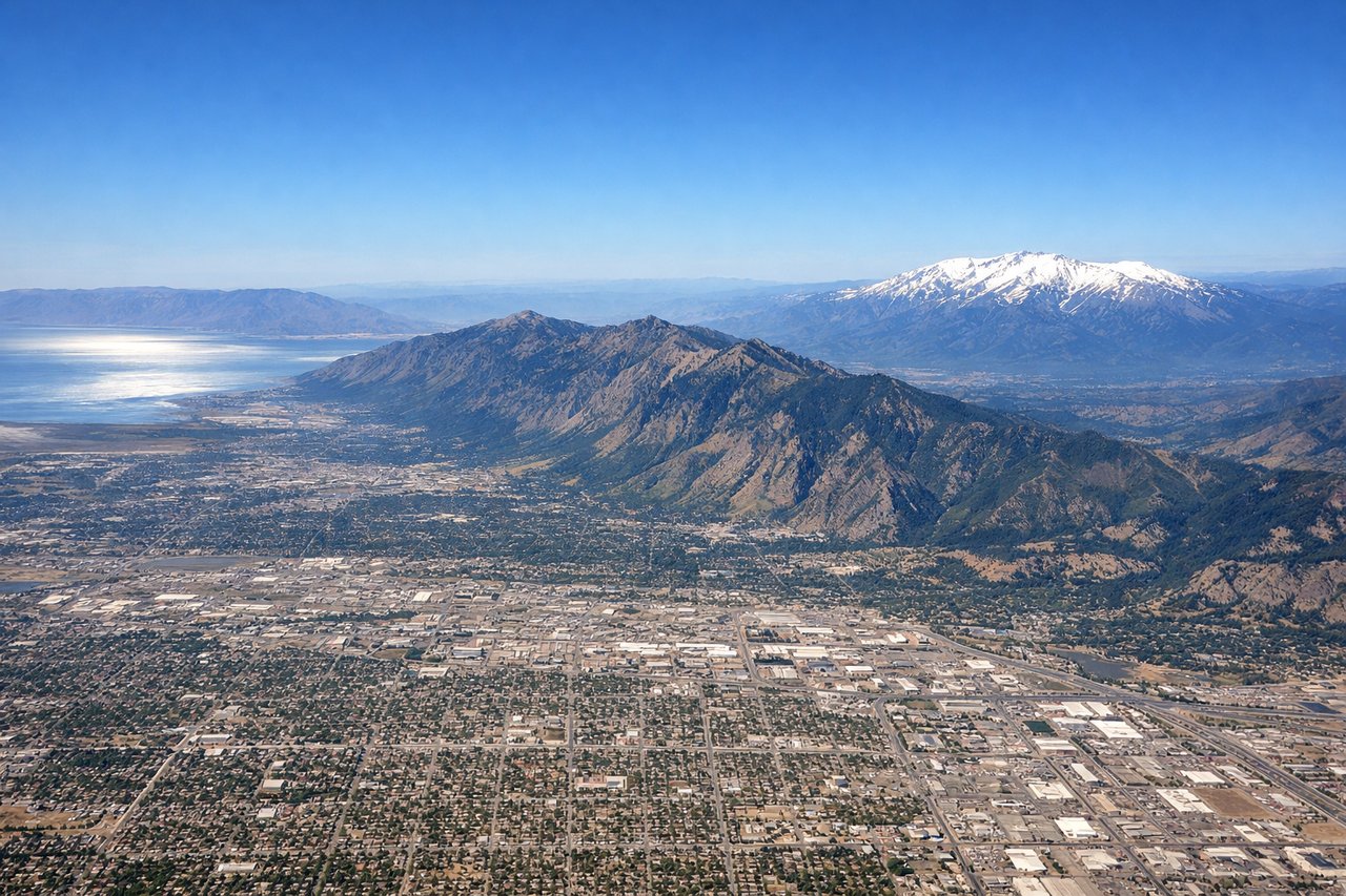
Takeoff from SLC
LEFTSLC typically departs northbound (runways 16L/R) or southbound (34L/R). Left seats offer the best view of the Wasatch Range's dramatic eastern escarpment immediately after takeoff, with the snow-capped peaks rising sharply from the Salt Lake Valley floor.
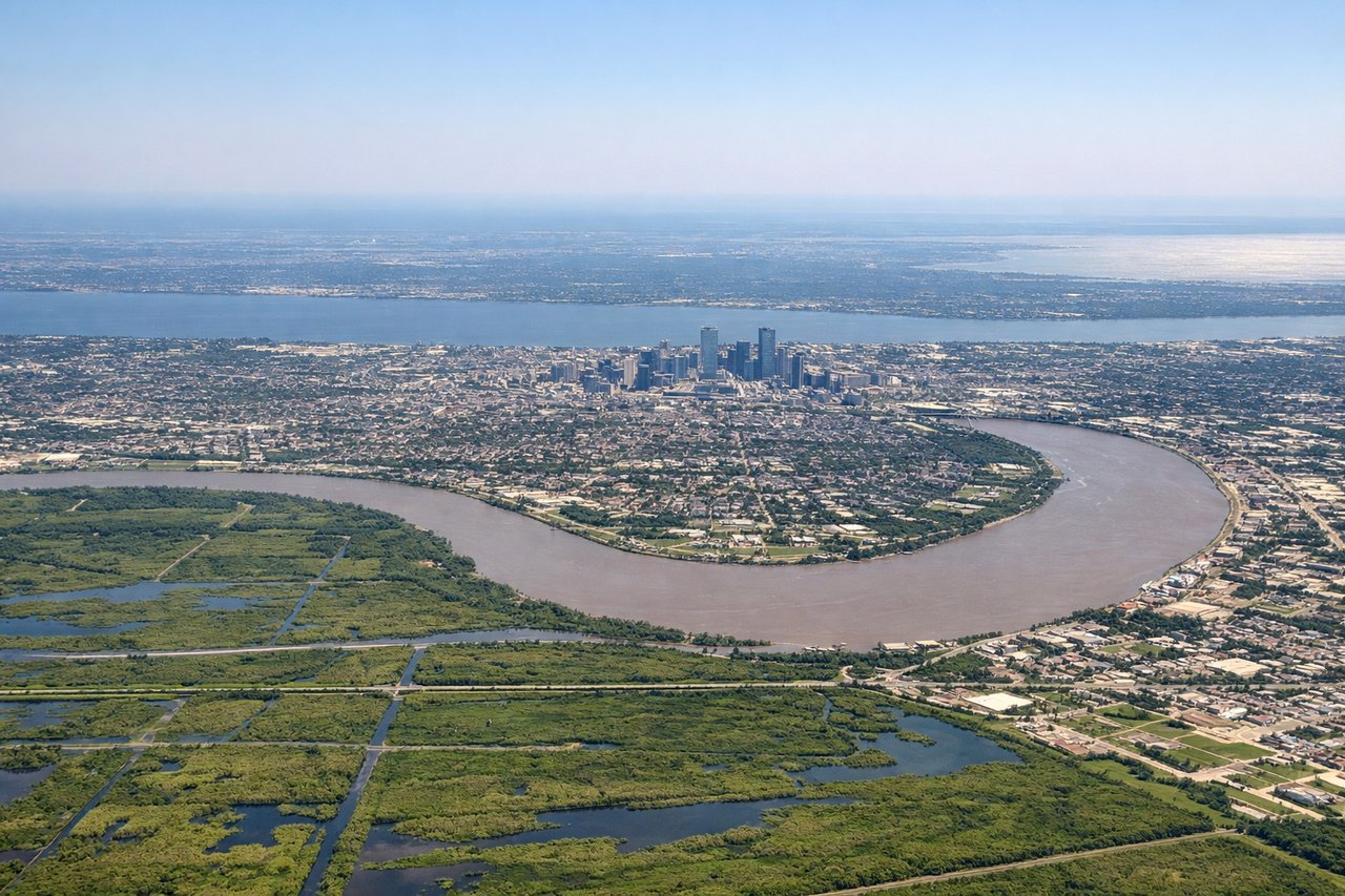
Landing at MSY
RIGHTMSY approaches from the east typically use runways 10L/R. Right-side seats provide excellent views of Lake Pontchartrain during descent, the Mississippi River's distinctive meanders south of the airport, and the New Orleans urban area with its characteristic crescent shape along the river.
Will your flight be in sunlight?
Pick a date and time in the Sun Map to watch the sun move across your whole flight.
About This Route
Which side of the plane should I sit on flying from Salt Lake City International (SLC) to Louis Armstrong New Orleans International (MSY)?
Sit on the Right side of the plane for the best views on flights from Salt Lake City to New Orleans. While left seats dominate the departure, right seats capture the more dramatic and sustained views during the lengthy descent into New Orleans, including Lake Pontchartrain and the Mississippi River's iconic meanders—the signature geographic features of this route's destination.
What can I see during takeoff from Salt Lake City International in Salt Lake City?
During takeoff from Salt Lake City International (SLC), sit on the Left side for the best views. SLC typically departs northbound (runways 16L/R) or southbound (34L/R). Left seats offer the best view of the Wasatch Range's dramatic eastern escarpment immediately after takeoff, with the snow-capped peaks rising sharply from the Salt Lake Valley floor. Notable sights include: Wasatch Range (east), Great Salt Lake (northwest), Salt Lake Valley urban grid (below), Oquirrh Mountains (west).
What can I see when landing at Louis Armstrong New Orleans International in New Orleans?
When landing at Louis Armstrong New Orleans International (MSY), sit on the Right side for the best views. MSY approaches from the east typically use runways 10L/R. Right-side seats provide excellent views of Lake Pontchartrain during descent, the Mississippi River's distinctive meanders south of the airport, and the New Orleans urban area with its characteristic crescent shape along the river. Notable sights include: Lake Pontchartrain (north), Mississippi River meanders (south), New Orleans urban crescent (southwest), Bayou Bienvenue marshlands (east).
How long is the flight from Salt Lake City to New Orleans?
The flight from Salt Lake City International (SLC) to Louis Armstrong New Orleans International (MSY) takes about 4 hours 15 minutes. The shortest flight path between them is 1,427 miles (2,296 km); winds and air traffic control usually add a few percent.
What does the Salt Lake City to New Orleans flight path pass over?
The flight path crosses the Colorado Plateau (visible as high desert terrain with subtle canyon systems), then transitions over the Texas Panhandle and Oklahoma (flat agricultural plains), before descending into the Mississippi River valley. The transition from high desert to Gulf Coast lowlands is gradual but marked by decreasing elevation and increasing vegetation density. No major mountain ranges are crossed after leaving Utah, making the descent into Louisiana's flat deltaic landscape the most visually distinctive portion of the route.