While the takeoff on the left offers dramatic mountain and lake scenery, the landing on the right provides more sustained visual interest over the Texas landscape. Right side captures the geological transition from the Hill Country to the San Antonio basin, making it the better choice for the overall flight experience.
Flown SLC to SAT? Did we get it right?
Flight Path
Salt Lake City to San Antonio is 1,087 miles (1,749 km), a flight of about 3 hours 15 minutes.
The flight path crosses central Texas, passing over the Edwards Plateau and its characteristic limestone terrain. Notable features include the Llano Uplift region (visible as slightly elevated terrain with exposed rock formations), multiple river systems including the Pedernales and Blanco rivers (appearing as thin drainage lines), and the transition from the Hill Country's rolling topography to the flatter terrain approaching San Antonio. The landscape gradually shifts from the higher elevations and more rugged terrain of the north to the smoother, lower elevations of the south Texas plain.
Great circle distance and headings ›

Phase by phase
Takeoff from SLC
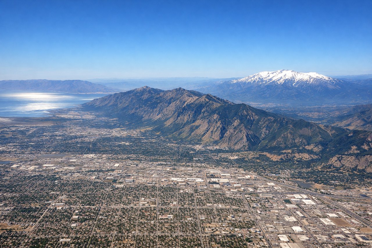
LEFTLeft side offers immediate views of the Wasatch Range and the Great Salt Lake as you climb out northwestward. The lake's irregular shoreline and the snow-capped peaks create strong visual contrast during the initial climb.
Landing at SAT
RIGHTRight side provides views of the Texas Hill Country and the Colorado River drainage as you descend into San Antonio from the north. The rolling terrain and river valleys create visible topographic relief during final approach.
Will your flight be in sunlight?
Pick a date and time in the Sun Map to watch the sun move across your whole flight.
About This Route
Which side of the plane should I sit on flying from Salt Lake City International (SLC) to San Antonio International (SAT)?
Sit on the Right side of the plane for the best views on flights from Salt Lake City to San Antonio. While the takeoff on the left offers dramatic mountain and lake scenery, the landing on the right provides more sustained visual interest over the Texas landscape. Right side captures the geological transition from the Hill Country to the San Antonio basin, making it the better choice for the overall flight experience.
What can I see during takeoff from Salt Lake City International in Salt Lake City?
During takeoff from Salt Lake City International (SLC), sit on the Left side for the best views. Left side offers immediate views of the Wasatch Range and the Great Salt Lake as you climb out northwestward. The lake's irregular shoreline and the snow-capped peaks create strong visual contrast during the initial climb. Notable sights include: Great Salt Lake (immediately west), Wasatch Range (north and northeast), Salt Lake City urban grid (directly below during climb), Antelope Island (visible in the lake's northern portion).
What can I see when landing at San Antonio International in San Antonio?
When landing at San Antonio International (SAT), sit on the Right side for the best views. Right side provides views of the Texas Hill Country and the Colorado River drainage as you descend into San Antonio from the north. The rolling terrain and river valleys create visible topographic relief during final approach. Notable sights include: Colorado River (visible as a meandering line through the landscape), Texas Hill Country (rolling terrain with visible ridge lines), San Antonio urban area (expanding below during descent), Balcones Escarpment (geological feature visible as a subtle elevation change in the terrain).
How long is the flight from Salt Lake City to San Antonio?
The flight from Salt Lake City International (SLC) to San Antonio International (SAT) takes about 3 hours 15 minutes. The shortest flight path between them is 1,087 miles (1,749 km); winds and air traffic control usually add a few percent.
What does the Salt Lake City to San Antonio flight path pass over?
The flight path crosses central Texas, passing over the Edwards Plateau and its characteristic limestone terrain. Notable features include the Llano Uplift region (visible as slightly elevated terrain with exposed rock formations), multiple river systems including the Pedernales and Blanco rivers (appearing as thin drainage lines), and the transition from the Hill Country's rolling topography to the flatter terrain approaching San Antonio. The landscape gradually shifts from the higher elevations and more rugged terrain of the north to the smoother, lower elevations of the south Texas plain.