While takeoff favors the right for the Wasatch Range, the landing approach into Costa Rica's Central Valley is superior on the left. The descent into SJO offers more dramatic and sustained views of the Cordillera Central volcanoes and the developed valley landscape. The landing experience outweighs the takeoff advantage.
Flown SLC to SJO? Did we get it right?
Flight Path
Salt Lake City to San Jose is 2,720 miles (4,377 km), a flight of about 5 hours 30 minutes.
The flight path crosses the southwestern United States and Mexico. Notable features include the Colorado Plateau (visible as elevated terrain with canyon systems), the Sierra Madre Occidental in northern Mexico (mountain ranges running north-south), and the Mexican Plateau. As you approach Central America, the terrain transitions to the Sierra Madre del Sur in southern Mexico, followed by the volcanic highlands of Guatemala and El Salvador. The Yucatan Peninsula may be visible to the east depending on exact routing. Cloud cover over Mexico and Central America typically increases in the afternoon, potentially obscuring ground features during the latter half of the flight.
Great circle distance and headings ›


Phase by phase
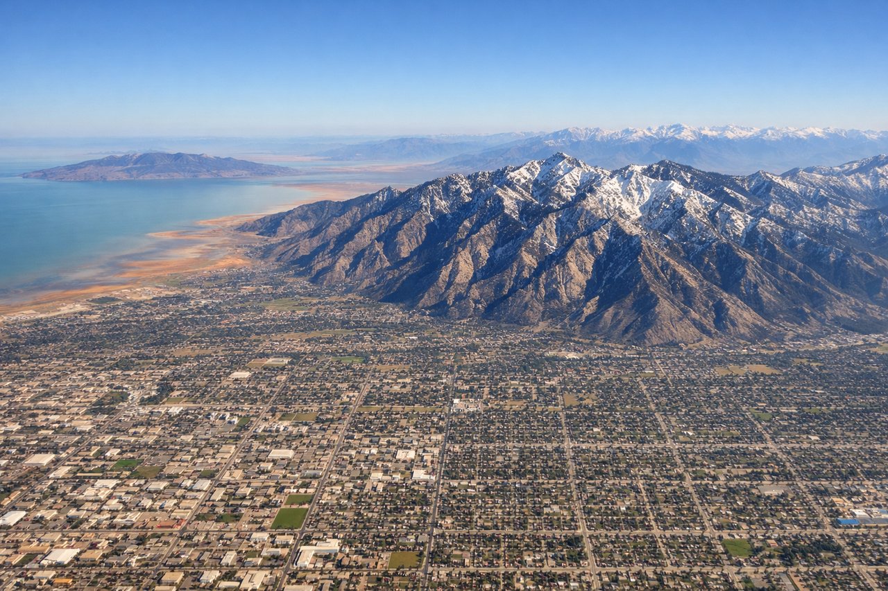
Takeoff from SLC
RIGHTSLC typically departs north or south on runways 16/34. Right-side seats offer the best view of the Wasatch Range's dramatic eastern escarpment as you climb out. The mountains rise sharply from the valley floor and remain visible for the first 15-20 minutes of flight.
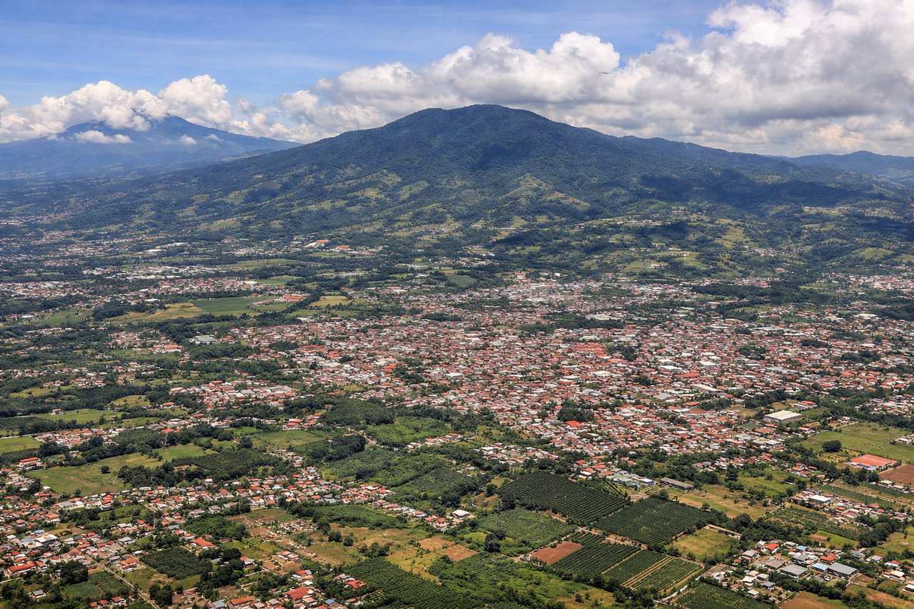
Landing at SJO
LEFTApproaching SJO typically uses runways 32 or 05. Left-side seats provide excellent views of the Central Valley of Costa Rica and the surrounding volcanic peaks. As you descend into the San Jose basin, you'll see the Cordillera Central mountains and the developed valley floor with the city sprawl visible below.
Will your flight be in sunlight?
Pick a date and time in the Sun Map to watch the sun move across your whole flight.
About This Route
Which side of the plane should I sit on flying from Salt Lake City International (SLC) to Juan Santamaria International (SJO)?
Sit on the Left side of the plane for the best views on flights from Salt Lake City to San Jose. While takeoff favors the right for the Wasatch Range, the landing approach into Costa Rica's Central Valley is superior on the left. The descent into SJO offers more dramatic and sustained views of the Cordillera Central volcanoes and the developed valley landscape. The landing experience outweighs the takeoff advantage.
What can I see during takeoff from Salt Lake City International in Salt Lake City?
During takeoff from Salt Lake City International (SLC), sit on the Right side for the best views. SLC typically departs north or south on runways 16/34. Right-side seats offer the best view of the Wasatch Range's dramatic eastern escarpment as you climb out. The mountains rise sharply from the valley floor and remain visible for the first 15-20 minutes of flight. Notable sights include: Wasatch Range (immediately east), Great Salt Lake (northwest, visible as a large pale water body), Salt Lake Valley urban grid (directly below), Antelope Island (in the lake, visible as a dark landmass).
What can I see when landing at Juan Santamaria International in San Jose?
When landing at Juan Santamaria International (SJO), sit on the Left side for the best views. Approaching SJO typically uses runways 32 or 05. Left-side seats provide excellent views of the Central Valley of Costa Rica and the surrounding volcanic peaks. As you descend into the San Jose basin, you'll see the Cordillera Central mountains and the developed valley floor with the city sprawl visible below. Notable sights include: Cordillera Central volcanic peaks (Poás and Barva volcanoes visible as rounded summits), Central Valley agricultural lands (patchwork of green fields), San Jose urban area (sprawling development in the valley floor), Meseta Central plateau terrain.
How long is the flight from Salt Lake City to San Jose?
The flight from Salt Lake City International (SLC) to Juan Santamaria International (SJO) takes about 5 hours 30 minutes. The shortest flight path between them is 2,720 miles (4,377 km); winds and air traffic control usually add a few percent.
What does the Salt Lake City to San Jose flight path pass over?
The flight path crosses the southwestern United States and Mexico. Notable features include the Colorado Plateau (visible as elevated terrain with canyon systems), the Sierra Madre Occidental in northern Mexico (mountain ranges running north-south), and the Mexican Plateau. As you approach Central America, the terrain transitions to the Sierra Madre del Sur in southern Mexico, followed by the volcanic highlands of Guatemala and El Salvador. The Yucatan Peninsula may be visible to the east depending on exact routing. Cloud cover over Mexico and Central America typically increases in the afternoon, potentially obscuring ground features during the latter half of the flight.