Right-side seats capture the Wasatch Range's dramatic topography during both takeoff and much of the northbound climb, which is the most visually distinctive feature of the SLC departure. While left seats have advantages during landing, the takeoff experience is superior on the right.
Flown SLC to YVR? Did we get it right?
Flight Path
Salt Lake City to Vancouver is 796 miles (1,282 km), a flight of about 2 hours 15 minutes.
After climbing north from SLC, the flight crosses the Wasatch Range's northern extensions near Ogden, Utah (visible as a small city in the valley). The route then passes over the Bear River Mountains and into Idaho, crossing relatively flat terrain with scattered lakes and forests. As you approach the Canadian border near the Okanagan region, terrain becomes more mountainous again with visible lakes (Pend Oreille, Coeur d'Alene area). The final approach into YVR descends over the Cascade Range foothills and the Fraser River valley, with Puget Sound and the Strait of Georgia becoming visible before landing.
Great circle distance and headings ›

Phase by phase
Takeoff from SLC
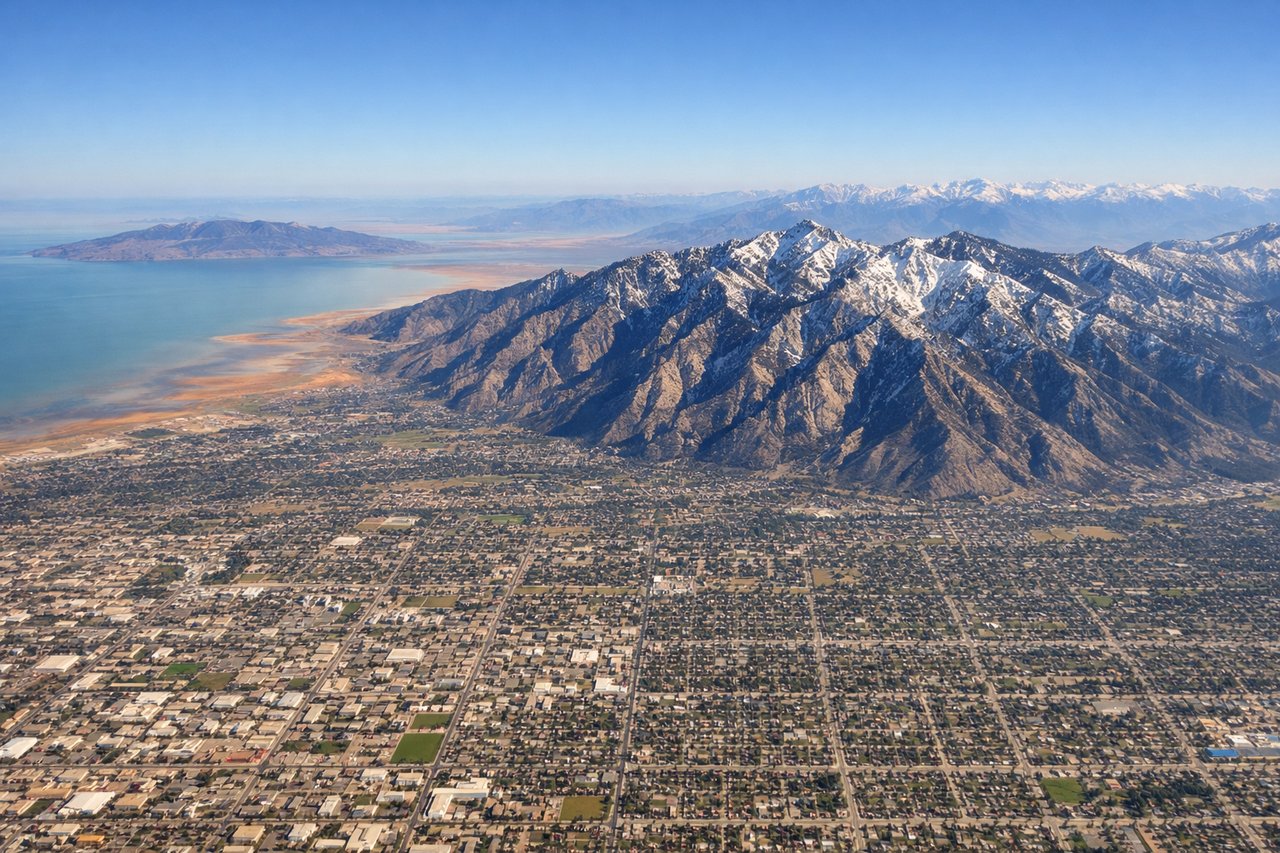
RIGHTSLC typically departs runways 16L/R heading north. Right-side seats offer immediate views of the Wasatch Range's dramatic eastern escarpment rising directly above the airport, with the Salt Lake Valley spreading westward below. Left seats face the flatter western terrain and Great Salt Lake in the distance.
Landing at YVR
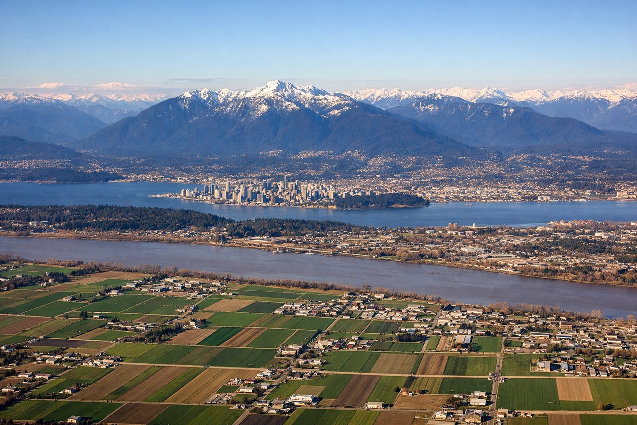
LEFTSLC typically lands on runways 16L/R heading north, meaning final approach comes from the south. Left-side seats provide the best views of the Wasatch Range's western face and the Salt Lake Valley's urban core during descent. Right seats face the flatter western terrain and Great Salt Lake.
Will your flight be in sunlight?
Pick a date and time in the Sun Map to watch the sun move across your whole flight.
About This Route
Which side of the plane should I sit on flying from Salt Lake City International (SLC) to Vancouver International (YVR)?
Sit on the Right side of the plane for the best views on flights from Salt Lake City to Vancouver. Right-side seats capture the Wasatch Range's dramatic topography during both takeoff and much of the northbound climb, which is the most visually distinctive feature of the SLC departure. While left seats have advantages during landing, the takeoff experience is superior on the right.
What can I see during takeoff from Salt Lake City International in Salt Lake City?
During takeoff from Salt Lake City International (SLC), sit on the Right side for the best views. SLC typically departs runways 16L/R heading north. Right-side seats offer immediate views of the Wasatch Range's dramatic eastern escarpment rising directly above the airport, with the Salt Lake Valley spreading westward below. Left seats face the flatter western terrain and Great Salt Lake in the distance. Notable sights include: Wasatch Range (immediately east, snow-capped peaks), Salt Lake Valley (urban grid spreading west), Great Salt Lake (western horizon, pale blue-gray), Oquirrh Mountains (western skyline, lower profile).
What can I see when landing at Vancouver International in Vancouver?
When landing at Vancouver International (YVR), sit on the Left side for the best views. SLC typically lands on runways 16L/R heading north, meaning final approach comes from the south. Left-side seats provide the best views of the Wasatch Range's western face and the Salt Lake Valley's urban core during descent. Right seats face the flatter western terrain and Great Salt Lake. Notable sights include: Wasatch Range (eastern wall, increasingly detailed as you descend), Salt Lake City downtown (grid pattern visible around 8,000 feet), Salt Lake Valley suburbs (spreading south and west), Great Salt Lake (western edge, visible until final descent).
How long is the flight from Salt Lake City to Vancouver?
The flight from Salt Lake City International (SLC) to Vancouver International (YVR) takes about 2 hours 15 minutes. The shortest flight path between them is 796 miles (1,282 km); winds and air traffic control usually add a few percent.
What does the Salt Lake City to Vancouver flight path pass over?
After climbing north from SLC, the flight crosses the Wasatch Range's northern extensions near Ogden, Utah (visible as a small city in the valley). The route then passes over the Bear River Mountains and into Idaho, crossing relatively flat terrain with scattered lakes and forests. As you approach the Canadian border near the Okanagan region, terrain becomes more mountainous again with visible lakes (Pend Oreille, Coeur d'Alene area). The final approach into YVR descends over the Cascade Range foothills and the Fraser River valley, with Puget Sound and the Strait of Georgia becoming visible before landing.