Both sides score equally at 2.0 due to the flight's short duration (2h 15m) over predominantly flat terrain with limited dramatic geography. However, the right side edges ahead for the landing sequence: the Colorado River, Lady Bird Lake, and downtown Austin skyline provide concentrated urban and water scenery during approach that the left side cannot match. The takeoff from Sacramento is comparable on both sides, but the landing experience tips the recommendation rightward.
Flown SMF to AUS? Did we get it right?
Flight Path
Sacramento to Austin is 1,479 miles (2,380 km), a flight of about 3 hours 30 minutes.
The flight crosses the flat to gently rolling terrain of central Texas. Notable features along the route include the Edwards Plateau (limestone hills visible to the west of the direct flight path), scattered ranch land and small towns across the Texas Hill Country transition zone, and the Colorado River drainage system that eventually feeds Lady Bird Lake near Austin. The landscape transitions gradually from California's Central Valley agricultural grid through the Great Plains and into Texas's characteristic limestone hill country. No major mountain ranges, coastlines, or dramatic geological features lie directly on the typical flight path.
Great circle distance and headings ›Phase by phase
Takeoff from SMF
LEFTLeft side offers views of the Sacramento Valley's agricultural grid and the Sierra Nevada foothills rising to the east during climb-out. Right side faces westward toward the flat Delta wetlands with minimal visual interest during departure.
Landing at AUS
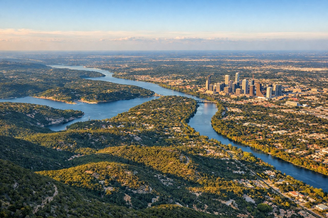
RIGHTRight side during approach to Austin captures the Colorado River and Lady Bird Lake as they wind through downtown Austin, plus views of the city's urban core and surrounding Hill Country terrain. Left side faces the flat eastern plains with minimal scenic features during descent.
Will your flight be in sunlight?
Pick a date and time in the Sun Map to watch the sun move across your whole flight.
About This Route
Which side of the plane should I sit on flying from Sacramento International (SMF) to Austin Bergstrom International (AUS)?
Sit on the Right side of the plane for the best views on flights from Sacramento to Austin. Both sides score equally at 2.0 due to the flight's short duration (2h 15m) over predominantly flat terrain with limited dramatic geography. However, the right side edges ahead for the landing sequence: the Colorado River, Lady Bird Lake, and downtown Austin skyline provide concentrated urban and water scenery during approach that the left side cannot match. The takeoff from Sacramento is comparable on both sides, but the landing experience tips the recommendation rightward.
What can I see during takeoff from Sacramento International in Sacramento?
During takeoff from Sacramento International (SMF), sit on the Left side for the best views. Left side offers views of the Sacramento Valley's agricultural grid and the Sierra Nevada foothills rising to the east during climb-out. Right side faces westward toward the flat Delta wetlands with minimal visual interest during departure. Notable sights include: Sierra Nevada foothills (east), Sacramento city grid (immediate), American River valley (south), agricultural checkerboard of the Central Valley.
What can I see when landing at Austin Bergstrom International in Austin?
When landing at Austin Bergstrom International (AUS), sit on the Right side for the best views. Right side during approach to Austin captures the Colorado River and Lady Bird Lake as they wind through downtown Austin, plus views of the city's urban core and surrounding Hill Country terrain. Left side faces the flat eastern plains with minimal scenic features during descent. Notable sights include: Lady Bird Lake (downtown), Colorado River (upstream), downtown Austin skyline, Hill Country ridges (west and northwest).
How long is the flight from Sacramento to Austin?
The flight from Sacramento International (SMF) to Austin Bergstrom International (AUS) takes about 3 hours 30 minutes. The shortest flight path between them is 1,479 miles (2,380 km); winds and air traffic control usually add a few percent.
What does the Sacramento to Austin flight path pass over?
The flight crosses the flat to gently rolling terrain of central Texas. Notable features along the route include the Edwards Plateau (limestone hills visible to the west of the direct flight path), scattered ranch land and small towns across the Texas Hill Country transition zone, and the Colorado River drainage system that eventually feeds Lady Bird Lake near Austin. The landscape transitions gradually from California's Central Valley agricultural grid through the Great Plains and into Texas's characteristic limestone hill country. No major mountain ranges, coastlines, or dramatic geological features lie directly on the typical flight path.