While takeoff offers Sierra Nevada views, the landing approach to Savannah provides more visually distinctive and geographically unique features—the estuary, tidal marshes, and coastal transition are more memorable and characteristic of the destination region.
Flown SMF to SAV? Did we get it right?
Flight Path
Sacramento to Savannah is 2,300 miles (3,702 km), a flight of about 5 hours 15 minutes.
The flight path crosses the Sierra Nevada crest (visible from altitude as a major ridge system), then traverses the Great Basin and Colorado Plateau regions. Over Nevada and Utah, the landscape transitions from mountains to high desert basins with sparse vegetation. Crossing into the Great Plains around Kansas/Oklahoma, the terrain flattens dramatically into agricultural and grassland regions. The Mississippi River valley becomes visible as a distinct green corridor in the lower Mississippi region. The final approach into Georgia crosses the Piedmont plateau before descending to the coastal plain.
Great circle distance and headings ›


Phase by phase
Takeoff from SMF
LEFTSacramento typically departs runway 16L/R (northbound) or 34L/R (southbound). Left seats capture the Sierra Nevada foothills rising to the east and the Sacramento Valley's agricultural grid spreading westward. The eastern view is more dramatic and geographically distinctive.
Landing at SAV
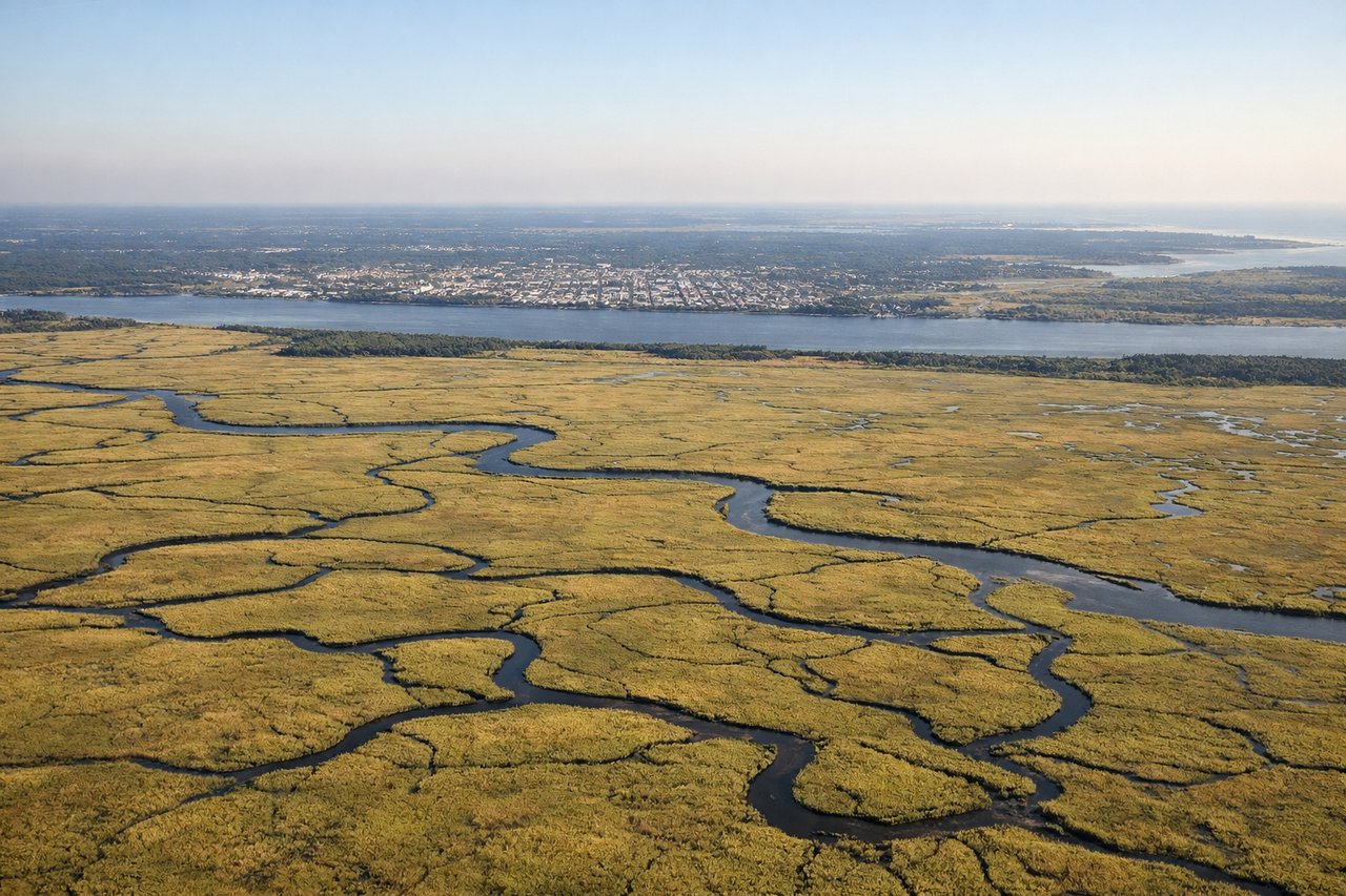
RIGHTSavannah typically lands runway 09 (eastbound) or 27 (westbound). Right-side seats on approach capture the Savannah River estuary, tidal marshlands, and the Atlantic coastal plain. The water features and marsh patterns are visually striking and geographically significant to the region.
Will your flight be in sunlight?
Pick a date and time in the Sun Map to watch the sun move across your whole flight.
About This Route
Which side of the plane should I sit on flying from Sacramento International (SMF) to Savannah Hilton Head International (SAV)?
Sit on the Right side of the plane for the best views on flights from Sacramento to Savannah. While takeoff offers Sierra Nevada views, the landing approach to Savannah provides more visually distinctive and geographically unique features—the estuary, tidal marshes, and coastal transition are more memorable and characteristic of the destination region.
What can I see during takeoff from Sacramento International in Sacramento?
During takeoff from Sacramento International (SMF), sit on the Left side for the best views. Sacramento typically departs runway 16L/R (northbound) or 34L/R (southbound). Left seats capture the Sierra Nevada foothills rising to the east and the Sacramento Valley's agricultural grid spreading westward. The eastern view is more dramatic and geographically distinctive. Notable sights include: Sierra Nevada foothills (eastern horizon), Sacramento Valley agricultural patchwork, American River corridor (visible as linear vegetation), Folsom Lake (if departing north, visible as a bright water body southeast).
What can I see when landing at Savannah Hilton Head International in Savannah?
When landing at Savannah Hilton Head International (SAV), sit on the Right side for the best views. Savannah typically lands runway 09 (eastbound) or 27 (westbound). Right-side seats on approach capture the Savannah River estuary, tidal marshlands, and the Atlantic coastal plain. The water features and marsh patterns are visually striking and geographically significant to the region. Notable sights include: Savannah River estuary (wide, meandering waterway), salt marshes and tidal creeks (golden-brown grid pattern), Atlantic coastal plain (flat terrain with scattered development), Tybee Island (barrier island visible to the east on runway 09 approaches).
How long is the flight from Sacramento to Savannah?
The flight from Sacramento International (SMF) to Savannah Hilton Head International (SAV) takes about 5 hours 15 minutes. The shortest flight path between them is 2,300 miles (3,702 km); winds and air traffic control usually add a few percent.
What does the Sacramento to Savannah flight path pass over?
The flight path crosses the Sierra Nevada crest (visible from altitude as a major ridge system), then traverses the Great Basin and Colorado Plateau regions. Over Nevada and Utah, the landscape transitions from mountains to high desert basins with sparse vegetation. Crossing into the Great Plains around Kansas/Oklahoma, the terrain flattens dramatically into agricultural and grassland regions. The Mississippi River valley becomes visible as a distinct green corridor in the lower Mississippi region. The final approach into Georgia crosses the Piedmont plateau before descending to the coastal plain.