The left side delivers dramatic mountain scenery at both ends of the flight — the Sierra Nevada de Santa Marta on departure and the Eastern Cordillera framing Bogotá on arrival — while the right side offers comparatively flat or open views for most of the short route.
Flight Path
Magdalena River valley and the western slopes of the Eastern Cordillera as the flight crosses from the Caribbean lowlands into the Andean interior
Great circle distance and headings ›
.jpg?width=600)
Phase by phase
Takeoff from SMR
LEFTDeparting SMR on runway 19 climbs south, putting the snow-capped Sierra Nevada de Santa Marta massif — the highest coastal mountain range in the world — directly on the left side of the aircraft. The right side shows only the flat Caribbean coastline receding behind.
Landing at BOG
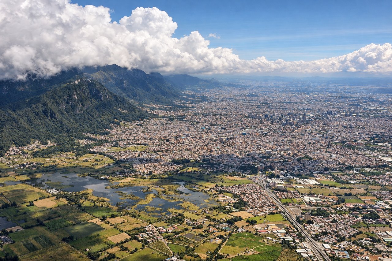
LEFTOn approach into Bogotá from the north, the aircraft descends over the savanna with the Eastern Cordillera and the city's signature eastern hills — Monserrate and Guadalupe — visible on the left, rising abruptly behind the skyline. The right side shows mostly flat, less distinctive plateau terrain.
Landmarks on this routeAll landmarks →
Will your flight be in sunlight?
See exactly which side of the plane gets sun and shade at your departure time.
About This Route
Which side of the plane should I sit on flying from Simon Bolivar (SMR) to Eldorado International (BOG)?
Sit on the Left side of the plane for the best views on flights from Santa Marta to Bogota. The left side delivers dramatic mountain scenery at both ends of the flight — the Sierra Nevada de Santa Marta on departure and the Eastern Cordillera framing Bogotá on arrival — while the right side offers comparatively flat or open views for most of the short route.
What can I see during takeoff from Simon Bolivar in Santa Marta?
During takeoff from Simon Bolivar (SMR), sit on the Left side for the best views. Departing SMR on runway 19 climbs south, putting the snow-capped Sierra Nevada de Santa Marta massif — the highest coastal mountain range in the world — directly on the left side of the aircraft. The right side shows only the flat Caribbean coastline receding behind. Notable sights include: Sierra Nevada de Santa Marta peaks, Santa Marta bay coastline, Ciénaga Grande wetlands.
What can I see when landing at Eldorado International in Bogota?
When landing at Eldorado International (BOG), sit on the Left side for the best views. On approach into Bogotá from the north, the aircraft descends over the savanna with the Eastern Cordillera and the city's signature eastern hills — Monserrate and Guadalupe — visible on the left, rising abruptly behind the skyline. The right side shows mostly flat, less distinctive plateau terrain. Notable sights include: Cerro de Monserrate, Cerro de Guadalupe, Bogotá savanna plateau, eastern Andes foothills.
How long is the flight from Santa Marta to Bogota?
The flight from Simon Bolivar (SMR) to Eldorado International (BOG) takes 1h 15m.
What does the Santa Marta to Bogota flight path pass over?
Magdalena River valley and the western slopes of the Eastern Cordillera as the flight crosses from the Caribbean lowlands into the Andean interior