The takeoff view of the Sierra Nevada de Santa Marta is more visually dramatic and geographically distinctive than the landing approach. The mountain range's sudden rise from sea level and snow-capped peaks create a more striking scenic experience than the urban valley landing.
Flight Path
Magdalena River valley running inland from the coast, transition from Caribbean coastal plain to Andean foothills, the Cordillera Occidental (Western Range) becoming visible as the flight progresses southward, multiple river valleys cutting through the mountain terrain, the terrain steadily rising from sea-level reference toward the Aburrá Valley at 1,500 meters elevation
Great circle distance and headings ›Phase by phase
Takeoff from SMR
RIGHTRight side seats face southwest toward the Sierra Nevada de Santa Marta, Colombia's highest coastal mountain range. The peaks rise dramatically from sea level to over 18,000 feet within 30 miles of the airport, creating striking vertical relief visible immediately after climb-out.
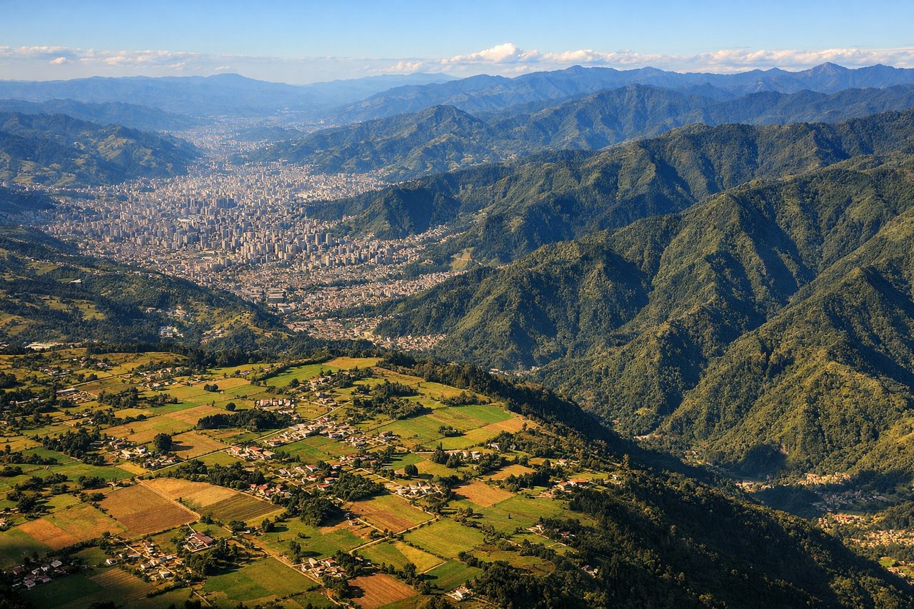
Landing at MDE
LEFTLeft side seats provide views of the Aburrá Valley and Medellín's urban landscape during descent into José María Córdoba. The city sprawls across the valley floor with surrounding ridges and the Cauca River visible, offering clear urban geography and the distinctive topography of the Cordillera Central.
Will your flight be in sunlight?
See exactly which side of the plane gets sun and shade at your departure time.
About This Route
Which side of the plane should I sit on flying from Simon Bolivar (SMR) to Jose Maria Cordova (MDE)?
Sit on the Right side of the plane for the best views on flights from Santa Marta to Rio Negro. The takeoff view of the Sierra Nevada de Santa Marta is more visually dramatic and geographically distinctive than the landing approach. The mountain range's sudden rise from sea level and snow-capped peaks create a more striking scenic experience than the urban valley landing.
What can I see during takeoff from Simon Bolivar in Santa Marta?
During takeoff from Simon Bolivar (SMR), sit on the Right side for the best views. Right side seats face southwest toward the Sierra Nevada de Santa Marta, Colombia's highest coastal mountain range. The peaks rise dramatically from sea level to over 18,000 feet within 30 miles of the airport, creating striking vertical relief visible immediately after climb-out. Notable sights include: Sierra Nevada de Santa Marta (snow-capped peaks), Caribbean Sea coastline to the north, Magdalena River delta to the east, Gaira River valley below.
What can I see when landing at Jose Maria Cordova in Rio Negro?
When landing at Jose Maria Cordova (MDE), sit on the Left side for the best views. Left side seats provide views of the Aburrá Valley and Medellín's urban landscape during descent into José María Córdoba. The city sprawls across the valley floor with surrounding ridges and the Cauca River visible, offering clear urban geography and the distinctive topography of the Cordillera Central. Notable sights include: Aburrá Valley with Medellín city grid, Cauca River running north-south through the valley, Cordillera Central ridgelines flanking both sides, surrounding municipalities (Envigado, Sabaneta) on the valley floor.
How long is the flight from Santa Marta to Rio Negro?
The flight from Simon Bolivar (SMR) to Jose Maria Cordova (MDE) takes 1h 15m.
What does the Santa Marta to Rio Negro flight path pass over?
Magdalena River valley running inland from the coast, transition from Caribbean coastal plain to Andean foothills, the Cordillera Occidental (Western Range) becoming visible as the flight progresses southward, multiple river valleys cutting through the mountain terrain, the terrain steadily rising from sea-level reference toward the Aburrá Valley at 1,500 meters elevation