Right side edges ahead due to the superior takeoff experience over Sarasota Bay and the Gulf coastline, which provides immediate scenic interest and water views. While landing favors the left side for Chicago's skyline, the takeoff advantage and the fact that both sides score equally for the long cruise phase (flat Midwest terrain with minimal variation) gives the right side the overall edge. The flight is dominated by featureless terrain over the southeastern United States and Midwest plains, limiting both sides significantly.
Flown SRQ to ORD? Did we get it right?
Flight Path
Sarasota/Bradenton to Chicago is 1,052 miles (1,693 km), a flight of about 3 hours 15 minutes.
The flight path crosses central Florida (Lake Okeechobee visible from altitude), then proceeds northwest over Georgia and Tennessee (Appalachian foothills on the distant horizon), continues through Kentucky and Indiana over relatively flat terrain with scattered lakes and river valleys, and approaches Chicago from the southwest over Illinois prairie and suburban development.
Great circle distance and headings ›Phase by phase
Takeoff from SRQ
RIGHTRight side captures Sarasota Bay and the Gulf of Mexico coastline during initial climb, offering immediate water views and the barrier islands. Left side departs over inland residential areas with minimal visual interest.
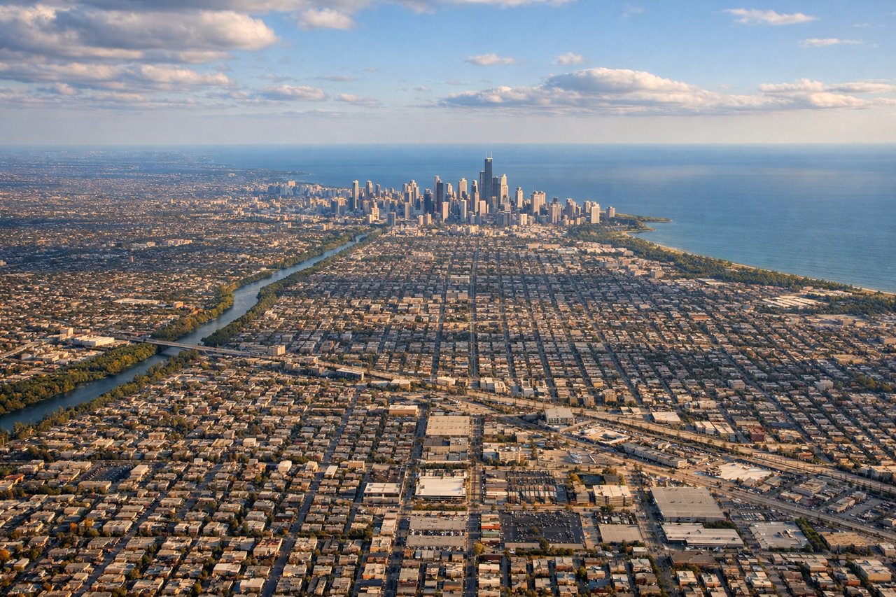
Landing at ORD
LEFTLeft side (north) provides views of Chicago's downtown skyline, Lake Michigan, and the urban lakefront during approach to ORD. Right side (south) shows industrial areas and suburban sprawl with less dramatic urban scenery.
Will your flight be in sunlight?
Pick a date and time in the Sun Map to watch the sun move across your whole flight.
About This Route
Which side of the plane should I sit on flying from Sarasota Bradenton International Airport (SRQ) to Chicago Ohare International (ORD)?
Sit on the Right side of the plane for the best views on flights from Sarasota/Bradenton to Chicago. Right side edges ahead due to the superior takeoff experience over Sarasota Bay and the Gulf coastline, which provides immediate scenic interest and water views. While landing favors the left side for Chicago's skyline, the takeoff advantage and the fact that both sides score equally for the long cruise phase (flat Midwest terrain with minimal variation) gives the right side the overall edge. The flight is dominated by featureless terrain over the southeastern United States and Midwest plains, limiting both sides significantly.
What can I see during takeoff from Sarasota Bradenton International Airport in Sarasota/Bradenton?
During takeoff from Sarasota Bradenton International Airport (SRQ), sit on the Right side for the best views. Right side captures Sarasota Bay and the Gulf of Mexico coastline during initial climb, offering immediate water views and the barrier islands. Left side departs over inland residential areas with minimal visual interest. Notable sights include: Sarasota Bay, Siesta Key barrier island, Gulf of Mexico horizon, Lido Key.
What can I see when landing at Chicago Ohare International in Chicago?
When landing at Chicago Ohare International (ORD), sit on the Left side for the best views. Left side (north) provides views of Chicago's downtown skyline, Lake Michigan, and the urban lakefront during approach to ORD. Right side (south) shows industrial areas and suburban sprawl with less dramatic urban scenery. Notable sights include: Lake Michigan, Chicago downtown skyline, Grant Park, O'Hare International Airport grounds.
How long is the flight from Sarasota/Bradenton to Chicago?
The flight from Sarasota Bradenton International Airport (SRQ) to Chicago Ohare International (ORD) takes about 3 hours 15 minutes. The shortest flight path between them is 1,052 miles (1,693 km); winds and air traffic control usually add a few percent.
What does the Sarasota/Bradenton to Chicago flight path pass over?
The flight path crosses central Florida (Lake Okeechobee visible from altitude), then proceeds northwest over Georgia and Tennessee (Appalachian foothills on the distant horizon), continues through Kentucky and Indiana over relatively flat terrain with scattered lakes and river valleys, and approaches Chicago from the southwest over Illinois prairie and suburban development.