St. Louis to Seattle is 1,705 miles (2,744 km), a flight of about 4 hours 10 minutes.
The right side wins on nearly every phase: a Missouri River glimpse at takeoff, northern Rockies terrain in Montana during cruise, and an unobstructed view of Mount Rainier on final approach into Seattle. The left side offers flatter Great Plains scenery and the Olympic Mountains/Puget Sound, but lacks Rainier's dramatic close-range payoff.
Flight Path
The Great Plains of Nebraska and South Dakota, the northern Rocky Mountain front and Bitterroot Range crossing Montana and Idaho, and the North Cascades before the descent toward Puget Sound.
Great circle distance and headings ›
.jpg?width=600)

Phase by phase

Takeoff from STL
RIGHTDepartures to the northwest on runway 30 climb out almost exactly on course for Seattle, passing over the Missouri River floodplain and St. Charles County farmland, which sits to the right of the climb path. The left side shows similar flat farmland but without the river as a visual anchor.
Landing at SEA
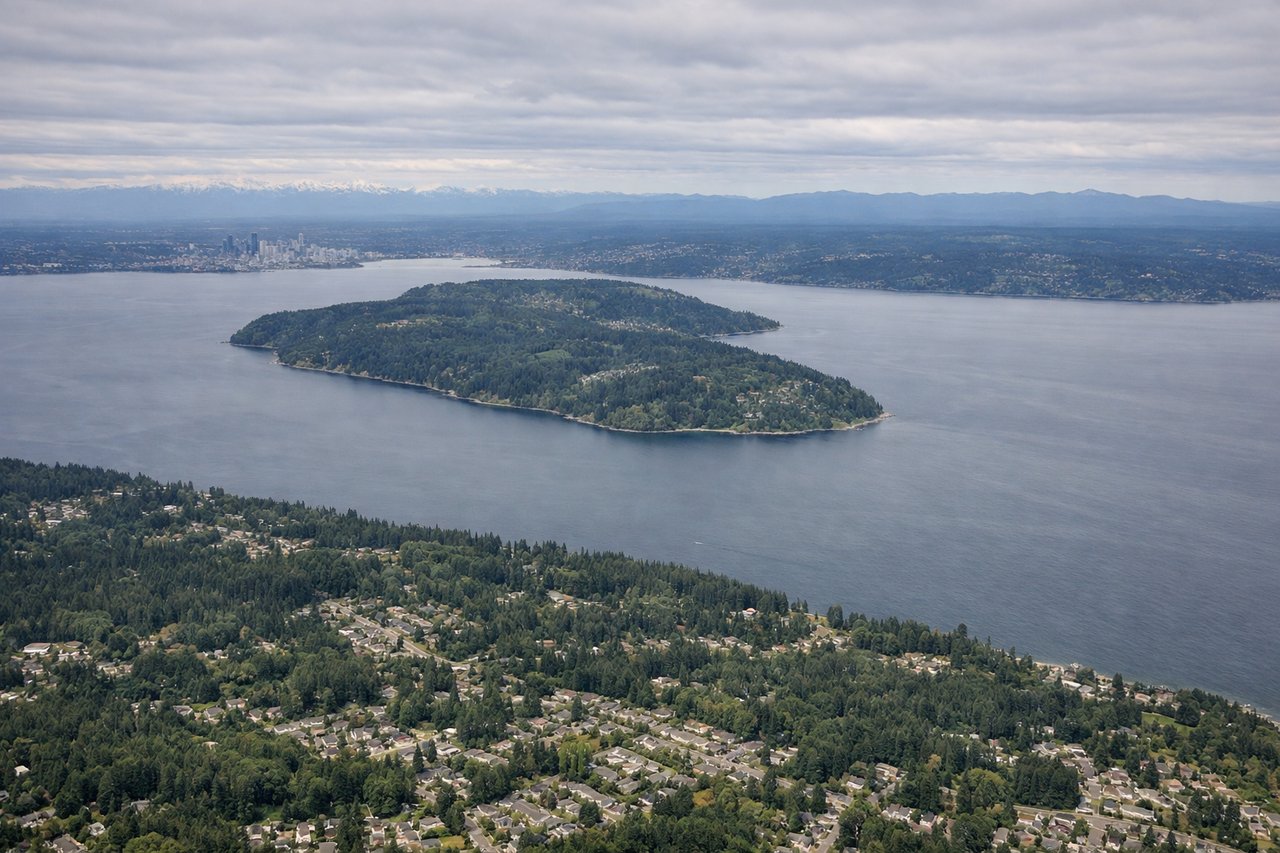
RIGHTOn the northbound final approach into Sea-Tac, the aircraft passes just west of Mount Rainier, putting the massive snow-capped volcano squarely on the right side of the cabin. The left side faces the Olympic Mountains and Puget Sound, which are attractive but less dramatic than Rainier's close-up profile.
Landmarks on this routeAll landmarks →
Will your flight be in sunlight?
Pick a date and time in the Sun Map to watch the sun move across your whole flight.
About This Route
Which side of the plane should I sit on flying from Lambert St Louis International (STL) to Seattle Tacoma International (SEA)?
Sit on the Right side of the plane for the best views on flights from St. Louis to Seattle. The right side wins on nearly every phase: a Missouri River glimpse at takeoff, northern Rockies terrain in Montana during cruise, and an unobstructed view of Mount Rainier on final approach into Seattle. The left side offers flatter Great Plains scenery and the Olympic Mountains/Puget Sound, but lacks Rainier's dramatic close-range payoff.
What can I see during takeoff from Lambert St Louis International in St. Louis?
During takeoff from Lambert St Louis International (STL), sit on the Right side for the best views. Departures to the northwest on runway 30 climb out almost exactly on course for Seattle, passing over the Missouri River floodplain and St. Charles County farmland, which sits to the right of the climb path. The left side shows similar flat farmland but without the river as a visual anchor. Notable sights include: Missouri River bends near St. Charles, patchwork Missouri farmland, distant Mississippi River valley haze.
What can I see when landing at Seattle Tacoma International in Seattle?
When landing at Seattle Tacoma International (SEA), sit on the Right side for the best views. On the northbound final approach into Sea-Tac, the aircraft passes just west of Mount Rainier, putting the massive snow-capped volcano squarely on the right side of the cabin. The left side faces the Olympic Mountains and Puget Sound, which are attractive but less dramatic than Rainier's close-up profile. Notable sights include: Mount Rainier, Puyallup River valley, forested foothills of the Cascade Range, distant Seattle skyline.
How long is the flight from St. Louis to Seattle?
The flight from Lambert St Louis International (STL) to Seattle Tacoma International (SEA) takes about 4 hours 10 minutes. The shortest flight path between them is 1,705 miles (2,744 km); winds and air traffic control usually add a few percent.
What does the St. Louis to Seattle flight path pass over?
The Great Plains of Nebraska and South Dakota, the northern Rocky Mountain front and Bitterroot Range crossing Montana and Idaho, and the North Cascades before the descent toward Puget Sound.