Seattle to St. Louis is 1,705 miles (2,744 km), a flight of about 3 hours 30 minutes.
The left side delivers the two most spectacular moments of the flight: Mount Rainier and the Cascades on departure, and the Gateway Arch with the Mississippi River confluence on arrival. The right side has no comparable anchoring landmarks at either end.
Flight Path
The flight crosses the Columbia Plateau and high desert of eastern Washington and Oregon, then the Rocky Mountain foothills over Idaho and Montana before tracking across the northern Great Plains of Wyoming and South Dakota. The Missouri River becomes visible as a recurring reference line across Nebraska and Missouri. The landscape transitions from volcanic plateau to rolling wheat country to the flat corn and soybean grid of the Midwest. No dramatic mountain crossings on this routing as the track stays north of the main Rockies spine.
Great circle distance and headings ›
.jpg?width=600)

Phase by phase
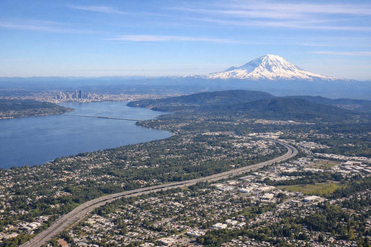
Takeoff from SEA
LEFTSEA primarily departs on runways 16L/16R heading south, or 34L/34R heading north. On a southbound departure heading toward STL, the left side faces east toward the Cascade Range including Mount Rainier, which dominates the skyline at 14,411 feet. On a northbound departure with a left turn to course, the left side still captures Rainier and the broader Cascades as the aircraft banks southeast.
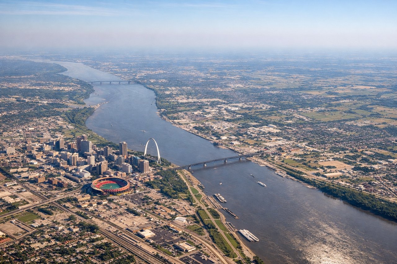
Landing at STL
LEFTLambert STL primarily uses runways 11/29 or 12L/12R/30L/30R. On approach from the west on runway 11 or 12, the aircraft tracks eastward and the left side looks south toward downtown St. Louis, with the Gateway Arch and the Mississippi River clearly visible. The left seat gets the city panorama while the right looks north over suburban Missouri.
Landmarks on this routeAll landmarks →
Will your flight be in sunlight?
Pick a date and time in the Sun Map to watch the sun move across your whole flight.
About This Route
Which side of the plane should I sit on flying from Seattle Tacoma International (SEA) to Lambert St Louis International (STL)?
Sit on the Left side of the plane for the best views on flights from Seattle to St. Louis. The left side delivers the two most spectacular moments of the flight: Mount Rainier and the Cascades on departure, and the Gateway Arch with the Mississippi River confluence on arrival. The right side has no comparable anchoring landmarks at either end.
What can I see during takeoff from Seattle Tacoma International in Seattle?
During takeoff from Seattle Tacoma International (SEA), sit on the Left side for the best views. SEA primarily departs on runways 16L/16R heading south, or 34L/34R heading north. On a southbound departure heading toward STL, the left side faces east toward the Cascade Range including Mount Rainier, which dominates the skyline at 14,411 feet. On a northbound departure with a left turn to course, the left side still captures Rainier and the broader Cascades as the aircraft banks southeast. Notable sights include: Mount Rainier (14,411 ft, unmistakable snow-capped volcanic cone to the southeast), Lake Washington (large urban lake east of Seattle), the Cascade Range stretching north to south, Puget Sound visible to the west before the turn.
What can I see when landing at Lambert St Louis International in St. Louis?
When landing at Lambert St Louis International (STL), sit on the Left side for the best views. Lambert STL primarily uses runways 11/29 or 12L/12R/30L/30R. On approach from the west on runway 11 or 12, the aircraft tracks eastward and the left side looks south toward downtown St. Louis, with the Gateway Arch and the Mississippi River clearly visible. The left seat gets the city panorama while the right looks north over suburban Missouri. Notable sights include: Gateway Arch (630 ft stainless steel monument, unmistakable from the air), Mississippi River (wide brown river forming the Missouri-Illinois border), downtown St. Louis skyline, Missouri River confluence with the Mississippi visible to the north.
How long is the flight from Seattle to St. Louis?
The flight from Seattle Tacoma International (SEA) to Lambert St Louis International (STL) takes about 3 hours 30 minutes. The shortest flight path between them is 1,705 miles (2,744 km); winds and air traffic control usually add a few percent.
What does the Seattle to St. Louis flight path pass over?
The flight crosses the Columbia Plateau and high desert of eastern Washington and Oregon, then the Rocky Mountain foothills over Idaho and Montana before tracking across the northern Great Plains of Wyoming and South Dakota. The Missouri River becomes visible as a recurring reference line across Nebraska and Missouri. The landscape transitions from volcanic plateau to rolling wheat country to the flat corn and soybean grid of the Midwest. No dramatic mountain crossings on this routing as the track stays north of the main Rockies spine.