While takeoff favors the right for Essex and North Sea views, the landing approach dominates this route—and left-side seats deliver the dramatic arrival over the Aegean and Samos's mountainous interior. The approach is more visually rewarding than the departure.
Flight Path
Flight path crosses the English Channel (white cliffs of Dover visible from right side if departing runway 03), then tracks southeast over France (Normandy and Île-de-France regions), continues over the Alps' northern foothills (visible as distant ridges from right side around 1.5 hours into flight), crosses into Italy over the Po Valley, then tracks southeast over the Adriatic Sea. The Apennines appear as a spine along Italy's east coast (right side). Final leg crosses the Ionian Sea toward Greece, with the Greek mainland and Peloponnese appearing on the left around 3.5 hours. The flight path then turns east toward the Aegean, with numerous Greek islands becoming visible—Cephalonia, Zakynthos, and smaller Ionian islands on the left during descent, then the Aegean island chain (Naxos, Paros, Mykonos area) visible on the right side before final approach to Samos.
Great circle distance and headings ›.jpeg?width=600)


Phase by phase
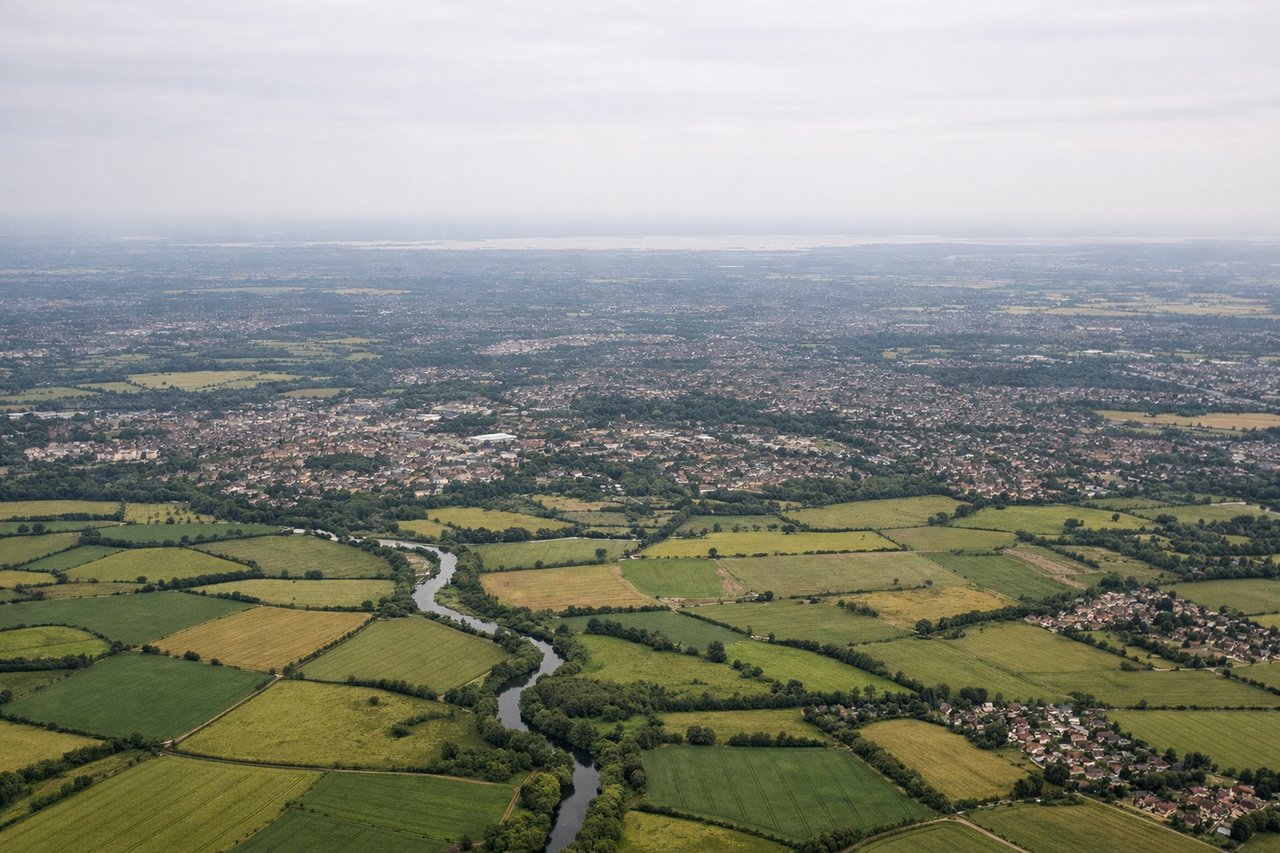
Takeoff from STN
RIGHTStansted typically departs eastbound (runways 03/21, with eastbound preference). Right-side seats face toward the North Sea coast and continental Europe, offering views of Essex's patchwork farmland, the Thames estuary, and the Kent coast as you climb out.
Landing at SMI
LEFTSamos airport (ICAO: LGSM) sits on the island's northwest coast and typically uses runway 09/27. Left-side seats during approach from the west offer views of the Aegean Sea approach, the island's mountainous interior, and Mount Ampelos rising dramatically from the island's center.
Landmarks on this routeAll landmarks →
Will your flight be in sunlight?
See exactly which side of the plane gets sun and shade at your departure time.
About This Route
Which side of the plane should I sit on flying from Stansted (STN) to Samos (SMI)?
Sit on the Left side of the plane for the best views on flights from London to Samos. While takeoff favors the right for Essex and North Sea views, the landing approach dominates this route—and left-side seats deliver the dramatic arrival over the Aegean and Samos's mountainous interior. The approach is more visually rewarding than the departure.
What can I see during takeoff from Stansted in London?
During takeoff from Stansted (STN), sit on the Right side for the best views. Stansted typically departs eastbound (runways 03/21, with eastbound preference). Right-side seats face toward the North Sea coast and continental Europe, offering views of Essex's patchwork farmland, the Thames estuary, and the Kent coast as you climb out. Notable sights include: Thames Estuary (broad water body southeast), Kent coastline (chalk cliffs visible in distance), North Sea horizon, Essex agricultural plains.
What can I see when landing at Samos in Samos?
When landing at Samos (SMI), sit on the Left side for the best views. Samos airport (ICAO: LGSM) sits on the island's northwest coast and typically uses runway 09/27. Left-side seats during approach from the west offer views of the Aegean Sea approach, the island's mountainous interior, and Mount Ampelos rising dramatically from the island's center. Notable sights include: Mount Ampelos (1,160m, central island peak), Aegean Sea (approach water), Samos town harbor (northwest coast), Mycale Mountains (Turkish mainland, distant).
How long is the flight from London to Samos?
The flight from Stansted (STN) to Samos (SMI) takes Approximately 3 hours 45 minutes to 4 hours 15 minutes.
What does the London to Samos flight path pass over?
Flight path crosses the English Channel (white cliffs of Dover visible from right side if departing runway 03), then tracks southeast over France (Normandy and Île-de-France regions), continues over the Alps' northern foothills (visible as distant ridges from right side around 1.5 hours into flight), crosses into Italy over the Po Valley, then tracks southeast over the Adriatic Sea. The Apennines appear as a spine along Italy's east coast (right side). Final leg crosses the Ionian Sea toward Greece, with the Greek mainland and Peloponnese appearing on the left around 3.5 hours. The flight path then turns east toward the Aegean, with numerous Greek islands becoming visible—Cephalonia, Zakynthos, and smaller Ionian islands on the left during descent, then the Aegean island chain (Naxos, Paros, Mykonos area) visible on the right side before final approach to Samos.