While the right side has a decent takeoff view over Essex, the left side wins overall. During the cruise over the North Sea and into Dutch airspace, the left side picks up the Suffolk and Norfolk coastline during initial climb, and then delivers the best view on approach into Schiphol with Amsterdam's canal ring and the IJ waterfront — the most visually distinctive landmark of the whole flight.
Flight Path
The flight crosses the Essex coast near Mersea Island or the Blackwater Estuary, then tracks northeast over the southern North Sea — largely featureless open water at cruise altitude. Wind farms in the Thames Estuary and the Dutch offshore wind arrays (Hollandse Kust) may be visible as clusters of white turbines on the water surface. The Dutch coast appears as a thin sandy line before the flat green polder landscape of South Holland and Noord-Holland opens up on descent.
Great circle distance and headings ›.jpeg?width=600)

Phase by phase
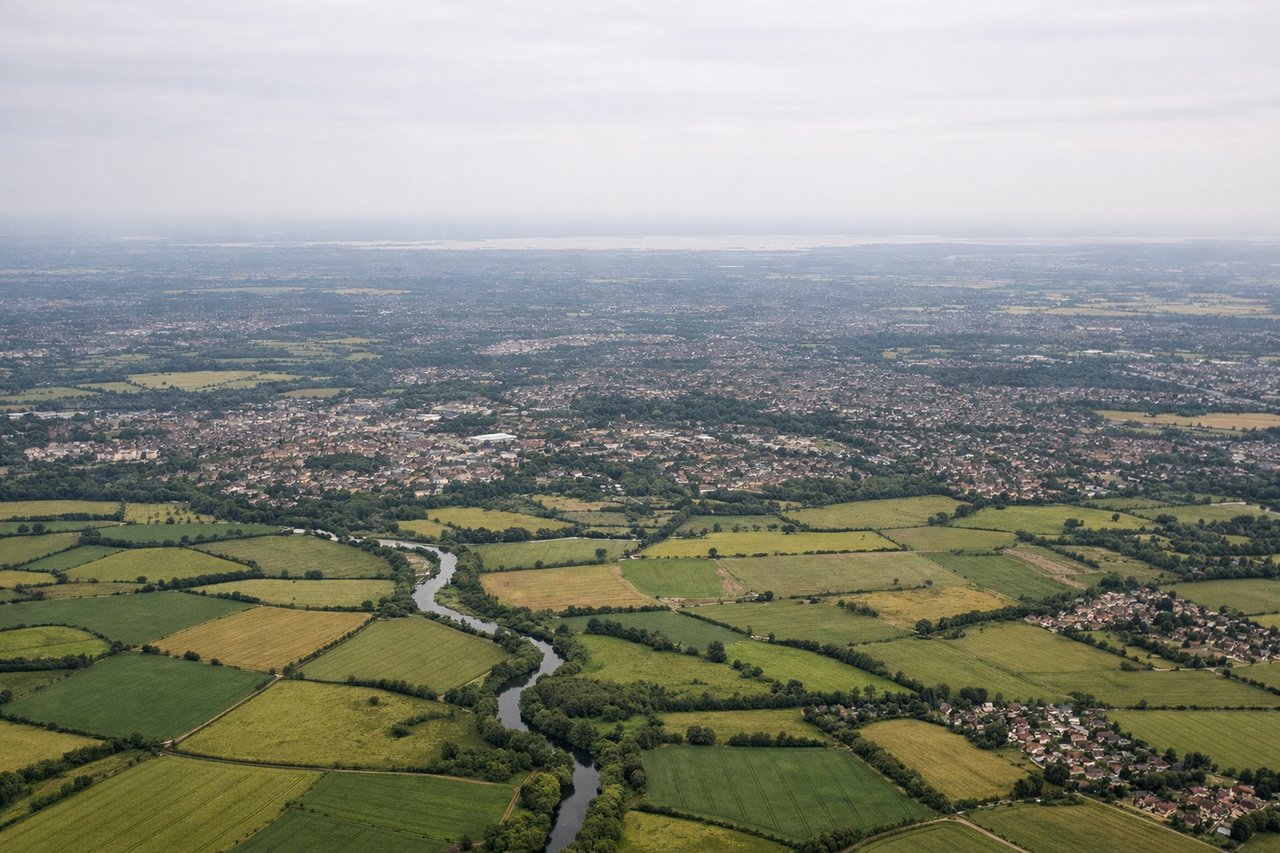
Takeoff from STN
RIGHTStansted's primary runway 04/22 means departures heading northeast toward Amsterdam will typically use runway 04, climbing out over the Essex countryside to the east. The right side gives you views over the Stort Valley and toward the Thames Estuary as you bank northeast, with the sprawl of outer East London visible to the south.
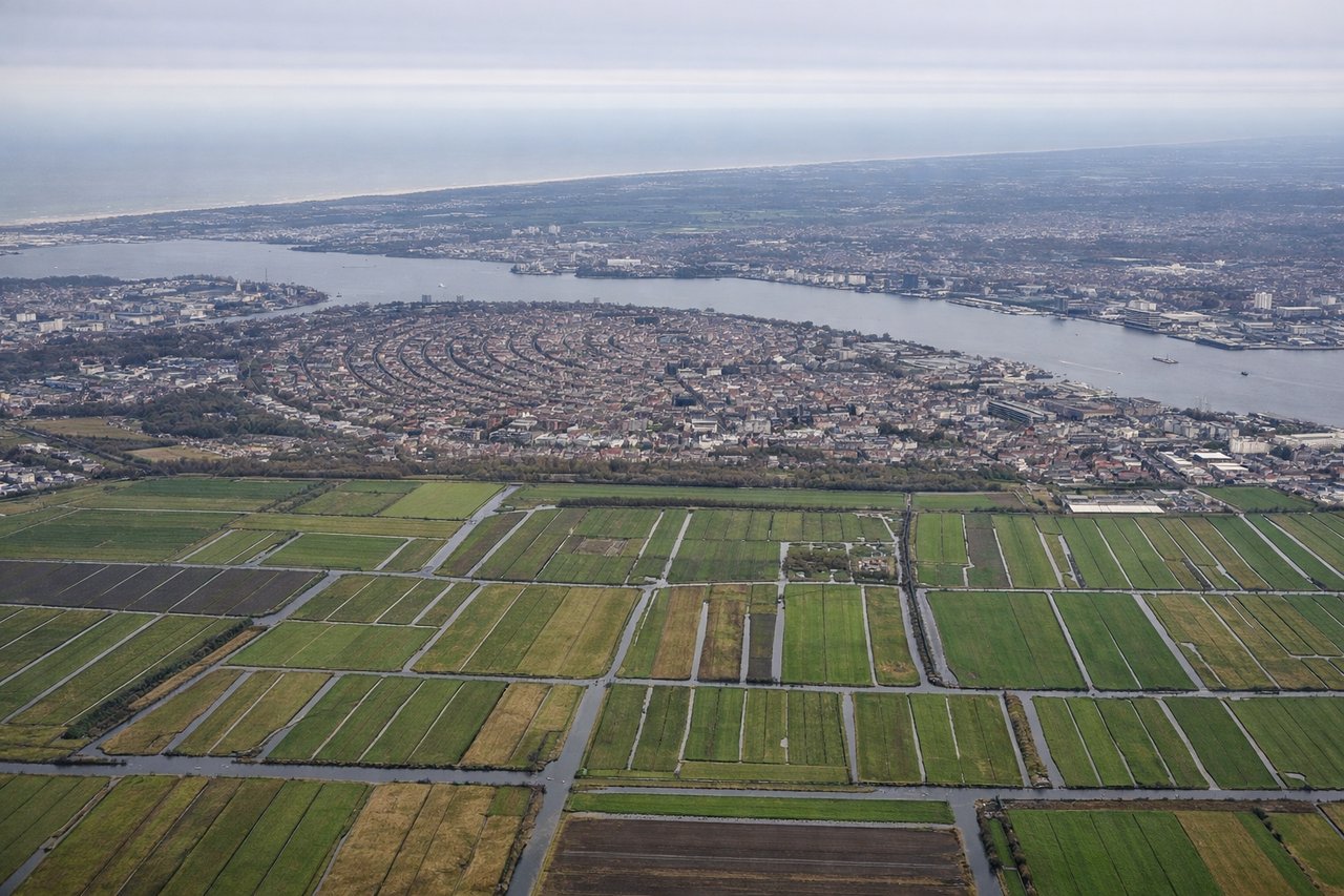
Landing at AMS
LEFTSchiphol's most common landing runway for traffic arriving from the west-southwest is 18R or 18C (heading south), meaning the aircraft approaches from the north over the IJmeer and Amsterdam. The left side gives a clear view over central Amsterdam's canal ring, the IJ waterfront, and the distinctive polder landscape of North Holland.
Landmarks on this routeAll landmarks →
Will your flight be in sunlight?
See exactly which side of the plane gets sun and shade at your departure time.
About This Route
Which side of the plane should I sit on flying from Stansted (STN) to Schiphol (AMS)?
Sit on the Left side of the plane for the best views on flights from London to Amsterdam. While the right side has a decent takeoff view over Essex, the left side wins overall. During the cruise over the North Sea and into Dutch airspace, the left side picks up the Suffolk and Norfolk coastline during initial climb, and then delivers the best view on approach into Schiphol with Amsterdam's canal ring and the IJ waterfront — the most visually distinctive landmark of the whole flight.
What can I see during takeoff from Stansted in London?
During takeoff from Stansted (STN), sit on the Right side for the best views. Stansted's primary runway 04/22 means departures heading northeast toward Amsterdam will typically use runway 04, climbing out over the Essex countryside to the east. The right side gives you views over the Stort Valley and toward the Thames Estuary as you bank northeast, with the sprawl of outer East London visible to the south. Notable sights include: Stort Valley and River Lea floodplains, outer East London suburbs, Thames Estuary glinting in the distance, Bishop's Stortford town directly below.
What can I see when landing at Schiphol in Amsterdam?
When landing at Schiphol (AMS), sit on the Left side for the best views. Schiphol's most common landing runway for traffic arriving from the west-southwest is 18R or 18C (heading south), meaning the aircraft approaches from the north over the IJmeer and Amsterdam. The left side gives a clear view over central Amsterdam's canal ring, the IJ waterfront, and the distinctive polder landscape of North Holland. Notable sights include: Amsterdam canal ring and historic city centre, IJ waterfront and Amsterdam Noord, IJmeer open water, North Holland polder grid.
How long is the flight from London to Amsterdam?
The flight from Stansted (STN) to Schiphol (AMS) takes Approximately 50-60 minutes.
What does the London to Amsterdam flight path pass over?
The flight crosses the Essex coast near Mersea Island or the Blackwater Estuary, then tracks northeast over the southern North Sea — largely featureless open water at cruise altitude. Wind farms in the Thames Estuary and the Dutch offshore wind arrays (Hollandse Kust) may be visible as clusters of white turbines on the water surface. The Dutch coast appears as a thin sandy line before the flat green polder landscape of South Holland and Noord-Holland opens up on descent.