Stavanger to Amsterdam is 455 miles (732 km), a flight of about 1 hour 55 minutes.
The right side delivers the most dramatic scenery at takeoff with the Norwegian fjords and Stavanger harbour, which is the visual highlight of this route. The mid-flight view over the North Sea is similar on both sides, and the Amsterdam approach on the left is interesting but relatively flat. The fjord scenery at departure tips the balance to the right overall.
Flight Path
The route crosses the southern North Sea, passing roughly over or near the Dogger Bank shallow area. At cruising altitude you may see offshore wind farms and oil platform clusters in the Norwegian and Dutch sectors of the North Sea, visible as tiny white specks on the water surface. The Dutch coast near Den Haag or Hook of Holland comes into view on descent, with the distinctive straight coastline and beach barrier visible before the flat polder interior opens up.
Great circle distance and headings ›

Phase by phase
Takeoff from SVG
RIGHTSola airport typically departs on runway 18 (southbound) or runway 11 (eastbound). On a southeasterly departure toward AMS, the right side faces east over the Gandsfjord and the city of Stavanger itself, with the distinctive Lysefjord visible in the distance. The left side faces west over the open North Sea with little to see.
Landing at AMS
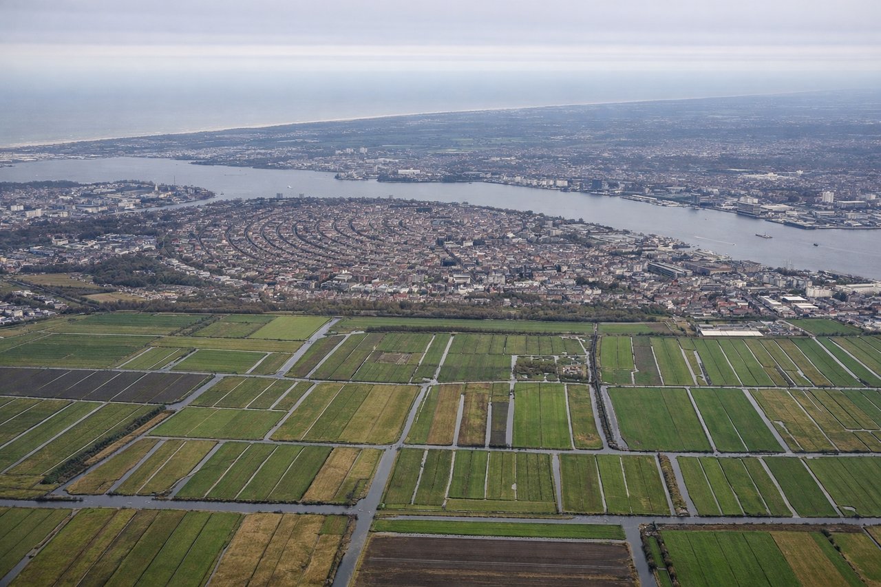
LEFTSchiphol typically lands on runways from the northeast or east, meaning the aircraft approaches from the north over the Netherlands. The left side gives views over Amsterdam city, the IJ waterway, and the distinctive polder landscape of North Holland. The right side faces south toward open flat farmland with less visual interest.
Landmarks on this routeAll landmarks →
Will your flight be in sunlight?
Pick a date and time in the Sun Map to watch the sun move across your whole flight.
About This Route
Which side of the plane should I sit on flying from Stavanger Sola (SVG) to Schiphol (AMS)?
Sit on the Right side of the plane for the best views on flights from Stavanger to Amsterdam. The right side delivers the most dramatic scenery at takeoff with the Norwegian fjords and Stavanger harbour, which is the visual highlight of this route. The mid-flight view over the North Sea is similar on both sides, and the Amsterdam approach on the left is interesting but relatively flat. The fjord scenery at departure tips the balance to the right overall.
What can I see during takeoff from Stavanger Sola in Stavanger?
During takeoff from Stavanger Sola (SVG), sit on the Right side for the best views. Sola airport typically departs on runway 18 (southbound) or runway 11 (eastbound). On a southeasterly departure toward AMS, the right side faces east over the Gandsfjord and the city of Stavanger itself, with the distinctive Lysefjord visible in the distance. The left side faces west over the open North Sea with little to see. Notable sights include: Gandsfjord inlet below, Stavanger city centre and harbour to the northeast, Lysefjord cutting inland to the southeast, Ryfylke archipelago islands.
What can I see when landing at Schiphol in Amsterdam?
When landing at Schiphol (AMS), sit on the Left side for the best views. Schiphol typically lands on runways from the northeast or east, meaning the aircraft approaches from the north over the Netherlands. The left side gives views over Amsterdam city, the IJ waterway, and the distinctive polder landscape of North Holland. The right side faces south toward open flat farmland with less visual interest. Notable sights include: Amsterdam city centre and canal ring, IJ waterway and Amsterdam harbour, Markermeer lake to the east, flat green polder fields of North Holland.
How long is the flight from Stavanger to Amsterdam?
The flight from Stavanger Sola (SVG) to Schiphol (AMS) takes about 1 hour 55 minutes. The shortest flight path between them is 455 miles (732 km); winds and air traffic control usually add a few percent.
What does the Stavanger to Amsterdam flight path pass over?
The route crosses the southern North Sea, passing roughly over or near the Dogger Bank shallow area. At cruising altitude you may see offshore wind farms and oil platform clusters in the Norwegian and Dutch sectors of the North Sea, visible as tiny white specks on the water surface. The Dutch coast near Den Haag or Hook of Holland comes into view on descent, with the distinctive straight coastline and beach barrier visible before the flat polder interior opens up.