While takeoff offers Moscow's urban interest on the right, the landing approach to Vladivostok on the left provides more dramatic natural scenery—the Golden Horn Bay and coastal geography are more visually striking than Moscow's flat urban sprawl. Left side captures the flight's geographic climax.
Flown SVO to VVO? Did we get it right?
Flight Path
Moscow to Vladivostok is 3,980 miles (6,405 km), a flight of about 9 hours.
The flight path crosses central Russia's vast taiga forest region. Notable features include: the Yenisei River basin (visible around 4-5 hours into flight, a massive river system cutting through boreal forest); the Lena River valley (around 6 hours, one of Russia's largest rivers); Lake Baikal (if flight path passes near it, visible as a massive elongated freshwater body surrounded by mountains and forest); the Stanovoy Range and other mountain chains of eastern Siberia (appearing as distant ridgelines on the horizon during mid-flight); and extensive coniferous forest with occasional clearings and settlements. The landscape transitions from European Russia's relatively developed regions through increasingly remote Siberian wilderness to the mountainous Far East approaching Vladivostok.
Great circle distance and headings ›Phase by phase
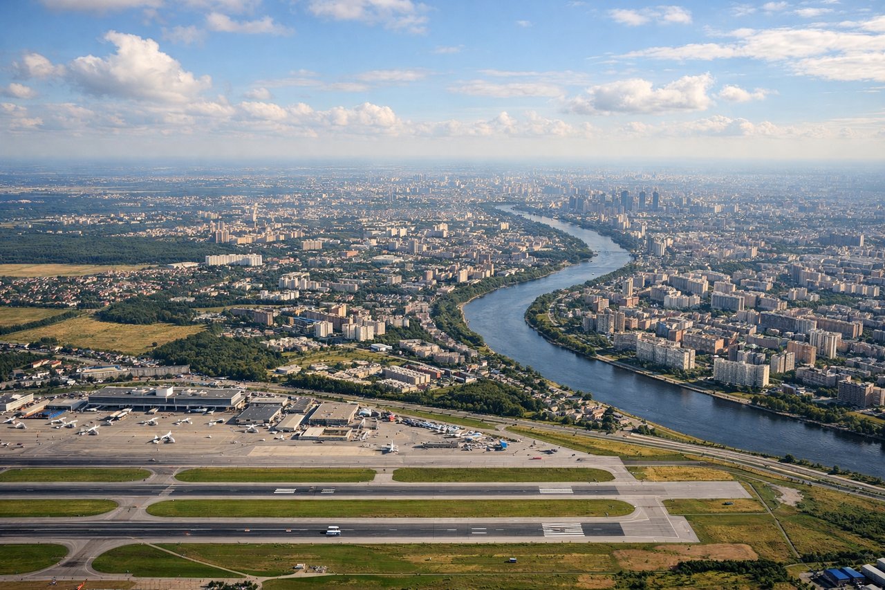
Takeoff from SVO
RIGHTRight side captures the Moscow River and urban sprawl of central Moscow during initial climb. Sheremetyevo's primary runways (06L/24R and 06R/24L) typically depart northward, so banking right offers views of the city's eastern districts and the river's curves through the metropolitan area.
Landing at VVO
LEFTLeft side provides views of Vladivostok's dramatic geography during descent. The approach typically comes from the northwest over the Sea of Japan, so left seats face the Golden Horn Bay, Russky Island, and the city's peninsula setting. This is Vladivostok's most visually distinctive feature.
Will your flight be in sunlight?
Pick a date and time in the Sun Map to watch the sun move across your whole flight.
About This Route
Which side of the plane should I sit on flying from Sheremetyevo (SVO) to Knevichi (VVO)?
Sit on the Left side of the plane for the best views on flights from Moscow to Vladivostok. While takeoff offers Moscow's urban interest on the right, the landing approach to Vladivostok on the left provides more dramatic natural scenery—the Golden Horn Bay and coastal geography are more visually striking than Moscow's flat urban sprawl. Left side captures the flight's geographic climax.
What can I see during takeoff from Sheremetyevo in Moscow?
During takeoff from Sheremetyevo (SVO), sit on the Right side for the best views. Right side captures the Moscow River and urban sprawl of central Moscow during initial climb. Sheremetyevo's primary runways (06L/24R and 06R/24L) typically depart northward, so banking right offers views of the city's eastern districts and the river's curves through the metropolitan area. Notable sights include: Moscow River winding through the city, Kremlin district (small but identifiable as the dense historic core), suburban ring roads radiating outward, Moskva River reservoirs to the northeast.
What can I see when landing at Knevichi in Vladivostok?
When landing at Knevichi (VVO), sit on the Left side for the best views. Left side provides views of Vladivostok's dramatic geography during descent. The approach typically comes from the northwest over the Sea of Japan, so left seats face the Golden Horn Bay, Russky Island, and the city's peninsula setting. This is Vladivostok's most visually distinctive feature. Notable sights include: Golden Horn Bay (Zolotoy Rog) with its distinctive curved inlet, Russky Island and the Strait of Nevelskoy, Vladivostok's hillside urban terrain, Peter the Great Gulf coastline.
How long is the flight from Moscow to Vladivostok?
The flight from Sheremetyevo (SVO) to Knevichi (VVO) takes about 9 hours. The shortest flight path between them is 3,980 miles (6,405 km); winds and air traffic control usually add a few percent.
What does the Moscow to Vladivostok flight path pass over?
The flight path crosses central Russia's vast taiga forest region. Notable features include: the Yenisei River basin (visible around 4-5 hours into flight, a massive river system cutting through boreal forest); the Lena River valley (around 6 hours, one of Russia's largest rivers); Lake Baikal (if flight path passes near it, visible as a massive elongated freshwater body surrounded by mountains and forest); the Stanovoy Range and other mountain chains of eastern Siberia (appearing as distant ridgelines on the horizon during mid-flight); and extensive coniferous forest with occasional clearings and settlements. The landscape transitions from European Russia's relatively developed regions through increasingly remote Siberian wilderness to the mountainous Far East approaching Vladivostok.