Right side captures the most dramatic scenery: Caribbean departure views and the approach over Panama's interior geography. While left offers the canal approach, right provides better overall visual variety across the full flight path.
Flown SXM to PTY? Did we get it right?
Flight Path
Philipsburg to Panama City is 1,255 miles (2,020 km), a flight of about 3 hours 5 minutes.
The flight path crosses the Caribbean Sea southwestward, passing over or near the Grenadines island chain (Bequia, Mustique, Canouan visible as small islands around 1.5 hours into flight), then transitions over the open Caribbean before approaching the Central American mainland. The Veraguas Province coastline and Azuero Peninsula become visible approximately 30 minutes before landing, with the landscape transitioning from coastal plains to the forested interior where Gatun Lake and the canal zone dominate the final approach.
Great circle distance and headings ›Phase by phase
Takeoff from SXM
RIGHTRight side offers immediate views of Sint Maarten's southern coastline and the Caribbean Sea. The airport sits on a narrow peninsula, and right-side seats capture the dramatic contrast between the island's developed western shore and open water as you climb out over the Caribbean.
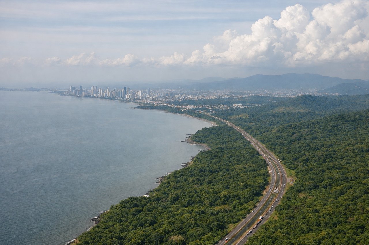
Landing at PTY
LEFTLeft side provides excellent views during the approach into Tocumen. You'll see the Panama Canal's Gatun Lake and surrounding rainforest, plus Panama City's skyline as you descend. The approach typically brings aircraft over central Panama, making the left side ideal for the canal and urban views.
Will your flight be in sunlight?
Pick a date and time in the Sun Map to watch the sun move across your whole flight.
About This Route
Which side of the plane should I sit on flying from Princess Juliana International (SXM) to Tocumen International (PTY)?
Sit on the Right side of the plane for the best views on flights from Philipsburg to Panama City. Right side captures the most dramatic scenery: Caribbean departure views and the approach over Panama's interior geography. While left offers the canal approach, right provides better overall visual variety across the full flight path.
What can I see during takeoff from Princess Juliana International in Philipsburg?
During takeoff from Princess Juliana International (SXM), sit on the Right side for the best views. Right side offers immediate views of Sint Maarten's southern coastline and the Caribbean Sea. The airport sits on a narrow peninsula, and right-side seats capture the dramatic contrast between the island's developed western shore and open water as you climb out over the Caribbean. Notable sights include: Simpson Bay Lagoon (immediately below during initial climb), Philipsburg harbor and waterfront, Caribbean Sea extending south, Sint Eustatius visible on the horizon to the southwest.
What can I see when landing at Tocumen International in Panama City?
When landing at Tocumen International (PTY), sit on the Left side for the best views. Left side provides excellent views during the approach into Tocumen. You'll see the Panama Canal's Gatun Lake and surrounding rainforest, plus Panama City's skyline as you descend. The approach typically brings aircraft over central Panama, making the left side ideal for the canal and urban views. Notable sights include: Gatun Lake (massive freshwater body with visible islands and waterways), Panama Canal locks and channel, Panama City skyline with high-rises, Darién rainforest to the southeast.
How long is the flight from Philipsburg to Panama City?
The flight from Princess Juliana International (SXM) to Tocumen International (PTY) takes about 3 hours 5 minutes. The shortest flight path between them is 1,255 miles (2,020 km); winds and air traffic control usually add a few percent.
What does the Philipsburg to Panama City flight path pass over?
The flight path crosses the Caribbean Sea southwestward, passing over or near the Grenadines island chain (Bequia, Mustique, Canouan visible as small islands around 1.5 hours into flight), then transitions over the open Caribbean before approaching the Central American mainland. The Veraguas Province coastline and Azuero Peninsula become visible approximately 30 minutes before landing, with the landscape transitioning from coastal plains to the forested interior where Gatun Lake and the canal zone dominate the final approach.