Right-side seats score higher (3.5 vs 2.5) because they capture both the Syracuse departure over Onondaga Lake and city, plus the dramatic Las Vegas Strip and mountain approach on landing. Left-side views are dominated by rural terrain on departure and open desert on arrival, with fewer distinctive landmarks. The right side delivers scenic variety and recognizable urban features at both ends of the flight.
Flown SYR to LAS? Did we get it right?
Flight Path
Syracuse to Las Vegas is 2,115 miles (3,403 km), a flight of about 5 hours 15 minutes.
Appalachian ridges and valleys (Pennsylvania/West Virginia), Ohio River valley, Great Plains (Indiana/Illinois/Missouri), Mississippi River, Great Plains (Kansas/Colorado), Rocky Mountain foothills (Colorado/Wyoming), high desert basins and ranges (Utah/Nevada)
Great circle distance and headings ›


Phase by phase
Takeoff from SYR
RIGHTRunway 28 departures favor eastbound turns that carry passengers over Syracuse city and Onondaga Lake before climbing westward. Right-side passengers see the urban core and water body during initial climb. Left-side passengers depart over rural terrain east of the airport with minimal landmarks.
Landing at LAS
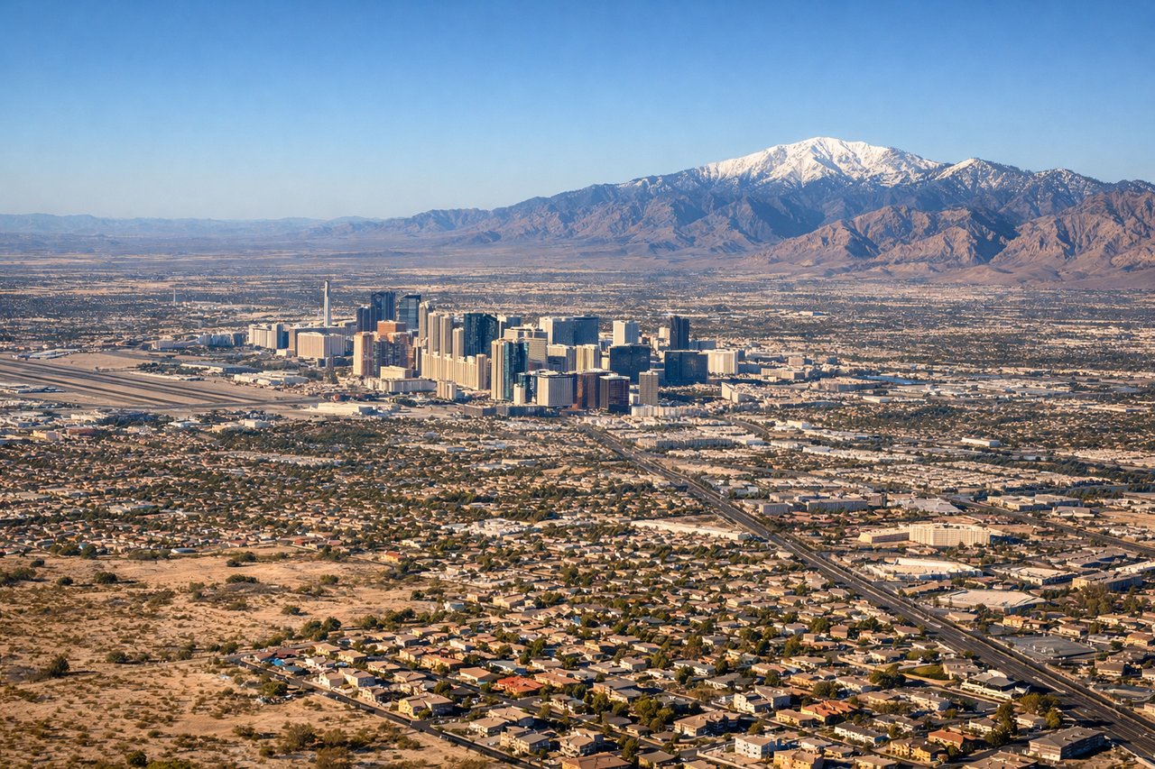
RIGHTWestbound landings on runway 26L/26R approach from the east over the Las Vegas Valley floor. Right-side passengers see the Strip, downtown Las Vegas, and surrounding desert mountains (Spring Mountains to the west, Red Rock Canyon features). Left-side passengers see mostly open desert and distant mountains with fewer recognizable urban landmarks during final approach.
Will your flight be in sunlight?
Pick a date and time in the Sun Map to watch the sun move across your whole flight.
About This Route
Which side of the plane should I sit on flying from Syracuse Hancock International (SYR) to Mc Carran International (LAS)?
Sit on the Right side of the plane for the best views on flights from Syracuse to Las Vegas. Right-side seats score higher (3.5 vs 2.5) because they capture both the Syracuse departure over Onondaga Lake and city, plus the dramatic Las Vegas Strip and mountain approach on landing. Left-side views are dominated by rural terrain on departure and open desert on arrival, with fewer distinctive landmarks. The right side delivers scenic variety and recognizable urban features at both ends of the flight.
What can I see during takeoff from Syracuse Hancock International in Syracuse?
During takeoff from Syracuse Hancock International (SYR), sit on the Right side for the best views. Runway 28 departures favor eastbound turns that carry passengers over Syracuse city and Onondaga Lake before climbing westward. Right-side passengers see the urban core and water body during initial climb. Left-side passengers depart over rural terrain east of the airport with minimal landmarks. Notable sights include: Onondaga Lake, Syracuse downtown skyline, Finger Lakes region (distant).
What can I see when landing at Mc Carran International in Las Vegas?
When landing at Mc Carran International (LAS), sit on the Right side for the best views. Westbound landings on runway 26L/26R approach from the east over the Las Vegas Valley floor. Right-side passengers see the Strip, downtown Las Vegas, and surrounding desert mountains (Spring Mountains to the west, Red Rock Canyon features). Left-side passengers see mostly open desert and distant mountains with fewer recognizable urban landmarks during final approach. Notable sights include: Las Vegas Strip (casinos and hotels), downtown Las Vegas, Spring Mountains, Red Rock Canyon escarpment.
How long is the flight from Syracuse to Las Vegas?
The flight from Syracuse Hancock International (SYR) to Mc Carran International (LAS) takes about 5 hours 15 minutes. The shortest flight path between them is 2,115 miles (3,403 km); winds and air traffic control usually add a few percent.
What does the Syracuse to Las Vegas flight path pass over?
Appalachian ridges and valleys (Pennsylvania/West Virginia), Ohio River valley, Great Plains (Indiana/Illinois/Missouri), Mississippi River, Great Plains (Kansas/Colorado), Rocky Mountain foothills (Colorado/Wyoming), high desert basins and ranges (Utah/Nevada)