Right side scores higher due to superior landing scenery—the Nile Delta's dramatic agricultural-to-desert contrast and Cairo's urban density along the river provide exceptional visual variety and landmark density. While takeoff is comparable on both sides, the landing experience on the right significantly outweighs the left's monotonous desert and Mediterranean views. The full flight benefits from right-side positioning during both critical phases.
Flown SZX to CAI? Did we get it right?
Flight Path
Shenzhen to Cairo is 5,018 miles (8,076 km), a flight of about 11 hours 15 minutes.
Arabian Peninsula interior (Rub' al Khali desert), Persian Gulf coastlines (Oman and UAE), Strait of Hormuz, Iranian plateau and Zagros Mountains, Iraq's Tigris-Euphrates river valleys, Syrian Desert, and the transition from Arabian Peninsula to Levantine terrain before descending toward Egypt
Great circle distance and headings ›Phase by phase
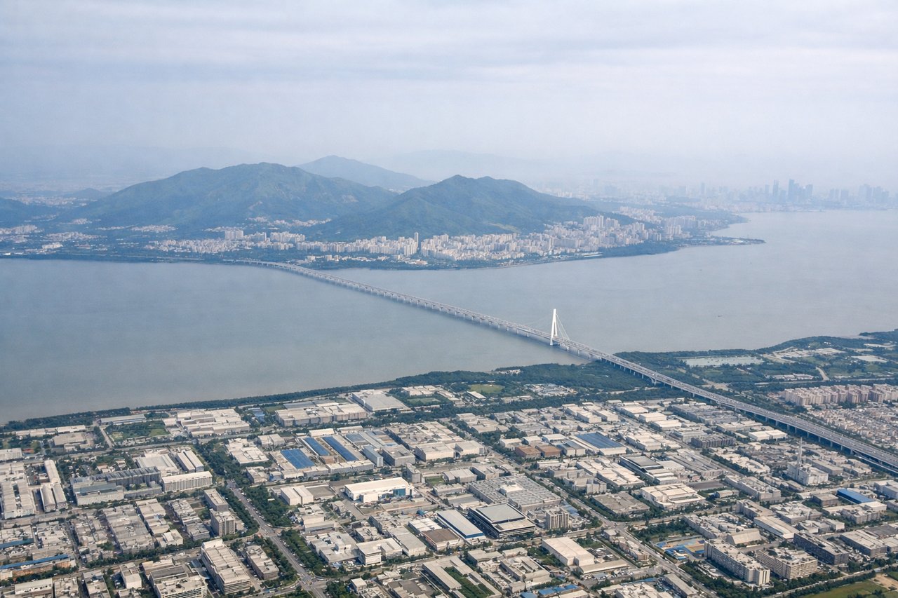
Takeoff from SZX
RIGHTRight side captures Shenzhen's harbor and Victoria Harbour (Hong Kong) during northward climb, with Pearl River Delta urban sprawl and coastal features. Left side shows inland Guangdong plains with minimal visual interest during initial climb.
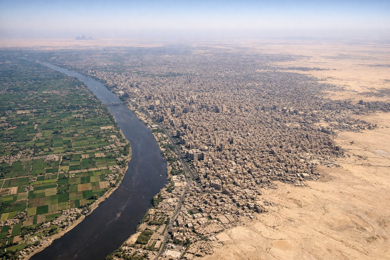
Landing at CAI
RIGHTRight side offers the Nile Delta's dramatic green agricultural fan against desert, Cairo's sprawling urban mass, and the Nile River's serpentine course through arid terrain. Left side shows only open Sahara Desert and Mediterranean coast—visually monotonous despite the water.
Will your flight be in sunlight?
Pick a date and time in the Sun Map to watch the sun move across your whole flight.
About This Route
Which side of the plane should I sit on flying from Baoan (SZX) to Cairo International (CAI)?
Sit on the Right side of the plane for the best views on flights from Shenzhen to Cairo. Right side scores higher due to superior landing scenery—the Nile Delta's dramatic agricultural-to-desert contrast and Cairo's urban density along the river provide exceptional visual variety and landmark density. While takeoff is comparable on both sides, the landing experience on the right significantly outweighs the left's monotonous desert and Mediterranean views. The full flight benefits from right-side positioning during both critical phases.
What can I see during takeoff from Baoan in Shenzhen?
During takeoff from Baoan (SZX), sit on the Right side for the best views. Right side captures Shenzhen's harbor and Victoria Harbour (Hong Kong) during northward climb, with Pearl River Delta urban sprawl and coastal features. Left side shows inland Guangdong plains with minimal visual interest during initial climb. Notable sights include: Victoria Harbour and Hong Kong skyline, Pearl River Delta industrial zones, Shenzhen Bay coastline, South China Sea horizon.
What can I see when landing at Cairo International in Cairo?
When landing at Cairo International (CAI), sit on the Right side for the best views. Right side offers the Nile Delta's dramatic green agricultural fan against desert, Cairo's sprawling urban mass, and the Nile River's serpentine course through arid terrain. Left side shows only open Sahara Desert and Mediterranean coast—visually monotonous despite the water. Notable sights include: Nile Delta's distinctive green fan-shaped agricultural zone, Cairo's urban sprawl along the Nile, the Nile River's winding course through desert, Giza Plateau and pyramids region (visible on clear approaches).
How long is the flight from Shenzhen to Cairo?
The flight from Baoan (SZX) to Cairo International (CAI) takes about 11 hours 15 minutes. The shortest flight path between them is 5,018 miles (8,076 km); winds and air traffic control usually add a few percent.
What does the Shenzhen to Cairo flight path pass over?
Arabian Peninsula interior (Rub' al Khali desert), Persian Gulf coastlines (Oman and UAE), Strait of Hormuz, Iranian plateau and Zagros Mountains, Iraq's Tigris-Euphrates river valleys, Syrian Desert, and the transition from Arabian Peninsula to Levantine terrain before descending toward Egypt