While takeoff offers interesting Pearl River Delta views, the landing approach into Taiyuan provides more dramatic and sustained scenery—the transition from Loess Plateau terrain to the Fen River valley and mountain approaches is geographically distinctive and visually compelling.
Flown SZX to TYN? Did we get it right?
Flight Path
Shenzhen to Taiyuan is 1,046 miles (1,684 km), a flight of about 2 hours 15 minutes.
The flight path crosses central China's transition zone: departing the Pearl River Delta's subtropical lowlands, passing over the Nanling Mountains and Huai River basin, then entering the North China Plain before reaching the Loess Plateau and Fen River valley system near Taiyuan. The Yangtze River basin lies to the west of the direct route. Major cities visible en route include Changsha and Wuhan areas (depending on exact routing), though these may be distant from the flight path.
Great circle distance and headings ›

Phase by phase
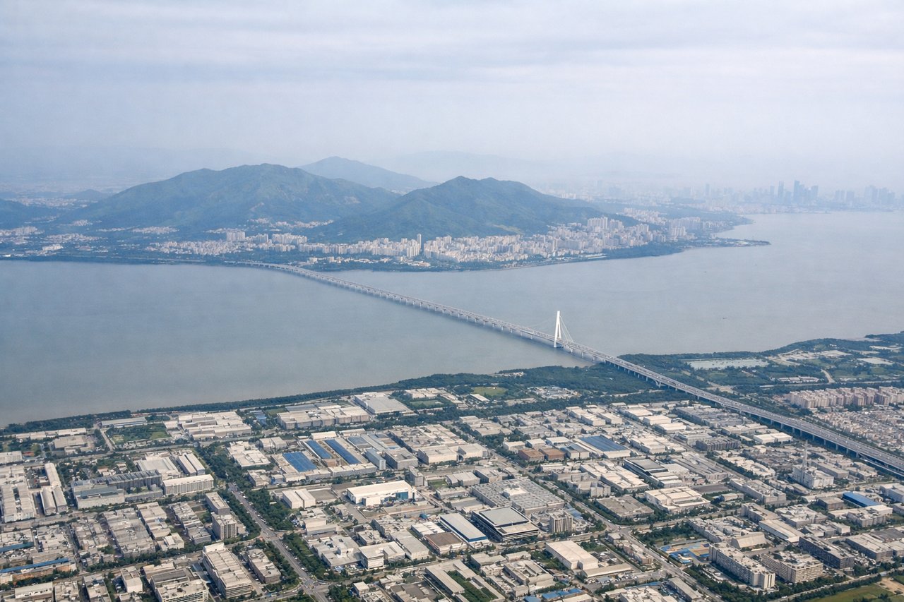
Takeoff from SZX
RIGHTRight-side seats capture the Pearl River Delta's urban sprawl and the Shenzhen coastline as the aircraft climbs northwestward. You'll see the contrast between Shenzhen's dense development and the water bodies that define the region's geography.
Landing at TYN
LEFTLeft-side seats offer the best views during descent into Taiyuan. You'll see the Fen River valley and the surrounding Loess Plateau terrain as the aircraft approaches from the southeast, with the Taihang Mountains visible to the east.
Will your flight be in sunlight?
Pick a date and time in the Sun Map to watch the sun move across your whole flight.
About This Route
Which side of the plane should I sit on flying from Baoan (SZX) to Wusu (TYN)?
Sit on the Left side of the plane for the best views on flights from Shenzhen to Taiyuan. While takeoff offers interesting Pearl River Delta views, the landing approach into Taiyuan provides more dramatic and sustained scenery—the transition from Loess Plateau terrain to the Fen River valley and mountain approaches is geographically distinctive and visually compelling.
What can I see during takeoff from Baoan in Shenzhen?
During takeoff from Baoan (SZX), sit on the Right side for the best views. Right-side seats capture the Pearl River Delta's urban sprawl and the Shenzhen coastline as the aircraft climbs northwestward. You'll see the contrast between Shenzhen's dense development and the water bodies that define the region's geography. Notable sights include: Pearl River Delta urban grid, Shenzhen Bay, Victoria Harbour (Hong Kong) to the south, Daya Bay coastline.
What can I see when landing at Wusu in Taiyuan?
When landing at Wusu (TYN), sit on the Left side for the best views. Left-side seats offer the best views during descent into Taiyuan. You'll see the Fen River valley and the surrounding Loess Plateau terrain as the aircraft approaches from the southeast, with the Taihang Mountains visible to the east. Notable sights include: Fen River valley, Loess Plateau terrain, Taihang Mountains (eastern horizon), Taiyuan urban area in the valley floor.
How long is the flight from Shenzhen to Taiyuan?
The flight from Baoan (SZX) to Wusu (TYN) takes about 2 hours 15 minutes. The shortest flight path between them is 1,046 miles (1,684 km); winds and air traffic control usually add a few percent.
What does the Shenzhen to Taiyuan flight path pass over?
The flight path crosses central China's transition zone: departing the Pearl River Delta's subtropical lowlands, passing over the Nanling Mountains and Huai River basin, then entering the North China Plain before reaching the Loess Plateau and Fen River valley system near Taiyuan. The Yangtze River basin lies to the west of the direct route. Major cities visible en route include Changsha and Wuhan areas (depending on exact routing), though these may be distant from the flight path.