Tirana to Buenos Aires is 7,229 miles (11,633 km), a flight of about 14 hours.
While takeoff favors left seats for Alpine views, the landing approach over the Río de la Plata and Buenos Aires city is more visually rewarding and geographically significant. Right seats capture the estuary, city, and pampas context during descent—the more memorable portion of this ultra-long-haul flight.
Flight Path
This routing crosses the Mediterranean (Ionian Sea south of Greece), North Africa (Atlas Mountains visible from altitude over Morocco/Algeria), Atlantic Ocean (12+ hours over open water with occasional weather systems), and approaches South America via the South Atlantic. Notable midpoint landmarks include the Strait of Gibraltar (if visible during daylight), the Canary Islands (off northwest Africa), and the Cape Verde Islands region. The majority of the flight is over open ocean with no visible landmarks for 8-10 hours. Approaching Argentina, the Andes Mountains appear on the western horizon before descent into the Pampas.
Great circle distance and headings ›
_(cropped).jpg?width=600)
Phase by phase
Takeoff from TIA
LEFTTirana Rinas typically departs runway 03 (northeast) or 21 (southwest). Left seats on a northeast departure offer views of the Dinaric Alps and Lake Ohrid to the north and east. Southwest departures favor right seats, but northeast is more common for long-haul routing toward South America.
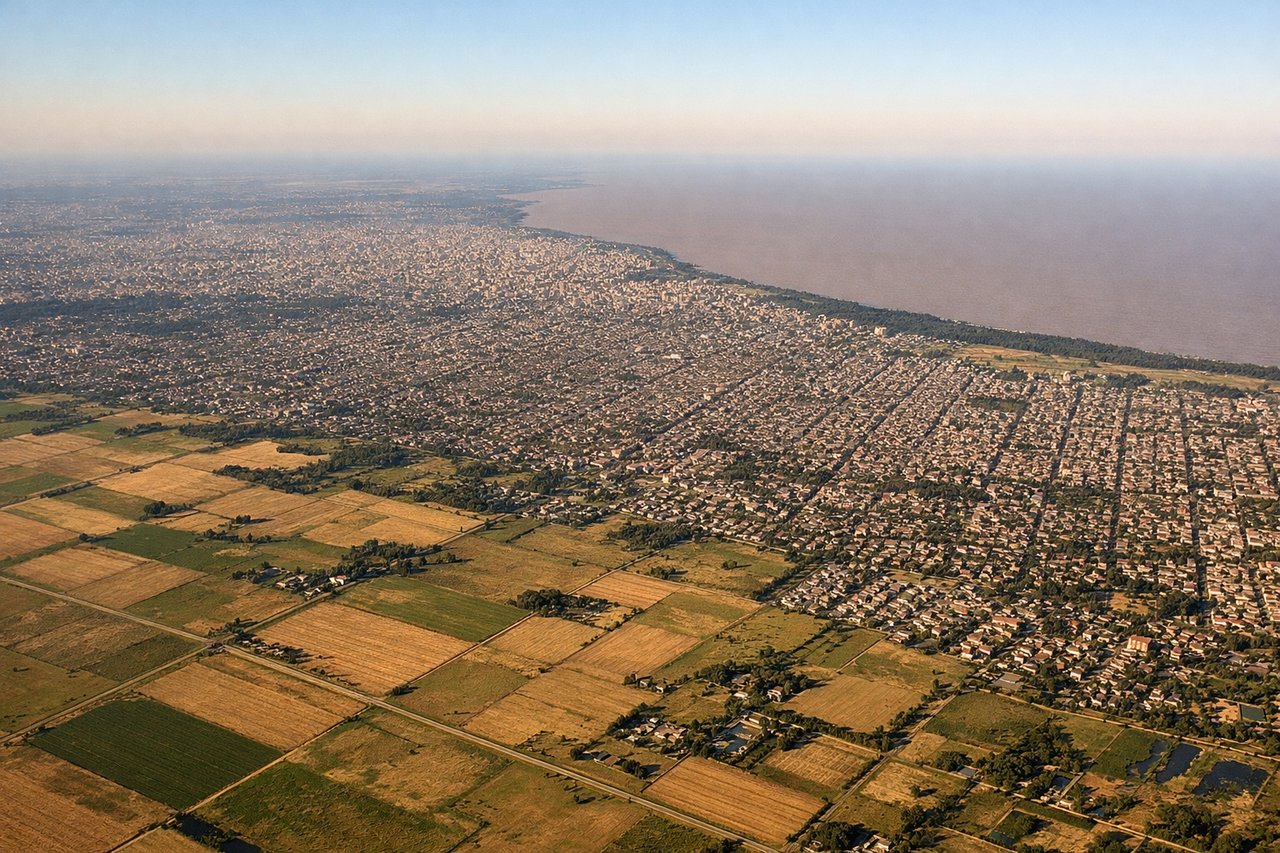
Landing at EZE
RIGHTEzeiza typically uses runways 09 (east) or 27 (west). Right seats on approach from the north provide views of the Río de la Plata estuary, Buenos Aires city proper, and the surrounding pampas. The approach corridor over the estuary and city offers superior geographic context on the right side.
Landmarks on this routeAll landmarks →
Will your flight be in sunlight?
Pick a date and time in the Sun Map to watch the sun move across your whole flight.
About This Route
Which side of the plane should I sit on flying from Tirana Rinas (TIA) to Ezeiza Ministro Pistarini (EZE)?
Sit on the Right side of the plane for the best views on flights from Tirana to Buenos Aires. While takeoff favors left seats for Alpine views, the landing approach over the Río de la Plata and Buenos Aires city is more visually rewarding and geographically significant. Right seats capture the estuary, city, and pampas context during descent—the more memorable portion of this ultra-long-haul flight.
What can I see during takeoff from Tirana Rinas in Tirana?
During takeoff from Tirana Rinas (TIA), sit on the Left side for the best views. Tirana Rinas typically departs runway 03 (northeast) or 21 (southwest). Left seats on a northeast departure offer views of the Dinaric Alps and Lake Ohrid to the north and east. Southwest departures favor right seats, but northeast is more common for long-haul routing toward South America. Notable sights include: Dinaric Alps (northeast, snow-capped peaks visible 30-50 miles distant), Lake Ohrid (east, large freshwater body straddling Albania-North Macedonia border), Adriatic Sea (west, visible as coastline), Tirana city sprawl (directly below during climb).
What can I see when landing at Ezeiza Ministro Pistarini in Buenos Aires?
When landing at Ezeiza Ministro Pistarini (EZE), sit on the Right side for the best views. Ezeiza typically uses runways 09 (east) or 27 (west). Right seats on approach from the north provide views of the Río de la Plata estuary, Buenos Aires city proper, and the surrounding pampas. The approach corridor over the estuary and city offers superior geographic context on the right side. Notable sights include: Río de la Plata estuary (massive muddy-brown waterway, 35 miles wide at this point), Buenos Aires city grid (visible street patterns and high-rises in La Boca and Puerto Madero districts), Ezeiza airport itself (runways and taxiways visible at 2,000-3,000 feet), flat pampas grassland (extending south and west to horizon).
How long is the flight from Tirana to Buenos Aires?
The flight from Tirana Rinas (TIA) to Ezeiza Ministro Pistarini (EZE) takes about 14 hours. The shortest flight path between them is 7,229 miles (11,633 km); winds and air traffic control usually add a few percent.
What does the Tirana to Buenos Aires flight path pass over?
This routing crosses the Mediterranean (Ionian Sea south of Greece), North Africa (Atlas Mountains visible from altitude over Morocco/Algeria), Atlantic Ocean (12+ hours over open water with occasional weather systems), and approaches South America via the South Atlantic. Notable midpoint landmarks include the Strait of Gibraltar (if visible during daylight), the Canary Islands (off northwest Africa), and the Cape Verde Islands region. The majority of the flight is over open ocean with no visible landmarks for 8-10 hours. Approaching Argentina, the Andes Mountains appear on the western horizon before descent into the Pampas.