Right side scores 3.5 vs left's 2.5 due to superior scenery on both legs. Takeoff offers the dramatic Strait of Gibraltar and Rif Mountains; landing provides the Sierra de Guadarrama and Madrid's approach over varied terrain. Left side is dominated by open Atlantic and flat plains with minimal landmark density.
Flown TNG to MAD? Did we get it right?
Flight Path
Tanger to Madrid is 353 miles (568 km), a flight of about 1 hour 15 minutes.
Strait of Gibraltar (narrowest point ~8 miles wide), Spanish coast near Málaga and Granada provinces, Sierra Nevada mountains (visible to the south during cruise), Meseta Central plateau (central Spanish interior), Sierra de Guadarrama (northern approach to Madrid)
Great circle distance and headings ›Phase by phase
Takeoff from TNG
RIGHTRight side captures the Strait of Gibraltar and North African coastline during initial climb. Departing eastbound from runway 10, the right (south) side faces toward the Rif Mountains and Moroccan coast, offering immediate dramatic terrain. Left side turns inland over flat Atlantic approaches.
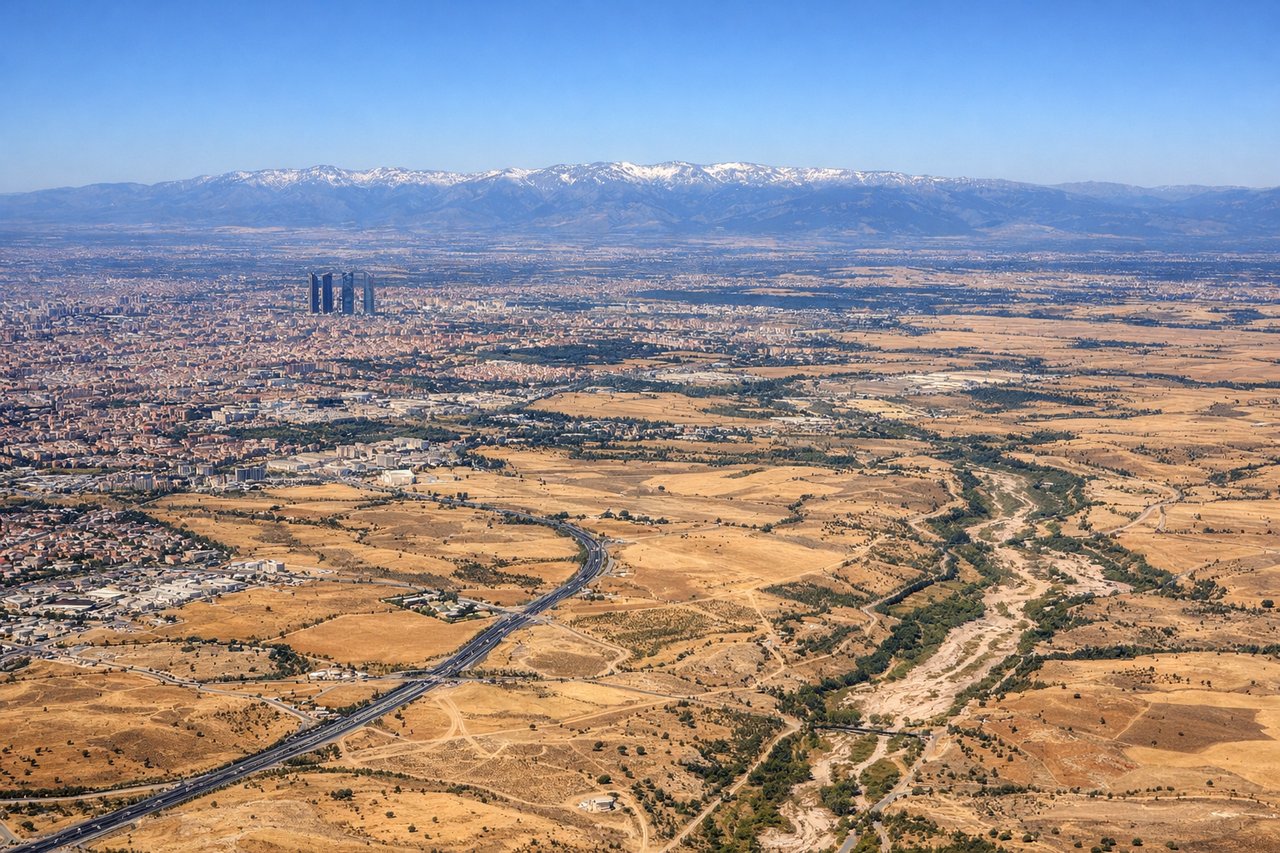
Landing at MAD
RIGHTRight side (north) provides superior approach scenery into Madrid. Descending from the northeast on typical north-configuration arrivals, the right side faces the Sierra de Guadarrama mountains and the approach corridor over central Spanish plateau. Left side shows open plains with minimal visual interest.
Will your flight be in sunlight?
Pick a date and time in the Sun Map to watch the sun move across your whole flight.
About This Route
Which side of the plane should I sit on flying from Ibn Batouta (TNG) to Barajas (MAD)?
Sit on the Right side of the plane for the best views on flights from Tanger to Madrid. Right side scores 3.5 vs left's 2.5 due to superior scenery on both legs. Takeoff offers the dramatic Strait of Gibraltar and Rif Mountains; landing provides the Sierra de Guadarrama and Madrid's approach over varied terrain. Left side is dominated by open Atlantic and flat plains with minimal landmark density.
What can I see during takeoff from Ibn Batouta in Tanger?
During takeoff from Ibn Batouta (TNG), sit on the Right side for the best views. Right side captures the Strait of Gibraltar and North African coastline during initial climb. Departing eastbound from runway 10, the right (south) side faces toward the Rif Mountains and Moroccan coast, offering immediate dramatic terrain. Left side turns inland over flat Atlantic approaches. Notable sights include: Strait of Gibraltar (narrow water passage between continents), Rif Mountains (snow-capped peaks visible 20-30 miles south), Tangier medina and harbor (urban sprawl along coast).
What can I see when landing at Barajas in Madrid?
When landing at Barajas (MAD), sit on the Right side for the best views. Right side (north) provides superior approach scenery into Madrid. Descending from the northeast on typical north-configuration arrivals, the right side faces the Sierra de Guadarrama mountains and the approach corridor over central Spanish plateau. Left side shows open plains with minimal visual interest. Notable sights include: Sierra de Guadarrama (major mountain range north of Madrid), Meseta Central plateau (vast flat terrain), Madrid city sprawl and Barajas airport complex (urban grid visible 10-15 miles ahead).
How long is the flight from Tanger to Madrid?
The flight from Ibn Batouta (TNG) to Barajas (MAD) takes about 1 hour 15 minutes. The shortest flight path between them is 353 miles (568 km); winds and air traffic control usually add a few percent.
What does the Tanger to Madrid flight path pass over?
Strait of Gibraltar (narrowest point ~8 miles wide), Spanish coast near Málaga and Granada provinces, Sierra Nevada mountains (visible to the south during cruise), Meseta Central plateau (central Spanish interior), Sierra de Guadarrama (northern approach to Madrid)