Both sides score equally for the cruise phase over the Great Plains and Rocky Mountains, but the right side wins on the strength of superior takeoff and landing views. The Appalachian foothills visible on right-side departure and the Las Vegas Strip visible on right-side arrival provide more dramatic and recognizable landmarks than the left side offers at either end of the flight.
Flown TRI to LAS? Did we get it right?
Flight Path
Blountville to Las Vegas is 1,815 miles (2,921 km), a flight of about 4 hours 15 minutes.
The flight path crosses the Cumberland Plateau in Tennessee, then the Ohio River valley, the Appalachian Mountains (including the New River Gorge in West Virginia), the Great Plains of Kentucky and Missouri, the Ozark Plateau, the High Plains of Oklahoma and the Texas Panhandle, and finally the Rocky Mountains of New Mexico and Arizona before descending into the Las Vegas Valley. Notable visible features include the Mississippi River (near St. Louis), the Colorado Plateau, and the Kaibab Plateau north of the Grand Canyon.
Great circle distance and headings ›


Phase by phase
Takeoff from TRI
RIGHTRunway 05 departures from TRI climb eastward over the Holston River valley and the foothills of the Appalachian Mountains. Right-side passengers see the ridge-and-valley topography of eastern Tennessee immediately after liftoff, with the Clinch Mountains and Powell Mountain visible during the initial climb. Left side faces westward over relatively flat terrain toward Kentucky.
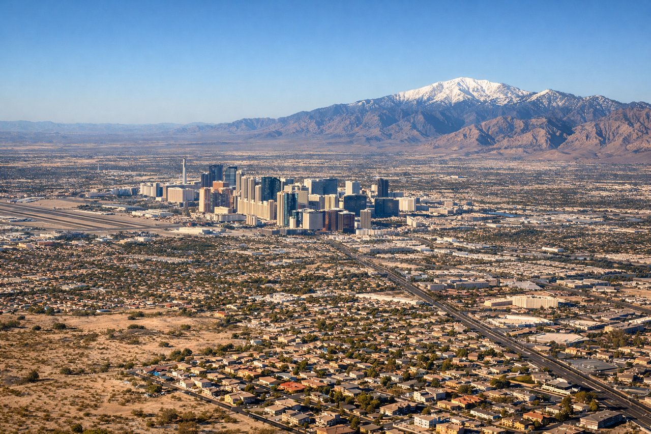
Landing at LAS
RIGHTWestbound landings on runway 26L/26R at LAS approach from the east over the Las Vegas Valley. Right-side passengers see the Strip and downtown Las Vegas skyline during final approach, with the Spring Mountains visible to the west. Left side faces north toward the desert and mountains beyond the city.
Will your flight be in sunlight?
Pick a date and time in the Sun Map to watch the sun move across your whole flight.
About This Route
Which side of the plane should I sit on flying from Tri-Cities Regional TN/VA Airport (TRI) to Mc Carran International (LAS)?
Sit on the Right side of the plane for the best views on flights from Blountville to Las Vegas. Both sides score equally for the cruise phase over the Great Plains and Rocky Mountains, but the right side wins on the strength of superior takeoff and landing views. The Appalachian foothills visible on right-side departure and the Las Vegas Strip visible on right-side arrival provide more dramatic and recognizable landmarks than the left side offers at either end of the flight.
What can I see during takeoff from Tri-Cities Regional TN/VA Airport in Blountville?
During takeoff from Tri-Cities Regional TN/VA Airport (TRI), sit on the Right side for the best views. Runway 05 departures from TRI climb eastward over the Holston River valley and the foothills of the Appalachian Mountains. Right-side passengers see the ridge-and-valley topography of eastern Tennessee immediately after liftoff, with the Clinch Mountains and Powell Mountain visible during the initial climb. Left side faces westward over relatively flat terrain toward Kentucky. Notable sights include: Holston River, Clinch Mountains, Powell Mountain, Watauga Lake.
What can I see when landing at Mc Carran International in Las Vegas?
When landing at Mc Carran International (LAS), sit on the Right side for the best views. Westbound landings on runway 26L/26R at LAS approach from the east over the Las Vegas Valley. Right-side passengers see the Strip and downtown Las Vegas skyline during final approach, with the Spring Mountains visible to the west. Left side faces north toward the desert and mountains beyond the city. Notable sights include: Las Vegas Strip, Downtown Las Vegas, Spring Mountains, Lake Mead (distant).
How long is the flight from Blountville to Las Vegas?
The flight from Tri-Cities Regional TN/VA Airport (TRI) to Mc Carran International (LAS) takes about 4 hours 15 minutes. The shortest flight path between them is 1,815 miles (2,921 km); winds and air traffic control usually add a few percent.
What does the Blountville to Las Vegas flight path pass over?
The flight path crosses the Cumberland Plateau in Tennessee, then the Ohio River valley, the Appalachian Mountains (including the New River Gorge in West Virginia), the Great Plains of Kentucky and Missouri, the Ozark Plateau, the High Plains of Oklahoma and the Texas Panhandle, and finally the Rocky Mountains of New Mexico and Arizona before descending into the Las Vegas Valley. Notable visible features include the Mississippi River (near St. Louis), the Colorado Plateau, and the Kaibab Plateau north of the Grand Canyon.