The left side offers a more consistent scenic experience with coastal views at both ends of the flight—Magnetic Island and Cleveland Bay on departure, Moreton Bay and Brisbane's skyline on arrival—while the right side mostly overlooks flat inland terrain and the Great Dividing Range foothills with less visual variety.
Flown TSV to BNE? Did we get it right?
Flight Path
Townsville to Brisbane is 691 miles (1,112 km), a flight of about 1 hour 50 minutes.
The route tracks roughly parallel to the Queensland coast, passing inland of the Whitsunday Islands and near Mackay and the Fitzroy River delta around Rockhampton, with the Great Dividing Range visible as low ranges to the west.
Great circle distance and headings ›Phase by phase
Takeoff from TSV
LEFTTownsville departures typically climb southbound, giving left-side passengers a view over Cleveland Bay, Magnetic Island's granite peaks, and the fringing reef waters as the aircraft climbs away from the coast.
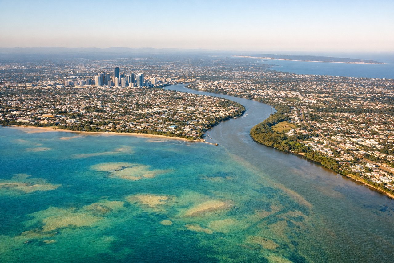
Landing at BNE
LEFTArrivals into Brisbane from the north commonly track down over Moreton Bay before turning onto final approach, giving left-side passengers views of Moreton Island's sand dunes, the bay's islands, and the Brisbane skyline as the aircraft banks toward the runway.
Will your flight be in sunlight?
Pick a date and time in the Sun Map to watch the sun move across your whole flight.
About This Route
Which side of the plane should I sit on flying from Townsville (TSV) to Brisbane International (BNE)?
Sit on the Left side of the plane for the best views on flights from Townsville to Brisbane. The left side offers a more consistent scenic experience with coastal views at both ends of the flight—Magnetic Island and Cleveland Bay on departure, Moreton Bay and Brisbane's skyline on arrival—while the right side mostly overlooks flat inland terrain and the Great Dividing Range foothills with less visual variety.
What can I see during takeoff from Townsville in Townsville?
During takeoff from Townsville (TSV), sit on the Left side for the best views. Townsville departures typically climb southbound, giving left-side passengers a view over Cleveland Bay, Magnetic Island's granite peaks, and the fringing reef waters as the aircraft climbs away from the coast. Notable sights include: Magnetic Island, Cleveland Bay, Townsville coastline, offshore reef shoals.
What can I see when landing at Brisbane International in Brisbane?
When landing at Brisbane International (BNE), sit on the Left side for the best views. Arrivals into Brisbane from the north commonly track down over Moreton Bay before turning onto final approach, giving left-side passengers views of Moreton Island's sand dunes, the bay's islands, and the Brisbane skyline as the aircraft banks toward the runway. Notable sights include: Moreton Bay, Moreton Island, Brisbane city skyline, Brisbane River mouth.
How long is the flight from Townsville to Brisbane?
The flight from Townsville (TSV) to Brisbane International (BNE) takes about 1 hour 50 minutes. The shortest flight path between them is 691 miles (1,112 km); winds and air traffic control usually add a few percent.
What does the Townsville to Brisbane flight path pass over?
The route tracks roughly parallel to the Queensland coast, passing inland of the Whitsunday Islands and near Mackay and the Fitzroy River delta around Rockhampton, with the Great Dividing Range visible as low ranges to the west.