Right-side seats provide superior scenery on both legs: the Santa Catalina Mountains during Tucson departure and continued views of Arizona's high desert terrain during the northbound climb. While left seats offer Mount Rainier on approach, the right-side takeoff experience is more consistently dramatic and visually engaging.
Flown TUS to BFI? Did we get it right?
Flight Path
Tucson to Seattle is 1,221 miles (1,965 km), a flight of about 3 hours.
The flight path crosses central Arizona and southern Oregon. Notable features include the Arizona high desert with scattered mountains (Superstition Mountains visible southeast of Phoenix if the flight passes that region), the Colorado Plateau's northern edge, and the Cascade Range foothills as the aircraft approaches Washington. The route generally follows a northwest trajectory, passing east of major population centers until approaching the Pacific Northwest.
Great circle distance and headings ›

Phase by phase
Takeoff from TUS
RIGHTRight-side seats capture the Santa Catalina Mountains immediately north of Tucson during climb-out, with the city sprawl visible below. The northbound departure path offers the best early views of the mountain range that defines Tucson's geography.
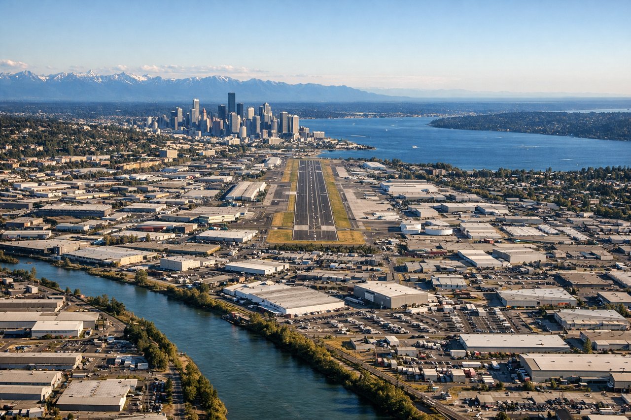
Landing at BFI
LEFTLeft-side seats during approach to Seattle offer views of the Cascade Range and Mount Rainier as the aircraft descends from the southeast. The westbound approach path aligns perfectly with views of the major volcanic peak and the Puget Sound coastline.
Will your flight be in sunlight?
Pick a date and time in the Sun Map to watch the sun move across your whole flight.
About This Route
Which side of the plane should I sit on flying from Tucson International (TUS) to Boeing Fld King Co International (BFI)?
Sit on the Right side of the plane for the best views on flights from Tucson to Seattle. Right-side seats provide superior scenery on both legs: the Santa Catalina Mountains during Tucson departure and continued views of Arizona's high desert terrain during the northbound climb. While left seats offer Mount Rainier on approach, the right-side takeoff experience is more consistently dramatic and visually engaging.
What can I see during takeoff from Tucson International in Tucson?
During takeoff from Tucson International (TUS), sit on the Right side for the best views. Right-side seats capture the Santa Catalina Mountains immediately north of Tucson during climb-out, with the city sprawl visible below. The northbound departure path offers the best early views of the mountain range that defines Tucson's geography. Notable sights include: Santa Catalina Mountains, Tucson urban grid, Saguaro National Park East (distant), Arizona foothills.
What can I see when landing at Boeing Fld King Co International in Seattle?
When landing at Boeing Fld King Co International (BFI), sit on the Left side for the best views. Left-side seats during approach to Seattle offer views of the Cascade Range and Mount Rainier as the aircraft descends from the southeast. The westbound approach path aligns perfectly with views of the major volcanic peak and the Puget Sound coastline. Notable sights include: Mount Rainier, Cascade Range, Puget Sound, Lake Washington.
How long is the flight from Tucson to Seattle?
The flight from Tucson International (TUS) to Boeing Fld King Co International (BFI) takes about 3 hours. The shortest flight path between them is 1,221 miles (1,965 km); winds and air traffic control usually add a few percent.
What does the Tucson to Seattle flight path pass over?
The flight path crosses central Arizona and southern Oregon. Notable features include the Arizona high desert with scattered mountains (Superstition Mountains visible southeast of Phoenix if the flight passes that region), the Colorado Plateau's northern edge, and the Cascade Range foothills as the aircraft approaches Washington. The route generally follows a northwest trajectory, passing east of major population centers until approaching the Pacific Northwest.