Ushuaia to Sao Paulo is 2,443 miles (3,931 km), a flight of about 5 hours.
Takeoff from Ushuaia on the right side provides superior views of the dramatic Beagle Channel and Martial Mountains. While landing favors the left, the takeoff experience is more visually distinctive and geographically significant.
Flight Path
The flight path crosses the Pampas region of Argentina, passing west of Buenos Aires. Notable features include the Río de la Plata estuary (visible if crossing at lower altitudes during approach to Buenos Aires airspace), the flat, featureless terrain of the Argentine Pampas for most of the journey, and the gradual transition to more undulating terrain as the aircraft approaches the Serra da Mantiqueira near São Paulo. The Paraná River valley becomes visible in the final 90 minutes of flight as the aircraft approaches Brazilian airspace.
Great circle distance and headings ›

Phase by phase
Takeoff from USH
RIGHTUshuaia typically departs runway 02 (northbound). Right-side seats offer immediate views of the Beagle Channel and the Martial Mountains as the aircraft climbs. Left seats face inland toward less dramatic terrain.
Landing at GRU
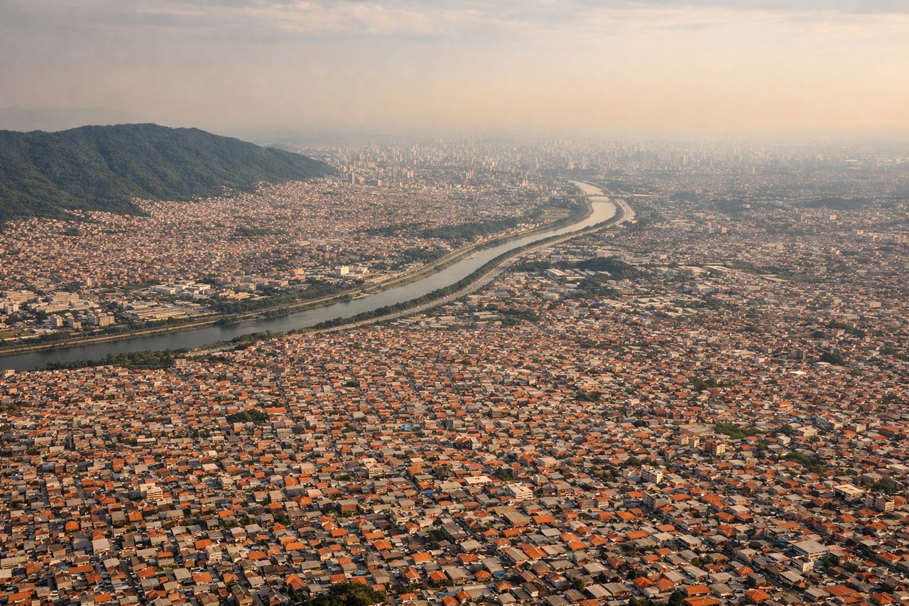
LEFTGuarulhos (GRU) typically lands runway 09L or 09R (eastbound). Left-side seats during descent provide views of the Paraíba do Sul River valley and the Serra da Mantiqueira mountains to the west and northwest. Right seats face toward the Atlantic and less distinctive terrain.
Landmarks on this routeAll landmarks →
Will your flight be in sunlight?
Pick a date and time in the Sun Map to watch the sun move across your whole flight.
About This Route
Which side of the plane should I sit on flying from Ushuaia Malvinas Argentinas (USH) to Guarulhos (GRU)?
Sit on the Right side of the plane for the best views on flights from Ushuaia to Sao Paulo. Takeoff from Ushuaia on the right side provides superior views of the dramatic Beagle Channel and Martial Mountains. While landing favors the left, the takeoff experience is more visually distinctive and geographically significant.
What can I see during takeoff from Ushuaia Malvinas Argentinas in Ushuaia?
During takeoff from Ushuaia Malvinas Argentinas (USH), sit on the Right side for the best views. Ushuaia typically departs runway 02 (northbound). Right-side seats offer immediate views of the Beagle Channel and the Martial Mountains as the aircraft climbs. Left seats face inland toward less dramatic terrain. Notable sights include: Beagle Channel (water body immediately south of airport), Martial Mountains (snow-capped range directly east), Ushuaia city sprawl (visible below during initial climb), Isla Navarino, Chile (visible across the channel to the south).
What can I see when landing at Guarulhos in Sao Paulo?
When landing at Guarulhos (GRU), sit on the Left side for the best views. Guarulhos (GRU) typically lands runway 09L or 09R (eastbound). Left-side seats during descent provide views of the Paraíba do Sul River valley and the Serra da Mantiqueira mountains to the west and northwest. Right seats face toward the Atlantic and less distinctive terrain. Notable sights include: Serra da Mantiqueira mountain range (visible to the left/west during approach), Paraíba do Sul River valley (winding through terrain below), São Paulo metropolitan sprawl (increasingly dense as descent continues), Cantareira Mountains (northern suburbs, visible left side).
How long is the flight from Ushuaia to Sao Paulo?
The flight from Ushuaia Malvinas Argentinas (USH) to Guarulhos (GRU) takes about 5 hours. The shortest flight path between them is 2,443 miles (3,931 km); winds and air traffic control usually add a few percent.
What does the Ushuaia to Sao Paulo flight path pass over?
The flight path crosses the Pampas region of Argentina, passing west of Buenos Aires. Notable features include the Río de la Plata estuary (visible if crossing at lower altitudes during approach to Buenos Aires airspace), the flat, featureless terrain of the Argentine Pampas for most of the journey, and the gradual transition to more undulating terrain as the aircraft approaches the Serra da Mantiqueira near São Paulo. The Paraná River valley becomes visible in the final 90 minutes of flight as the aircraft approaches Brazilian airspace.