Vienna to Beauvais is 664 miles (1,068 km), a flight of about 1 hour 25 minutes.
Vienna departure provides superior urban and geographical interest with the Danube River, city skyline, and Alpine foothills visible immediately after takeoff. While both sides score equally for the cruise segment (flat to gently rolling terrain across northern France and southern Austria), the takeoff advantage from Vienna's dramatic river valley and mountain backdrop outweighs Beauvais's modest landing scenery. This is a marginal preference on a relatively short, low-drama route.
Flight Path
Morava River valley (Czech-Austrian border region), Bohemian Plateau transitioning to Alpine foothills, then descent into the Seine-Oise valley of northern France. The flight crosses the Carpathian foothills, then descends over the flat Picardy plains. No major mountain ranges or dramatic coastlines are crossed; the route is characterized by rolling agricultural terrain and river valleys.
Great circle distance and headings ›Phase by phase
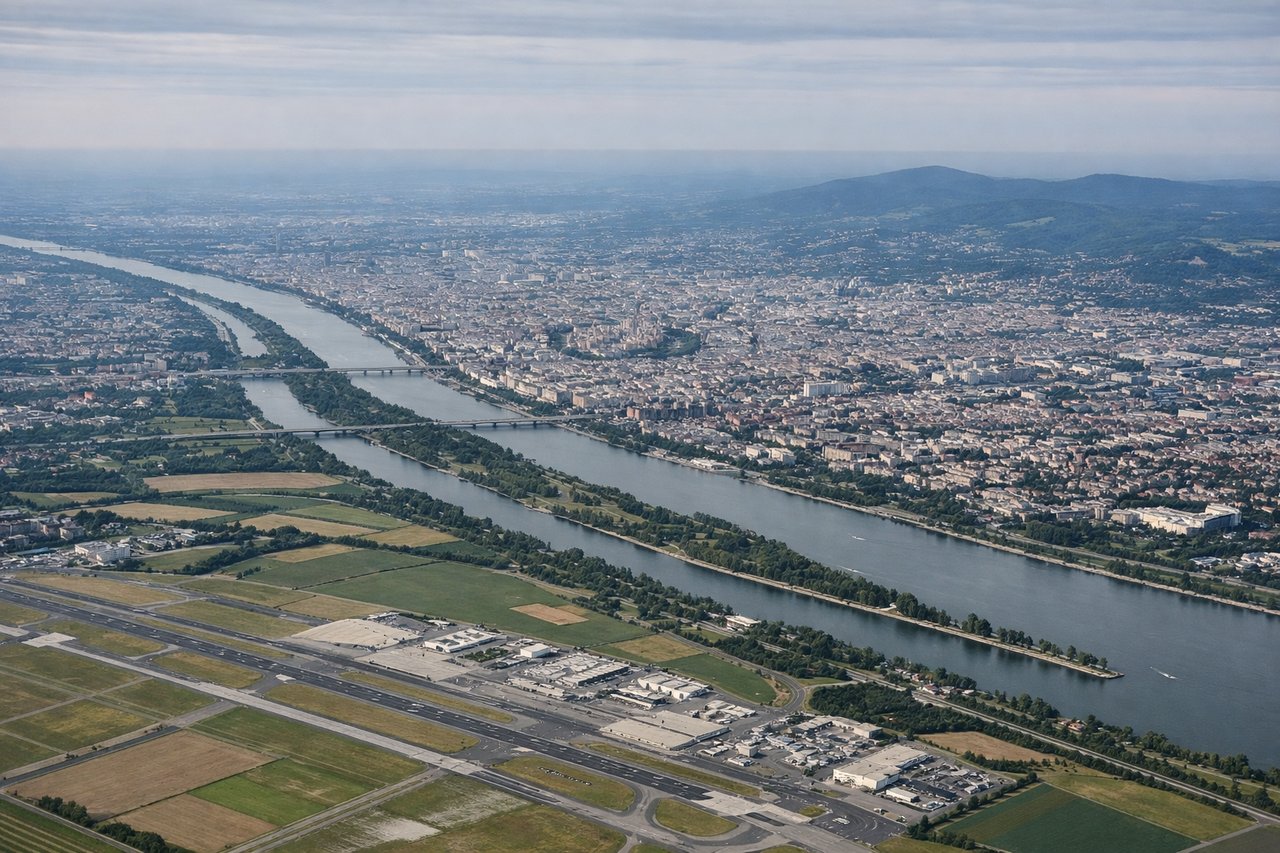
Takeoff from VIE
LEFTVienna departure offers urban scenery of Austria's capital and the Danube River valley immediately after takeoff, with the Eastern Alps visible on the left horizon. Beauvais approach is over flat Picardy farmland with minimal landmarks.
Landing at BVA
RIGHTBeauvais approach crosses the Seine River valley and offers views of Île-de-France's rolling terrain with scattered forests and small towns. Vienna landing is over flat Hungarian plains with minimal visual interest during descent.
Will your flight be in sunlight?
Pick a date and time in the Sun Map to watch the sun move across your whole flight.
About This Route
Which side of the plane should I sit on flying from Schwechat (VIE) to Tille (BVA)?
Sit on the Left side of the plane for the best views on flights from Vienna to Beauvais. Vienna departure provides superior urban and geographical interest with the Danube River, city skyline, and Alpine foothills visible immediately after takeoff. While both sides score equally for the cruise segment (flat to gently rolling terrain across northern France and southern Austria), the takeoff advantage from Vienna's dramatic river valley and mountain backdrop outweighs Beauvais's modest landing scenery. This is a marginal preference on a relatively short, low-drama route.
What can I see during takeoff from Schwechat in Vienna?
During takeoff from Schwechat (VIE), sit on the Left side for the best views. Vienna departure offers urban scenery of Austria's capital and the Danube River valley immediately after takeoff, with the Eastern Alps visible on the left horizon. Beauvais approach is over flat Picardy farmland with minimal landmarks. Notable sights include: Vienna city center and Danube River, Eastern Alps (Carpathian foothills) on left horizon, Schwechat airport industrial zone.
What can I see when landing at Tille in Beauvais?
When landing at Tille (BVA), sit on the Right side for the best views. Beauvais approach crosses the Seine River valley and offers views of Île-de-France's rolling terrain with scattered forests and small towns. Vienna landing is over flat Hungarian plains with minimal visual interest during descent. Notable sights include: Seine River valley, Beauvais cathedral and town center, Picardy forests and agricultural patchwork.
How long is the flight from Vienna to Beauvais?
The flight from Schwechat (VIE) to Tille (BVA) takes about 1 hour 25 minutes. The shortest flight path between them is 664 miles (1,068 km); winds and air traffic control usually add a few percent.
What does the Vienna to Beauvais flight path pass over?
Morava River valley (Czech-Austrian border region), Bohemian Plateau transitioning to Alpine foothills, then descent into the Seine-Oise valley of northern France. The flight crosses the Carpathian foothills, then descends over the flat Picardy plains. No major mountain ranges or dramatic coastlines are crossed; the route is characterized by rolling agricultural terrain and river valleys.