Beauvais to Vienna is 664 miles (1,068 km), a flight of about 2 hours 15 minutes.
Right side scores 3.5 vs left's 2.5 due to the Vienna landing approach, which offers genuine Alpine foothills, the Danube River, and urban scenery. The takeoff from Beauvais is relatively flat on both sides, but the landing dominates the flight experience. Right-side passengers see the Danube valley and Carpathian foothills during descent—a clear scenic advantage over the flat Hungarian plains visible from the left.
Flight Path
The flight crosses the Champagne region (chalk plains and vineyards), then transitions into the Lorraine plateau and Vosges Mountains foothills. The Meuse River valley and Moselle River drainage are visible during cruise. The route then descends into the Danube valley approaching Vienna, with the Carpathian foothills becoming prominent on the right side during final approach.
Great circle distance and headings ›Phase by phase
Takeoff from BVA
LEFTBeauvais airport sits north of the Île-de-France region. Left-side departure routes typically head northeast over the Seine valley and toward the Oise River valley, offering views of suburban Paris sprawl transitioning to rural Picardy. Right-side departures head southeast over flatter agricultural plains with minimal visual interest.
Landing at VIE
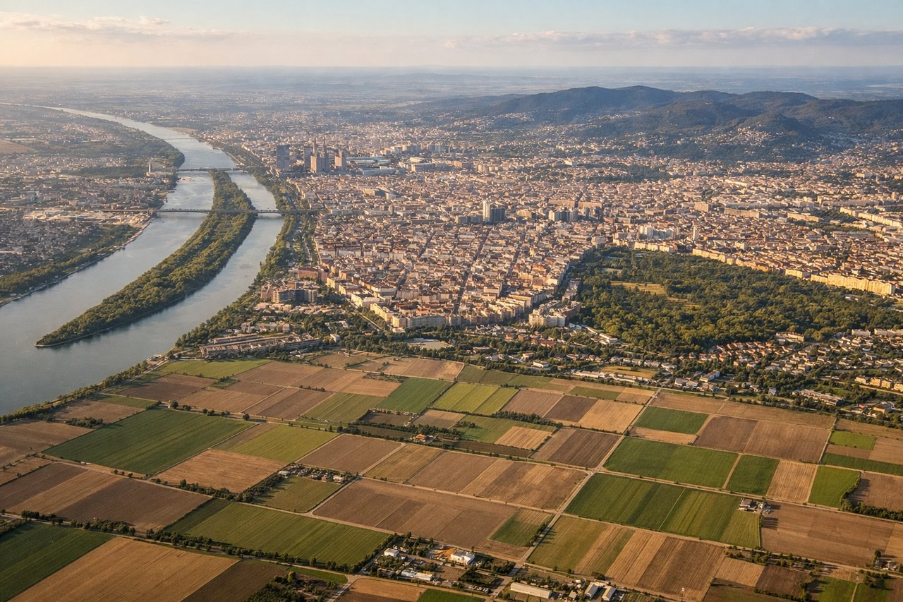
RIGHTVienna's approach from the west crosses the Danube valley and enters the Alpine foothills. Right-side descent offers views of the Danube River, Vienna's urban sprawl, and the northern Alps (Carpathian foothills) rising to the south and east. Left-side approach shows flat Hungarian plains with minimal terrain variation.
Will your flight be in sunlight?
Pick a date and time in the Sun Map to watch the sun move across your whole flight.
About This Route
Which side of the plane should I sit on flying from Tille (BVA) to Schwechat (VIE)?
Sit on the Right side of the plane for the best views on flights from Beauvais to Vienna. Right side scores 3.5 vs left's 2.5 due to the Vienna landing approach, which offers genuine Alpine foothills, the Danube River, and urban scenery. The takeoff from Beauvais is relatively flat on both sides, but the landing dominates the flight experience. Right-side passengers see the Danube valley and Carpathian foothills during descent—a clear scenic advantage over the flat Hungarian plains visible from the left.
What can I see during takeoff from Tille in Beauvais?
During takeoff from Tille (BVA), sit on the Left side for the best views. Beauvais airport sits north of the Île-de-France region. Left-side departure routes typically head northeast over the Seine valley and toward the Oise River valley, offering views of suburban Paris sprawl transitioning to rural Picardy. Right-side departures head southeast over flatter agricultural plains with minimal visual interest. Notable sights include: Seine River valley, Oise River drainage, suburban Paris fringe, Picardy agricultural plateau.
What can I see when landing at Schwechat in Vienna?
When landing at Schwechat (VIE), sit on the Right side for the best views. Vienna's approach from the west crosses the Danube valley and enters the Alpine foothills. Right-side descent offers views of the Danube River, Vienna's urban sprawl, and the northern Alps (Carpathian foothills) rising to the south and east. Left-side approach shows flat Hungarian plains with minimal terrain variation. Notable sights include: Danube River and its floodplain, Vienna city center and Danube Island, Alpine foothills and Carpathian range to the south, Schwechat airport and industrial zones.
How long is the flight from Beauvais to Vienna?
The flight from Tille (BVA) to Schwechat (VIE) takes about 2 hours 15 minutes. The shortest flight path between them is 664 miles (1,068 km); winds and air traffic control usually add a few percent.
What does the Beauvais to Vienna flight path pass over?
The flight crosses the Champagne region (chalk plains and vineyards), then transitions into the Lorraine plateau and Vosges Mountains foothills. The Meuse River valley and Moselle River drainage are visible during cruise. The route then descends into the Danube valley approaching Vienna, with the Carpathian foothills becoming prominent on the right side during final approach.