Left side scores higher (3.5 vs 2.0) due to superior scenery on both legs. Takeoff captures Vienna's Danube valley and urban geography; landing reveals Gran Canaria's dramatic volcanic terrain and northern coastline. Right side is dominated by open ocean and flat terrain with minimal landmarks. Left provides consistent visual interest throughout the 5-hour flight.
Flown VIE to LPA? Did we get it right?
Flight Path
Vienna to Gran Canaria is 2,202 miles (3,544 km), a flight of about 5 hours 15 minutes.
Bay of Biscay (open Atlantic), Iberian Peninsula's western coast (Portugal/Spain border region), Sierra de Gredos mountains visible to the south during cruise, Strait of Gibraltar region as flight approaches southern Spain, Atlas Mountains of Morocco visible to the south on the horizon during descent phase
Great circle distance and headings ›Phase by phase
Takeoff from VIE
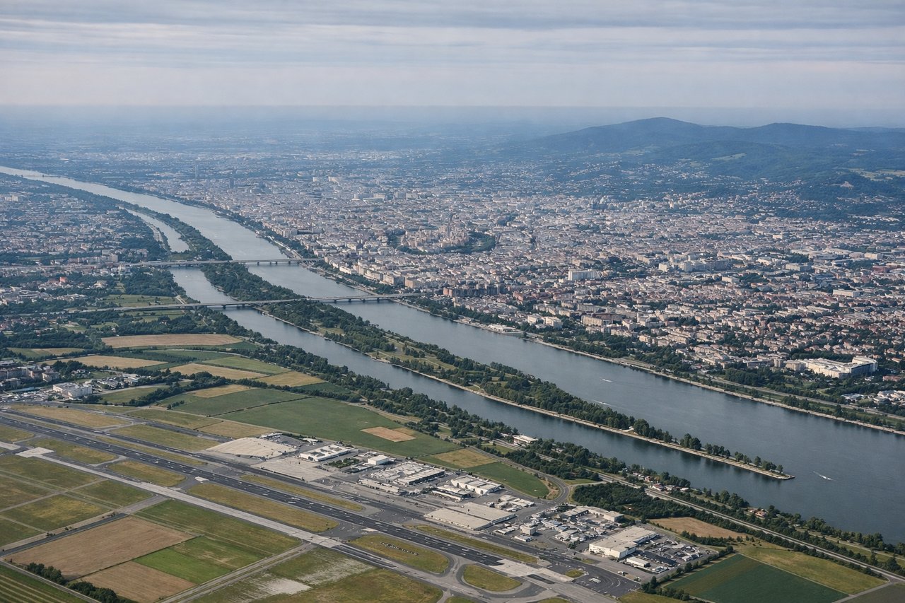
LEFTLeft side captures Vienna's urban sprawl and the Danube River valley during initial climb. The city's distinctive layout along the Danube is visible from altitude, with the river's meandering course providing clear geographic reference. Right side faces open countryside with minimal landmarks.
Landing at LPA
LEFTLeft side offers the most dramatic approach to Gran Canaria. Descending toward runway 03L/03R (northeast heading), the left side reveals the island's volcanic interior, northern coastline, and the Atlantic Ocean. The island's rugged terrain and coastal cliffs are striking. Right side faces open Atlantic with minimal visual interest.
Will your flight be in sunlight?
Pick a date and time in the Sun Map to watch the sun move across your whole flight.
About This Route
Which side of the plane should I sit on flying from Schwechat (VIE) to Gran Canaria (LPA)?
Sit on the Left side of the plane for the best views on flights from Vienna to Gran Canaria. Left side scores higher (3.5 vs 2.0) due to superior scenery on both legs. Takeoff captures Vienna's Danube valley and urban geography; landing reveals Gran Canaria's dramatic volcanic terrain and northern coastline. Right side is dominated by open ocean and flat terrain with minimal landmarks. Left provides consistent visual interest throughout the 5-hour flight.
What can I see during takeoff from Schwechat in Vienna?
During takeoff from Schwechat (VIE), sit on the Left side for the best views. Left side captures Vienna's urban sprawl and the Danube River valley during initial climb. The city's distinctive layout along the Danube is visible from altitude, with the river's meandering course providing clear geographic reference. Right side faces open countryside with minimal landmarks. Notable sights include: Danube River (visible as a silvery ribbon through Vienna), Vienna city center and suburbs, Carpathian foothills to the northeast.
What can I see when landing at Gran Canaria in Gran Canaria?
When landing at Gran Canaria (LPA), sit on the Left side for the best views. Left side offers the most dramatic approach to Gran Canaria. Descending toward runway 03L/03R (northeast heading), the left side reveals the island's volcanic interior, northern coastline, and the Atlantic Ocean. The island's rugged terrain and coastal cliffs are striking. Right side faces open Atlantic with minimal visual interest. Notable sights include: Gran Canaria's volcanic peaks (Pico de las Nieves visible at 6,394 ft), northern coastline with Las Palmas harbor, Atlantic Ocean horizon.
How long is the flight from Vienna to Gran Canaria?
The flight from Schwechat (VIE) to Gran Canaria (LPA) takes about 5 hours 15 minutes. The shortest flight path between them is 2,202 miles (3,544 km); winds and air traffic control usually add a few percent.
What does the Vienna to Gran Canaria flight path pass over?
Bay of Biscay (open Atlantic), Iberian Peninsula's western coast (Portugal/Spain border region), Sierra de Gredos mountains visible to the south during cruise, Strait of Gibraltar region as flight approaches southern Spain, Atlas Mountains of Morocco visible to the south on the horizon during descent phase