While the takeoff from Vilnius is marginally more interesting on the left, the landing approach to CDG on the right side is significantly more scenic, featuring the Seine River valley, Versailles region, and the distinctive suburban-to-urban transition. The landing experience outweighs the takeoff advantage, and the right side captures more recognizable Parisian geography overall.
Flown VNO to CDG? Did we get it right?
Flight Path
Vilnius to Paris is 1,040 miles (1,674 km), a flight of about 2 hours 15 minutes.
The flight crosses the North European Plain, passing over Poland (Masovian Lowlands near Warsaw region at cruise altitude), then transitions into the Carpathian foothills and Moravian highlands of the Czech-Polish border region. The route then descends across central France, crossing the Loire Valley and approaching the Île-de-France basin. No major mountain ranges are crossed at cruise altitude; the terrain remains predominantly flat to gently rolling throughout the journey.
Great circle distance and headings ›Phase by phase
Takeoff from VNO
LEFTVilnius lies in relatively flat terrain, but the left (south/southwest) side during northerly runway operations captures the city's urban sprawl and the Neris River valley as it winds through the landscape. The right side departs over featureless agricultural plains with minimal visual interest.
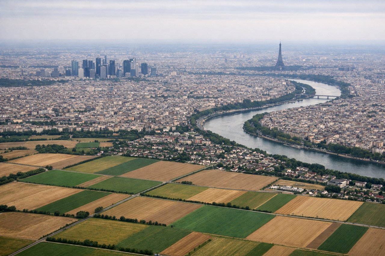
Landing at CDG
RIGHTThe approach to CDG typically uses westerly runways (26/27 configuration in prevailing winds), which means the descent path crosses the Seine River valley, the Île-de-France agricultural belt, and the distinctive suburban ring of Paris. The right side captures the Seine's meanders, Versailles region, and the approach over the northern Paris suburbs with better visibility of urban structure. The left side sees mostly open countryside and forest.
Will your flight be in sunlight?
Pick a date and time in the Sun Map to watch the sun move across your whole flight.
About This Route
Which side of the plane should I sit on flying from Vilnius International Airport (VNO) to Charles De Gaulle (CDG)?
Sit on the Right side of the plane for the best views on flights from Vilnius to Paris. While the takeoff from Vilnius is marginally more interesting on the left, the landing approach to CDG on the right side is significantly more scenic, featuring the Seine River valley, Versailles region, and the distinctive suburban-to-urban transition. The landing experience outweighs the takeoff advantage, and the right side captures more recognizable Parisian geography overall.
What can I see during takeoff from Vilnius International Airport in Vilnius?
During takeoff from Vilnius International Airport (VNO), sit on the Left side for the best views. Vilnius lies in relatively flat terrain, but the left (south/southwest) side during northerly runway operations captures the city's urban sprawl and the Neris River valley as it winds through the landscape. The right side departs over featureless agricultural plains with minimal visual interest. Notable sights include: Vilnius Old Town and Cathedral Basilica, Neris River valley, suburban residential districts extending south.
What can I see when landing at Charles De Gaulle in Paris?
When landing at Charles De Gaulle (CDG), sit on the Right side for the best views. The approach to CDG typically uses westerly runways (26/27 configuration in prevailing winds), which means the descent path crosses the Seine River valley, the Île-de-France agricultural belt, and the distinctive suburban ring of Paris. The right side captures the Seine's meanders, Versailles region, and the approach over the northern Paris suburbs with better visibility of urban structure. The left side sees mostly open countryside and forest. Notable sights include: Seine River meanders and valley, Versailles region to the southwest, northern Paris suburban sprawl, CDG airport complex itself.
How long is the flight from Vilnius to Paris?
The flight from Vilnius International Airport (VNO) to Charles De Gaulle (CDG) takes about 2 hours 15 minutes. The shortest flight path between them is 1,040 miles (1,674 km); winds and air traffic control usually add a few percent.
What does the Vilnius to Paris flight path pass over?
The flight crosses the North European Plain, passing over Poland (Masovian Lowlands near Warsaw region at cruise altitude), then transitions into the Carpathian foothills and Moravian highlands of the Czech-Polish border region. The route then descends across central France, crossing the Loire Valley and approaching the Île-de-France basin. No major mountain ranges are crossed at cruise altitude; the terrain remains predominantly flat to gently rolling throughout the journey.