While the takeoff favors the right side with Singapore's skyline, the left side accumulates more dramatic and varied terrain over the full flight: Palawan's scattered karst islands mid-route and Negros' Kanlaon volcano rising into view during the descent into Cebu give it the edge for sustained scenic interest.
Flight Path
The route crosses the South China Sea toward northern Borneo, passing close to the Sabah/Brunei coastline where Mount Kinabalu can appear on the horizon in clear weather, before continuing over the Sulu Sea past Palawan's limestone islands and into the Visayas.
Great circle distance and headings ›Phase by phase
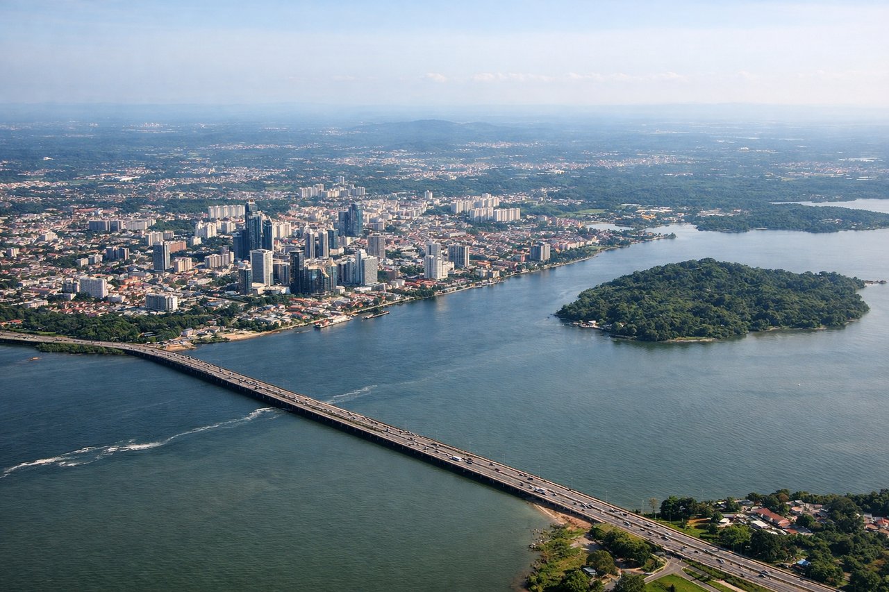
Takeoff from XSP
RIGHTDeparting Seletar toward the northeast, the right side faces south across the Johor Strait toward Singapore's skyline, Marina Bay, and the busy Singapore Strait shipping lanes. The left side mostly shows Johor Bahru's flatter urban sprawl in Malaysia, which is less visually striking.
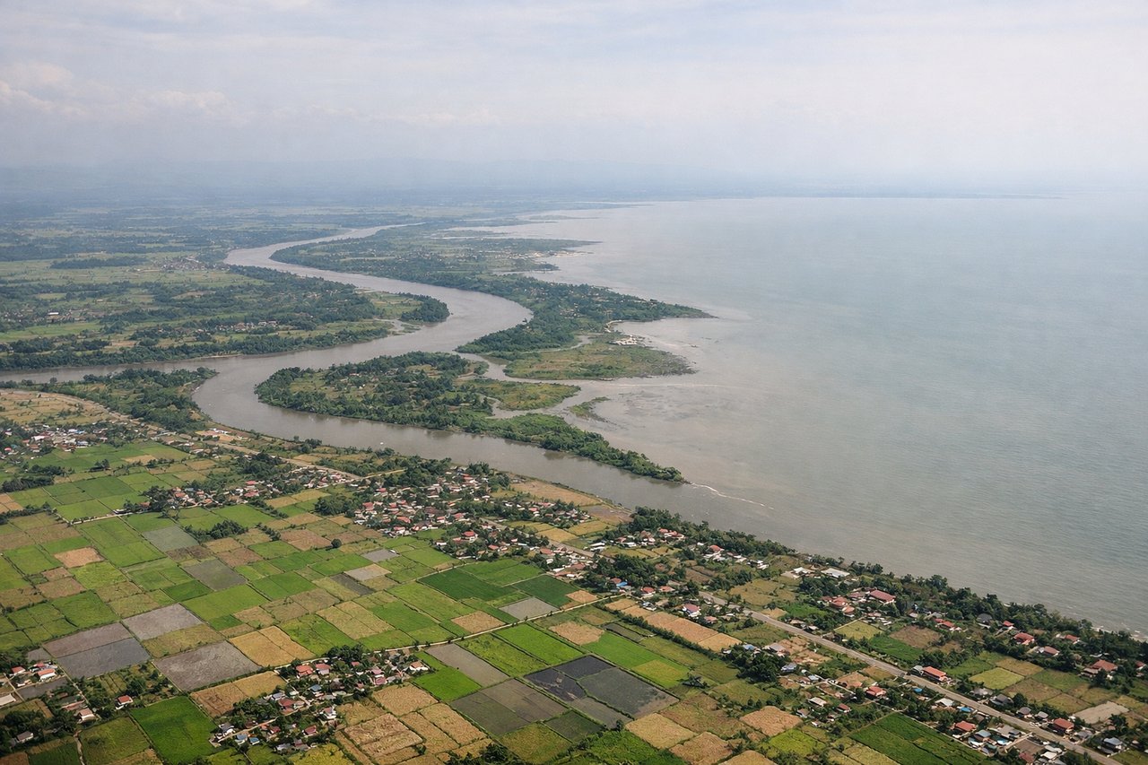
Landing at CEB
LEFTOn the approach into Cebu, the flight path tracks past southwestern Negros, putting the active cone of Mount Kanlaon and Negros' green ridgeline on the left side as the aircraft descends toward Mactan. The right side mostly overlooks the open, featureless waters of the Camotes Sea.
Landmarks on this routeAll landmarks →
Will your flight be in sunlight?
See exactly which side of the plane gets sun and shade at your departure time.
About This Route
Which side of the plane should I sit on flying from Seletar (XSP) to Mactan Cebu International Airport (CEB)?
Sit on the Left side of the plane for the best views on flights from Singapore to Cebu. While the takeoff favors the right side with Singapore's skyline, the left side accumulates more dramatic and varied terrain over the full flight: Palawan's scattered karst islands mid-route and Negros' Kanlaon volcano rising into view during the descent into Cebu give it the edge for sustained scenic interest.
What can I see during takeoff from Seletar in Singapore?
During takeoff from Seletar (XSP), sit on the Right side for the best views. Departing Seletar toward the northeast, the right side faces south across the Johor Strait toward Singapore's skyline, Marina Bay, and the busy Singapore Strait shipping lanes. The left side mostly shows Johor Bahru's flatter urban sprawl in Malaysia, which is less visually striking. Notable sights include: Marina Bay Sands and the Singapore CBD skyline, Singapore Strait with anchored container ships, Pulau Ubin, Changi Point coastline.
What can I see when landing at Mactan Cebu International Airport in Cebu?
When landing at Mactan Cebu International Airport (CEB), sit on the Left side for the best views. On the approach into Cebu, the flight path tracks past southwestern Negros, putting the active cone of Mount Kanlaon and Negros' green ridgeline on the left side as the aircraft descends toward Mactan. The right side mostly overlooks the open, featureless waters of the Camotes Sea. Notable sights include: Mount Kanlaon volcano, Negros Island's central mountain ridge, Tañon Strait, Cebu's central highland spine near the descent path.
How long is the flight from Singapore to Cebu?
The flight from Seletar (XSP) to Mactan Cebu International Airport (CEB) takes 3h 10m.
What does the Singapore to Cebu flight path pass over?
The route crosses the South China Sea toward northern Borneo, passing close to the Sabah/Brunei coastline where Mount Kinabalu can appear on the horizon in clear weather, before continuing over the Sulu Sea past Palawan's limestone islands and into the Visayas.