Edmonton to Vancouver is 503 miles (809 km), a flight of about 1 hour 25 minutes.
The right side wins the full flight: it catches Edmonton's river valley on departure, then during cruise the flight path crosses the Canadian Rockies near Mount Robson and the Columbia Icefield area, which sit mostly north of the direct route and thus appear on the right. That mountain crossing plus the close-up North Shore Mountains and Vancouver skyline on final approach give it far more dramatic, varied scenery than the left side's flatter, more distant views.
Flight Path
Direct crossing of the Canadian Rockies near Mount Robson and the Yellowhead Pass area, followed by the Columbia Mountains and the Fraser Plateau before descending toward the Fraser Valley.
Great circle distance and headings ›

.jpg?width=600)

Phase by phase
Takeoff from YEG
RIGHTOn the typical runway 20 departure heading southwest, Edmonton's downtown skyline and the North Saskatchewan River valley sit off the tail to the right as the aircraft climbs, giving a brief but genuine city/river glimpse. The left side only shows flat, repetitive Alberta farmland with no distinguishing features.
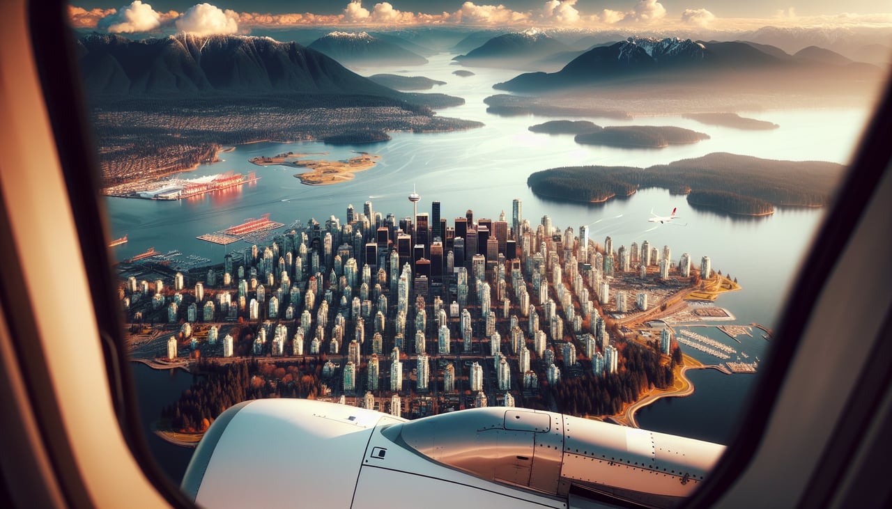
Landing at YVR
RIGHTLanding on runway 26 at YVR, the final approach tracks west over the Fraser Valley with the North Shore Mountains and downtown Vancouver's skyline clearly visible off the right side. The left side only offers flat delta farmland and a distant, hazier view of Mount Baker across the border.
Landmarks on this routeAll landmarks →
Will your flight be in sunlight?
Pick a date and time in the Sun Map to watch the sun move across your whole flight.
About This Route
Which side of the plane should I sit on flying from Edmonton International (YEG) to Vancouver International (YVR)?
Sit on the Right side of the plane for the best views on flights from Edmonton to Vancouver. The right side wins the full flight: it catches Edmonton's river valley on departure, then during cruise the flight path crosses the Canadian Rockies near Mount Robson and the Columbia Icefield area, which sit mostly north of the direct route and thus appear on the right. That mountain crossing plus the close-up North Shore Mountains and Vancouver skyline on final approach give it far more dramatic, varied scenery than the left side's flatter, more distant views.
What can I see during takeoff from Edmonton International in Edmonton?
During takeoff from Edmonton International (YEG), sit on the Right side for the best views. On the typical runway 20 departure heading southwest, Edmonton's downtown skyline and the North Saskatchewan River valley sit off the tail to the right as the aircraft climbs, giving a brief but genuine city/river glimpse. The left side only shows flat, repetitive Alberta farmland with no distinguishing features. Notable sights include: North Saskatchewan River valley, Edmonton downtown skyline (distant), Alberta prairie patchwork farmland.
What can I see when landing at Vancouver International in Vancouver?
When landing at Vancouver International (YVR), sit on the Right side for the best views. Landing on runway 26 at YVR, the final approach tracks west over the Fraser Valley with the North Shore Mountains and downtown Vancouver's skyline clearly visible off the right side. The left side only offers flat delta farmland and a distant, hazier view of Mount Baker across the border. Notable sights include: North Shore Mountains (Grouse, Cypress, Seymour), Burrard Inlet, downtown Vancouver skyline, Stanley Park peninsula.
How long is the flight from Edmonton to Vancouver?
The flight from Edmonton International (YEG) to Vancouver International (YVR) takes about 1 hour 25 minutes. The shortest flight path between them is 503 miles (809 km); winds and air traffic control usually add a few percent.
What does the Edmonton to Vancouver flight path pass over?
Direct crossing of the Canadian Rockies near Mount Robson and the Yellowhead Pass area, followed by the Columbia Mountains and the Fraser Plateau before descending toward the Fraser Valley.