Kelowna to Seattle is 219 miles (352 km), a flight of about 50 minutes.
Left wins at takeoff for Okanagan Lake views, but right side delivers consistently through the flight — the North Cascades come into view on the right as you cross into Washington state, and the Seattle approach on the right gives the classic Elliott Bay and downtown combination. Right side edges it overall.
Flight Path
The flight crosses the Okanagan Highlands and then the North Cascades, passing near the Similkameen Valley and Okanogan Highlands on the Canadian side, then tracking over the Methow Valley and the rugged North Cascades peaks including the Skagit River watershed before descending over the foothills into the Seattle basin. The transition from dry interior plateau to dense conifer-covered Cascade terrain is clearly visible from altitude.
Great circle distance and headings ›Phase by phase
Takeoff from YLW
LEFTKelowna airport sits on the east shore of Okanagan Lake. Departing northwest on runway 34, the left side looks back over the full length of Okanagan Lake stretching south, with the city of Kelowna and its orchards visible along the lakeshore. The right side faces the dry benchlands east of the valley.
Landing at SEA
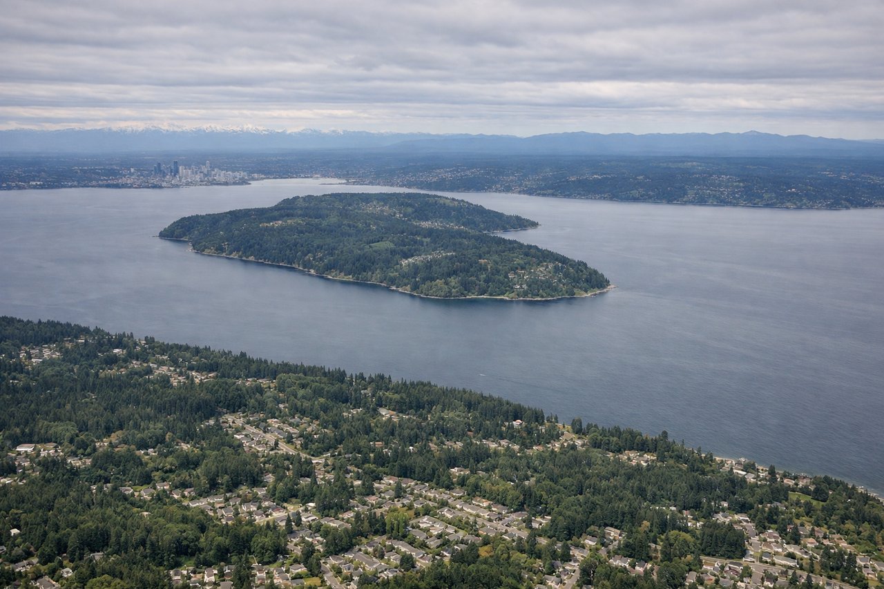
RIGHTSeaTac typically lands from the north on runways 16L/16R, meaning the approach tracks southward over the Seattle metro area. The right side gives a clear view of downtown Seattle, Elliott Bay, and the Olympic Mountains across Puget Sound. The left side faces east toward the Cascades, which are also impressive but the right-side water and city combination is more varied.
Landmarks on this routeAll landmarks →
Will your flight be in sunlight?
Pick a date and time in the Sun Map to watch the sun move across your whole flight.
About This Route
Which side of the plane should I sit on flying from Kelowna (YLW) to Seattle Tacoma International (SEA)?
Sit on the Right side of the plane for the best views on flights from Kelowna to Seattle. Left wins at takeoff for Okanagan Lake views, but right side delivers consistently through the flight — the North Cascades come into view on the right as you cross into Washington state, and the Seattle approach on the right gives the classic Elliott Bay and downtown combination. Right side edges it overall.
What can I see during takeoff from Kelowna in Kelowna?
During takeoff from Kelowna (YLW), sit on the Left side for the best views. Kelowna airport sits on the east shore of Okanagan Lake. Departing northwest on runway 34, the left side looks back over the full length of Okanagan Lake stretching south, with the city of Kelowna and its orchards visible along the lakeshore. The right side faces the dry benchlands east of the valley. Notable sights include: Okanagan Lake (full southern stretch), Kelowna city waterfront, Mission Creek valley, Okanagan Mountain Provincial Park ridgeline.
What can I see when landing at Seattle Tacoma International in Seattle?
When landing at Seattle Tacoma International (SEA), sit on the Right side for the best views. SeaTac typically lands from the north on runways 16L/16R, meaning the approach tracks southward over the Seattle metro area. The right side gives a clear view of downtown Seattle, Elliott Bay, and the Olympic Mountains across Puget Sound. The left side faces east toward the Cascades, which are also impressive but the right-side water and city combination is more varied. Notable sights include: Downtown Seattle skyline, Elliott Bay, Puget Sound, Olympic Mountains (distant, across the water).
How long is the flight from Kelowna to Seattle?
The flight from Kelowna (YLW) to Seattle Tacoma International (SEA) takes about 50 minutes. The shortest flight path between them is 219 miles (352 km); winds and air traffic control usually add a few percent.
What does the Kelowna to Seattle flight path pass over?
The flight crosses the Okanagan Highlands and then the North Cascades, passing near the Similkameen Valley and Okanogan Highlands on the Canadian side, then tracking over the Methow Valley and the rugged North Cascades peaks including the Skagit River watershed before descending over the foothills into the Seattle basin. The transition from dry interior plateau to dense conifer-covered Cascade terrain is clearly visible from altitude.