Right side scores higher due to superior landing views over the Río de la Plata and Buenos Aires' distinctive waterfront and urban landscape. While left side offers a better Toronto departure experience, the landing sequence dominates the overall flight experience on this 10+ hour journey, and the approach into Aeroparque provides more dramatic and recognizable urban scenery than the cruise phase offers either side.
Flown YTZ to AEP? Did we get it right?
Flight Path
Toronto to Buenos Aires is 5,561 miles (8,950 km), a flight of about 10 hours 15 minutes.
The flight path crosses the Atlantic Ocean for approximately 5 hours with minimal scenic features—open water dominates the midpoint. Notable waypoints include the eastern seaboard of North America (Appalachian foothills visible during initial climb), the Mid-Atlantic Ridge area (underwater, not visible), and the approach to South America showing the Brazilian coast and then the Paraná River delta before reaching Buenos Aires. The cruise phase over open Atlantic offers little variation; the most dramatic scenery occurs during departure from Toronto and arrival into Buenos Aires.
Great circle distance and headings ›Phase by phase
Takeoff from YTZ
LEFTLeft side captures Toronto's downtown skyline and the Lake Ontario waterfront during initial climb. The city's harbor, CN Tower, and the lake's northern shoreline are prominent features during the eastbound departure sequence from runway 08.
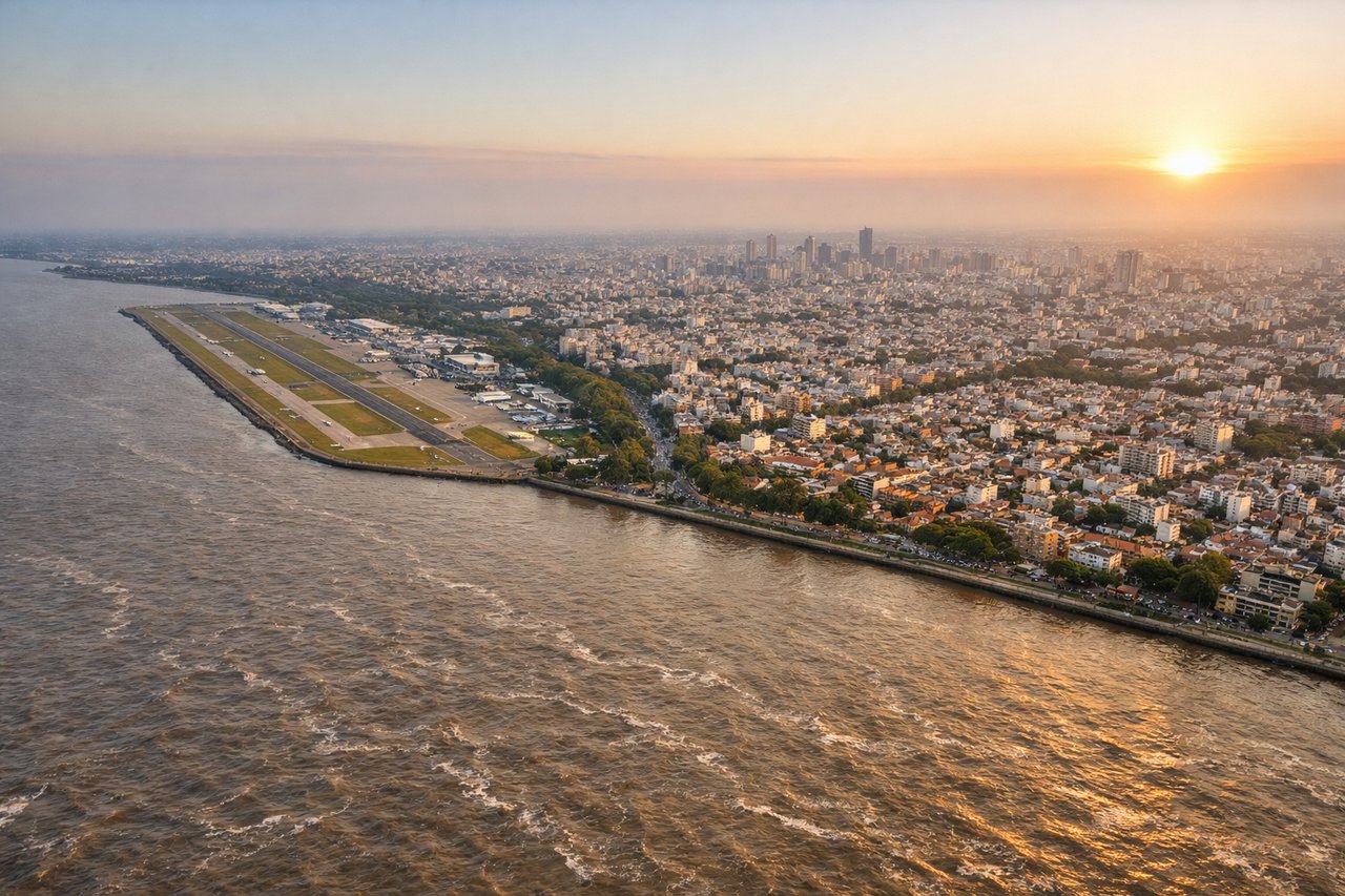
Landing at AEP
RIGHTRight side offers superior arrival views as aircraft approach runway 31 from over the Río de la Plata. Passengers see the wide river estuary, Buenos Aires' waterfront districts, and the city's grid layout spreading inland. The approach path over water provides unobstructed views of the urban landscape and surrounding pampas.
Will your flight be in sunlight?
Pick a date and time in the Sun Map to watch the sun move across your whole flight.
About This Route
Which side of the plane should I sit on flying from City Centre (YTZ) to Aeroparque Jorge Newbery (AEP)?
Sit on the Right side of the plane for the best views on flights from Toronto to Buenos Aires. Right side scores higher due to superior landing views over the Río de la Plata and Buenos Aires' distinctive waterfront and urban landscape. While left side offers a better Toronto departure experience, the landing sequence dominates the overall flight experience on this 10+ hour journey, and the approach into Aeroparque provides more dramatic and recognizable urban scenery than the cruise phase offers either side.
What can I see during takeoff from City Centre in Toronto?
During takeoff from City Centre (YTZ), sit on the Left side for the best views. Left side captures Toronto's downtown skyline and the Lake Ontario waterfront during initial climb. The city's harbor, CN Tower, and the lake's northern shoreline are prominent features during the eastbound departure sequence from runway 08. Notable sights include: Toronto downtown skyline and CN Tower, Lake Ontario northern shore, Toronto Islands, Scarborough Bluffs.
What can I see when landing at Aeroparque Jorge Newbery in Buenos Aires?
When landing at Aeroparque Jorge Newbery (AEP), sit on the Right side for the best views. Right side offers superior arrival views as aircraft approach runway 31 from over the Río de la Plata. Passengers see the wide river estuary, Buenos Aires' waterfront districts, and the city's grid layout spreading inland. The approach path over water provides unobstructed views of the urban landscape and surrounding pampas. Notable sights include: Río de la Plata estuary, Buenos Aires waterfront and harbor, La Boca district, Palermo and central Buenos Aires grid.
How long is the flight from Toronto to Buenos Aires?
The flight from City Centre (YTZ) to Aeroparque Jorge Newbery (AEP) takes about 10 hours 15 minutes. The shortest flight path between them is 5,561 miles (8,950 km); winds and air traffic control usually add a few percent.
What does the Toronto to Buenos Aires flight path pass over?
The flight path crosses the Atlantic Ocean for approximately 5 hours with minimal scenic features—open water dominates the midpoint. Notable waypoints include the eastern seaboard of North America (Appalachian foothills visible during initial climb), the Mid-Atlantic Ridge area (underwater, not visible), and the approach to South America showing the Brazilian coast and then the Paraná River delta before reaching Buenos Aires. The cruise phase over open Atlantic offers little variation; the most dramatic scenery occurs during departure from Toronto and arrival into Buenos Aires.