While takeoff offers Lake Ontario views on the right, the landing approach on the left provides more dramatic and concentrated scenic value with Lady Bird Lake, the Colorado River, and downtown Austin all visible in close proximity during descent. The landing experience outweighs the takeoff advantage.
Flown YTZ to AUS? Did we get it right?
Flight Path
Toronto to Austin is 1,365 miles (2,197 km), a flight of about 3 hours 30 minutes.
The flight path crosses the Appalachian foothills (Pennsylvania/West Virginia border region), then transitions to the Ohio River valley. Over Kentucky and Tennessee, the landscape becomes rolling hills and agricultural areas. As the aircraft approaches the Texas border, the terrain flattens into the Great Plains with scattered lakes and reservoirs visible. The Mississippi River is crossed somewhere over southern Illinois or Missouri, appearing as a wide, meandering waterway. By mid-flight, the landscape transitions from green deciduous forest to increasingly sparse vegetation and prairie as the aircraft moves southwest toward Texas.
Great circle distance and headings ›

Phase by phase
Takeoff from YTZ
RIGHTRight-side seats offer views of Lake Ontario immediately after departure, with the Toronto waterfront and downtown skyline visible during the initial climb-out. The aircraft typically departs eastbound or southeastbound from YTZ, making the right side the scenic advantage.
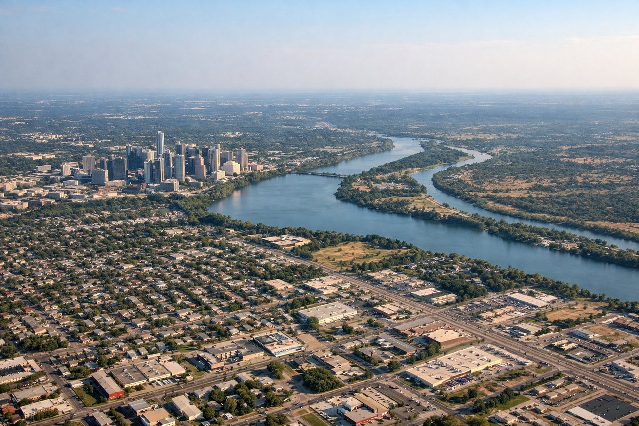
Landing at AUS
LEFTLeft-side seats provide excellent views during the descent approach to AUS. Aircraft typically descend from the north or northeast, and the left side captures the Colorado River, Lady Bird Lake, and central Austin's downtown district. The approach path offers clear sightlines to these urban and water features.
Will your flight be in sunlight?
Pick a date and time in the Sun Map to watch the sun move across your whole flight.
About This Route
Which side of the plane should I sit on flying from City Centre (YTZ) to Austin Bergstrom International (AUS)?
Sit on the Left side of the plane for the best views on flights from Toronto to Austin. While takeoff offers Lake Ontario views on the right, the landing approach on the left provides more dramatic and concentrated scenic value with Lady Bird Lake, the Colorado River, and downtown Austin all visible in close proximity during descent. The landing experience outweighs the takeoff advantage.
What can I see during takeoff from City Centre in Toronto?
During takeoff from City Centre (YTZ), sit on the Right side for the best views. Right-side seats offer views of Lake Ontario immediately after departure, with the Toronto waterfront and downtown skyline visible during the initial climb-out. The aircraft typically departs eastbound or southeastbound from YTZ, making the right side the scenic advantage. Notable sights include: Lake Ontario (immediate foreground), Toronto Islands (Toronto Island Airport visible as a small strip), Downtown Toronto skyline, Scarborough Bluffs (eastern shoreline).
What can I see when landing at Austin Bergstrom International in Austin?
When landing at Austin Bergstrom International (AUS), sit on the Left side for the best views. Left-side seats provide excellent views during the descent approach to AUS. Aircraft typically descend from the north or northeast, and the left side captures the Colorado River, Lady Bird Lake, and central Austin's downtown district. The approach path offers clear sightlines to these urban and water features. Notable sights include: Lady Bird Lake (Town Lake) in downtown Austin, Colorado River, Downtown Austin skyline, Barton Springs Pool area.
How long is the flight from Toronto to Austin?
The flight from City Centre (YTZ) to Austin Bergstrom International (AUS) takes about 3 hours 30 minutes. The shortest flight path between them is 1,365 miles (2,197 km); winds and air traffic control usually add a few percent.
What does the Toronto to Austin flight path pass over?
The flight path crosses the Appalachian foothills (Pennsylvania/West Virginia border region), then transitions to the Ohio River valley. Over Kentucky and Tennessee, the landscape becomes rolling hills and agricultural areas. As the aircraft approaches the Texas border, the terrain flattens into the Great Plains with scattered lakes and reservoirs visible. The Mississippi River is crossed somewhere over southern Illinois or Missouri, appearing as a wide, meandering waterway. By mid-flight, the landscape transitions from green deciduous forest to increasingly sparse vegetation and prairie as the aircraft moves southwest toward Texas.