The left side wins on both ends of the flight: a rare skyline view of Toronto at takeoff and a dramatic Andes mountain backdrop during the Santiago approach, while the right side offers mostly open lake, ocean, and flatter coastal terrain.
Flown YTZ to SCL? Did we get it right?
Flight Path
Toronto to Santiago is 5,349 miles (8,609 km), a flight of about 10 hours 45 minutes.
Caribbean Sea and Cuba, northern Andes of Colombia and Ecuador, upper Amazon basin, high Andean plateau near the Peru-Bolivia border before descending into the Chilean Andes
Great circle distance and headings ›


Phase by phase
Takeoff from YTZ
LEFTDepartures from YTZ heading south typically use runway 26, with the subsequent turn keeping the downtown Toronto skyline and CN Tower on the left side of the aircraft as it climbs out over Lake Ontario. This gives a brief but striking urban and waterfront view before the route turns south toward the US.
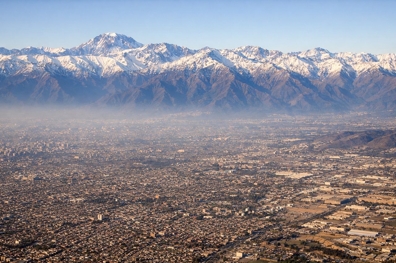
Landing at SCL
LEFTOn approach into Santiago, aircraft descend from the north on a southbound heading, putting the towering Andes mountains directly on the left side of the plane. The snow-capped peaks rising abruptly from the Santiago valley floor create a dramatic final descent, far more striking than the lower coastal range visible on the right.
Will your flight be in sunlight?
Pick a date and time in the Sun Map to watch the sun move across your whole flight.
About This Route
Which side of the plane should I sit on flying from City Centre (YTZ) to Arturo Merino Benitez International (SCL)?
Sit on the Left side of the plane for the best views on flights from Toronto to Santiago. The left side wins on both ends of the flight: a rare skyline view of Toronto at takeoff and a dramatic Andes mountain backdrop during the Santiago approach, while the right side offers mostly open lake, ocean, and flatter coastal terrain.
What can I see during takeoff from City Centre in Toronto?
During takeoff from City Centre (YTZ), sit on the Left side for the best views. Departures from YTZ heading south typically use runway 26, with the subsequent turn keeping the downtown Toronto skyline and CN Tower on the left side of the aircraft as it climbs out over Lake Ontario. This gives a brief but striking urban and waterfront view before the route turns south toward the US. Notable sights include: CN Tower, Toronto downtown skyline, Lake Ontario shoreline, Toronto Islands.
What can I see when landing at Arturo Merino Benitez International in Santiago?
When landing at Arturo Merino Benitez International (SCL), sit on the Left side for the best views. On approach into Santiago, aircraft descend from the north on a southbound heading, putting the towering Andes mountains directly on the left side of the plane. The snow-capped peaks rising abruptly from the Santiago valley floor create a dramatic final descent, far more striking than the lower coastal range visible on the right. Notable sights include: Andes Cordillera, snow-capped peaks near Santiago, Maipo river valley, Santiago basin.
How long is the flight from Toronto to Santiago?
The flight from City Centre (YTZ) to Arturo Merino Benitez International (SCL) takes about 10 hours 45 minutes. The shortest flight path between them is 5,349 miles (8,609 km); winds and air traffic control usually add a few percent.
What does the Toronto to Santiago flight path pass over?
Caribbean Sea and Cuba, northern Andes of Colombia and Ecuador, upper Amazon basin, high Andean plateau near the Peru-Bolivia border before descending into the Chilean Andes