Right side scores higher (3.5 vs 2.5) because it captures two distinct scenic sequences: the St. Lawrence River and Laurentian Mountains during departure, and the Panama Canal system with Gatun Lake during arrival. Left side is dominated by flat terrain on departure and open ocean on cruise/arrival, offering minimal visual variety or landmark density.
Flown YUL to PTY? Did we get it right?
Flight Path
Montreal to Panama City is 2,537 miles (4,083 km), a flight of about 5 hours 15 minutes.
The flight path crosses the southeastern United States (Appalachian foothills visible from altitude over Tennessee/Kentucky), the Gulf of Mexico (open water, 3+ hours), and approaches the Yucatan Peninsula before descending into Panama. The Caribbean Sea dominates the southern half of the cruise phase. No major mountain ranges or dramatic terrain features are visible during the extended ocean crossing over the Gulf and Caribbean.
Great circle distance and headings ›Phase by phase
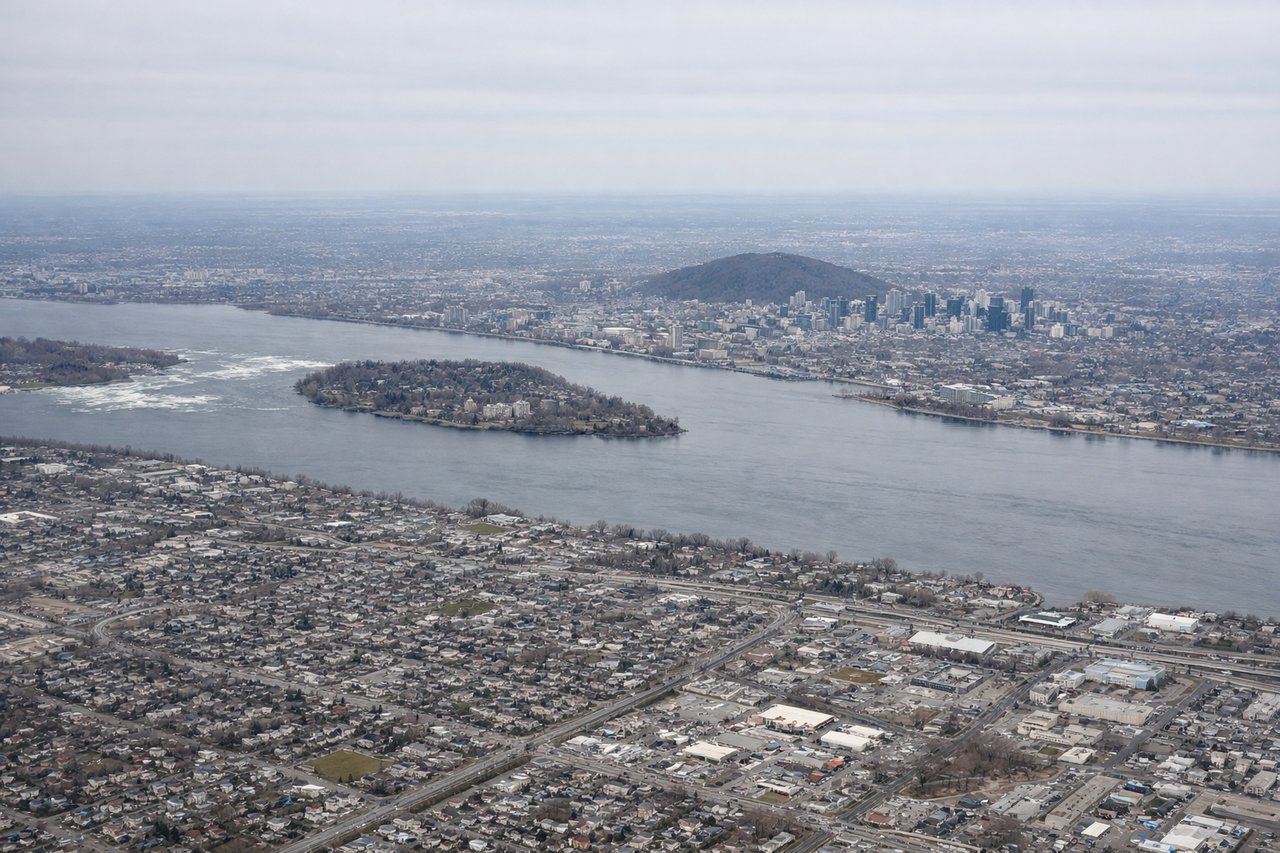
Takeoff from YUL
RIGHTRight side captures the St. Lawrence River valley and the Laurentian Mountains to the north during the initial climb-out. Left side faces southwest over flat suburban terrain and open farmland with minimal visual interest.
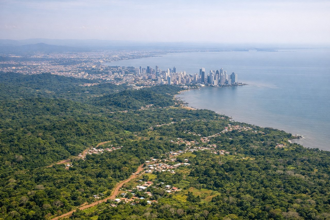
Landing at PTY
RIGHTRight side offers views of the Panama Canal approach, the Gatun Lake system, and the Caribbean coastline during descent into PTY. Left side faces the Pacific Ocean and open water with minimal distinguishing features during the final approach.
Will your flight be in sunlight?
Pick a date and time in the Sun Map to watch the sun move across your whole flight.
About This Route
Which side of the plane should I sit on flying from Montreal International Dorval (YUL) to Tocumen International (PTY)?
Sit on the Right side of the plane for the best views on flights from Montreal to Panama City. Right side scores higher (3.5 vs 2.5) because it captures two distinct scenic sequences: the St. Lawrence River and Laurentian Mountains during departure, and the Panama Canal system with Gatun Lake during arrival. Left side is dominated by flat terrain on departure and open ocean on cruise/arrival, offering minimal visual variety or landmark density.
What can I see during takeoff from Montreal International Dorval in Montreal?
During takeoff from Montreal International Dorval (YUL), sit on the Right side for the best views. Right side captures the St. Lawrence River valley and the Laurentian Mountains to the north during the initial climb-out. Left side faces southwest over flat suburban terrain and open farmland with minimal visual interest. Notable sights include: St. Lawrence River (visible as a broad ribbon running east-west), Laurentian Mountains (northern horizon), Montreal urban sprawl transitioning to rural Quebec.
What can I see when landing at Tocumen International in Panama City?
When landing at Tocumen International (PTY), sit on the Right side for the best views. Right side offers views of the Panama Canal approach, the Gatun Lake system, and the Caribbean coastline during descent into PTY. Left side faces the Pacific Ocean and open water with minimal distinguishing features during the final approach. Notable sights include: Panama Canal locks and cut (visible as a linear waterway through forested terrain), Gatun Lake (large freshwater reservoir), Caribbean coastline and Colón province forests, Panama City skyline on approach.
How long is the flight from Montreal to Panama City?
The flight from Montreal International Dorval (YUL) to Tocumen International (PTY) takes about 5 hours 15 minutes. The shortest flight path between them is 2,537 miles (4,083 km); winds and air traffic control usually add a few percent.
What does the Montreal to Panama City flight path pass over?
The flight path crosses the southeastern United States (Appalachian foothills visible from altitude over Tennessee/Kentucky), the Gulf of Mexico (open water, 3+ hours), and approaches the Yucatan Peninsula before descending into Panama. The Caribbean Sea dominates the southern half of the cruise phase. No major mountain ranges or dramatic terrain features are visible during the extended ocean crossing over the Gulf and Caribbean.