Winnipeg to Phoenix is 1,364 miles (2,196 km), a flight of about 3 hours 15 minutes.
Right-side seats offer superior scenery for both departure and arrival. The takeoff provides views of Winnipeg's urban-to-rural transition and prairie landscape, while the landing showcases Phoenix's sprawling metropolitan area, the Salt River valley, and the surrounding desert mountains. Right consistently delivers the most geographically interesting perspectives.
Flight Path
Great Plains agricultural landscape (eastern Colorado and New Mexico), Colorado River drainage systems, transition from prairie to high desert terrain, occasional visibility of the Rocky Mountain foothills in Colorado (weather permitting), New Mexico's high desert plateau with sparse vegetation and mesas
Great circle distance and headings ›.jpg?width=600)
.jpg?width=600)


Phase by phase
Takeoff from YWG
RIGHTRight-side seats offer views of the Red River valley and the transition from Winnipeg's urban grid to the agricultural plains stretching south. The departure path typically heads southwest, giving right-side passengers a clear view of the landscape morphology as the aircraft climbs.
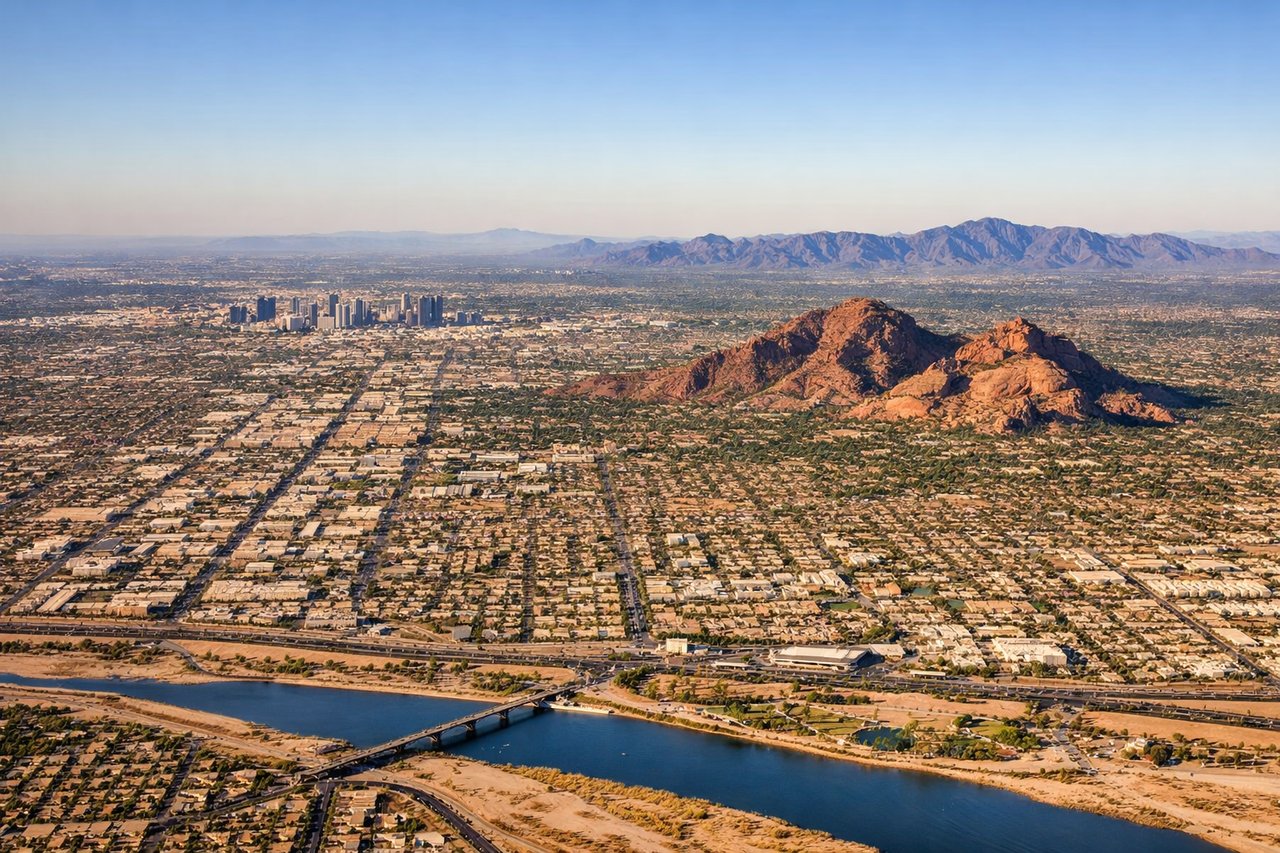
Landing at PHX
RIGHTRight-side seats provide excellent views of the Phoenix metropolitan area's sprawl and the approach over the Salt River valley. As the aircraft descends toward Sky Harbor, right-side passengers see the city's grid pattern and the surrounding desert terrain with the Sierra Estrella Mountains visible to the southwest.
Landmarks on this routeAll landmarks →
Will your flight be in sunlight?
Pick a date and time in the Sun Map to watch the sun move across your whole flight.
About This Route
Which side of the plane should I sit on flying from Winnipeg International (YWG) to Phoenix Sky Harbor International (PHX)?
Sit on the Right side of the plane for the best views on flights from Winnipeg to Phoenix. Right-side seats offer superior scenery for both departure and arrival. The takeoff provides views of Winnipeg's urban-to-rural transition and prairie landscape, while the landing showcases Phoenix's sprawling metropolitan area, the Salt River valley, and the surrounding desert mountains. Right consistently delivers the most geographically interesting perspectives.
What can I see during takeoff from Winnipeg International in Winnipeg?
During takeoff from Winnipeg International (YWG), sit on the Right side for the best views. Right-side seats offer views of the Red River valley and the transition from Winnipeg's urban grid to the agricultural plains stretching south. The departure path typically heads southwest, giving right-side passengers a clear view of the landscape morphology as the aircraft climbs. Notable sights include: Red River (visible as a linear feature through central Winnipeg), Winnipeg urban sprawl and grid pattern, agricultural plains extending south toward the US border, Lake Winnipeg (visible to the north/northwest as the aircraft climbs).
What can I see when landing at Phoenix Sky Harbor International in Phoenix?
When landing at Phoenix Sky Harbor International (PHX), sit on the Right side for the best views. Right-side seats provide excellent views of the Phoenix metropolitan area's sprawl and the approach over the Salt River valley. As the aircraft descends toward Sky Harbor, right-side passengers see the city's grid pattern and the surrounding desert terrain with the Sierra Estrella Mountains visible to the southwest. Notable sights include: Phoenix metropolitan area and urban grid, Salt River valley floor, Sierra Estrella Mountains (southwest of the airport), South Mountain Park (visible as elevated terrain south of downtown Phoenix).
How long is the flight from Winnipeg to Phoenix?
The flight from Winnipeg International (YWG) to Phoenix Sky Harbor International (PHX) takes about 3 hours 15 minutes. The shortest flight path between them is 1,364 miles (2,196 km); winds and air traffic control usually add a few percent.
What does the Winnipeg to Phoenix flight path pass over?
Great Plains agricultural landscape (eastern Colorado and New Mexico), Colorado River drainage systems, transition from prairie to high desert terrain, occasional visibility of the Rocky Mountain foothills in Colorado (weather permitting), New Mexico's high desert plateau with sparse vegetation and mesas